Zamir Ahmad
Ladakh is known as a cold, arid desert dotted by rugged brown mountains. Not any longer. The recent cloudburst did not only change notions about sustainable development of Ladakh region, it altered its face as well. The small town of Leh always buzzing with activity changed into a dead city inundated by slush and debris within an hour. Not only Leh but a large strip of inhabited land spanning over 150 Kms in length was badly affected. In certain areas entire villages were erased without any trace. The human tragedy that came to the fore little by little was colossal. Immense loss of lives and property is what Ladakh is nowadays known by. Gloom and destruction is writ large all over. One wonders what happened to the township that looked like an ‘alien land in your homeland’ , just a few weeks ago.
I was in Ladakh a week before the cloudburst hit its Leh district. I had in fact rode into this beautiful land through the Zojila pass, spent some days in Kargil before eventually reaching Leh. The first step into Leh changed all your perceptions about this place. We reached Leh at around 9:30 pm but it seemed that the day had just started there. The Leh bazar presented a look of a European market. Brightly illuminated shops selling Kashmiri and other handicrafts, the mesmerizing essence of barbecue wafting through the narrow roads and foreigners outnumbering locals engaged in all kinds of activities.
The foreign tourist was the predominant feature of Leh Market’s landscape. You could see them everywhere; roaming like zombies, jabbing a quick email to their loved ones at dozens of internet cafes, lost in their own world sitting cross legged in small enclosures, perhaps, high on dope, arranging trips to khardung la, Nubra, Manali and Pangong etc, revving up their bikes and readying them for tomorrows long and arduous journey and bargaining over apricots, apricot jams and oils.
Leh market had a certain aura around it that made it look more like a film set than a real town. We were told that the design of the windows of every building had compulsorily to be done in a certain style representing Tibetan architecture. The roads were clean and proper. A brook running through the market was properly maintained and covered.
Ban on smoking in public places was strictly enforced and there was a complete ban on use of polythene. Interestingly taxis coming from outside ladakh were not allowed to ply on its roads once they reached there. Quite obviously then, transport was emerging as the major sector in entire Leh region. So much so that, the Durbuk Branch of J&K bank situated deep in the Chang-thang valley, situated 130 kms away from Leh and catering to a population of just 4000 people, had a credit portfolio of Rs two crore comprising mostly of transport loans.
 Ladakh is famous for its monasteries and stupas. The one we visited is known as Shanti Stupa and is situated on a hillock. The information board at its entrance told us that it was built with the help of donations from the Japanese government and funds donated by the then Prime Minister, Mrs Indra Gandhi. The stupa is a closed domed structure built to preserve Buddhist scriptures and artefacts for the posterity.
Except for the fact that breathing becomes much labored in Leh, there was no other indication of this town being a part of an arid desert. The day temperature was as high as 30 degree centigrade. Humidity was palpable and the buzz in markets made it more a shoppers stop than a wanderers paradise. People who come to Leh in search of salvation would find it as urbanized as any other city. That perhaps explains, hordes of tourists leaving early in the morning, on bikes and cars to far-off places like the Pangong and the Nubra. Many others go for trekking even higher into the mountains.
While coming to Leh from Kargil one constantly sees a peculiar phenomenon in the nearby mountains. The wind swept mountains at many places look like old cities destroyed by the fury of nature and buried in the mountains. The patterns formed, perhaps by the high velocity winds, look like large castles with numerous windows dilapidated with the vagaries of time.
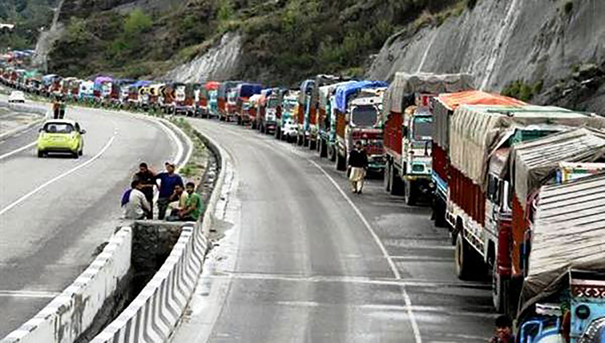
We had least imagined that a catastrophe was about to do the same with Leh. Eccentric and unheard of cloudburst in Choglamsar, Ladakh, on August 6, claimed hundreds of lives while several hundreds are still missing. Buildings were razed, communication lines snapped and highways leading to Srinagar and Manali washed away. Massive destruction, caused by over 250 cm rainfall in an hour, resulted in unprecedented floods and mudslides in the centre of Ladakh. Rescue work is still on, and one should not be surprised if the toll figure goes over 500, as far flung areas in Nubra, villages on the eastern and western slops of Chang La and densely populated villages between Upshi and Rumtek are still waiting for help to reach.
Ladakh was never ready for rains, mud houses and monasteries with thatched roofs are still standing on mountains of loose soil without deep foundations. Infrastructure developed for arid zone were shattered with the first stroke of nature’s fury. Nature’s retaliation, to be precise. For, unprecedented this calamity might have been, but it was not entirely unexpected.
Ladakh is a high altitude desert – Montane desert – as the Himalayas create a rain shadow, denying entry to monsoon clouds. The montane deserts owe their profound aridity (the average annual precipitation is often less than 40 mm or 1.5 in) to being very far from the nearest available sources of moisture.
A pertinent question, therefore being asked is, in the absence of monsoon winds, how did heavy rainfall occur on that fateful night? What are the factors that led the torrential rains.
Ladakh is strongly guarded by Peer Panjal, the Himalayas and the Stok and Zanskar ranges, which do not allow any moist air to reach the Indus valley. Areas miles away from moist sea winds usually receive precipitation by “convectional rainfall”. Warm, moist air starts rising from local water bodies and vegetation due to solar heat. With the increase in height this warm, moist air starts cooling and forms clouds after condensation. As clouds continue to grow, the weight of the water droplets can eventually lead to precipitation. Ladakh is, but, an exception for such climatic conditions because of unavailability of widespread water bodies, thick vegetation and cold climate.
Experts opine that Ladakh was slowly and steadily inviting the trouble itself. They are of the opinion that transformation of nomadic Ladakhi society into agrarian society was chiefly responsible for the disaster. This transformation had political reasons as well. Ladakh was a nomadic society, mainly dependent on livestock products and locally available natural resources. Leh, Khlasar, Kargil and Padum were small hamlets of Kuccha houses and few shops; Thiksey, Shey, Phutkul, Lamayuru, Hemis and Alchi monastries preserved Buddhist art and culture within their structures built with mud walls and thatched roofs, wall paintings of Alchi monasteries were intact for hundreds of years before it first experienced rains in the nineties.
Ladakh used to receive below 20 cm of precipitation annually with snow-fed rivers snaking through rugged mountains and deep gorges; exposing very little to sun resulting in negligible evaporation and almost no rainfall.
Things changed rapidly after 1962 Chinese invasion and deployment of Army over Siachen in mid-eighties. Border Road Organization (BRO) built roads till the fag-ends of the borders. The world’s three highest passes — Khardung La, Tanglang La and Chang La — all at over 17,000 feet height got all-weather, motorable roads. Civil administration opened new schools and hospitals in far-flung areas, laid communication lines and provided employment to locals. Money was poured into agricultural and irrigation schemes. Rapid overall development resulted in population boom, multi-fold increase in arable land and expansion of permanent human settlements.
Rugged brown mountains along the rivers got converted into green zones. The Sham region turned into apricot basket of India… The Nubra valley, known for double-humped camel and sand dunes at 3500 meters above sea, started extensively growing Leh-berry (Chhester Lulu), barley, vegetable and other unconventional crops across Shyok and Siachin rivers. Villages by Saltoro range such as Bukthang, Turtuk and Tyakshi turned the entire landscape into green. Once dominated by thorny bushes, Dishkit, Hunder and Panamik turned into tourist hubs. Zanskar and Markha valleys also followed the trend.
Widespread irrigated green fields and plantation along major river valleys across Ladakh provided much needed moisture to rising warm air responsible for cumulonimbus clouds. Thousands of hectares of new irrigated green fields and acres of new tree plantations, spread the water from narrow rivers over a large surface exposed to evaporation, ultimately resulted in unprecedented torrential rains. Rapid growth of human population and green fields for food tempered the eco-system of a high-land arid region, leading to the catastrophe of August 6.
Choglamsar, a village 12 kms from Leh, was caught in the eye of the storm and was completely wiped off. A look at the geography tells us why. It is in the bull’s eye of tempered-eco system. The Indus becomes wider near Choglamsar and Shey areas. Villages like Latho, Gaya, Miru across slopes from Tanglang La to Upshi had turned into major farming areas, The Indus valley down Choglamsar had completely turned green till Khalsar. Widespread green fields with moisten, open water surface of the Indus and rising day temperature provided favourable and deadly conditions for cloud formation, which created havoc on the area settled on loose soil mountains.
While it is easy to find out reasons for this man-made natural catastrophe it is important to lay the responsibilities as well. It was not just human greed that sought to uplift the standard of living of the inhabitants of Ladakh. It was a concerted effort to politically alter the geographical realities of the region. Those who decided for it may still be living in the cosy confines of their mansions and those who who faced the brunt were gullible guinea pigs consumed at the altar of lofty nationalistic goals of ‘geo-strategic’ influence.


