
SRINAGAR: As Jammu and Kashmir braces for a wave of rising temperatures and prolonged dry spells, the government on Thursday, June 12, convened a high-level meeting to strengthen its forest fire preparedness. Chief Secretary Atal Dulloo chaired the review session with senior officials from the Forest Department, Divisional and District Administrations, and the Department of Disaster Management, Relief, Rehabilitation and Reconstruction (DMRR&R).
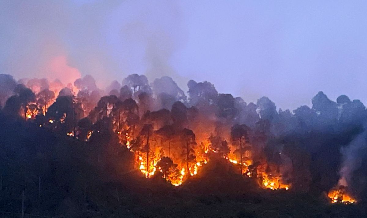
The region, which is home to over 20,000 square kilometres of forest land, has already been mapped for its vulnerability to forest fires. According to Principal Chief Conservator of Forests and Head of Forest Force, Suresh Kumar Gupta, the UT’s forest cover includes 270.11 sq km classified as “Very Highly Fire Prone”, 890.62 sq km as “Highly Fire Prone”, and 1,244.13 sq km as “Moderately Fire Prone”. The majority—19,203.80 sq km—falls under the “Less Fire Prone” category.
Chief Secretary Dulloo expressed particular concern that out of approximately 5,000 sq km of dense forests, nearly 1,000 sq km are vulnerable to fires. He called on all Deputy Commissioners to closely monitor their districts and regularly review the implementation of mitigation plans to safeguard these green assets.
He sought updates from each DC on recent fire incidents, the functioning of control rooms, active fires, if any, and the local response to fire alerts issued from the field. Emphasising the role of community participation, Dulloo directed that more volunteers be registered, particularly from Self Help Groups and among Anganwadi workers, who are present in large numbers near forest areas.
To support those involved in frontline response, he proposed a provision for relief and compensation in the event of injury or loss of life during firefighting duties performed by community volunteers. He also underscored the need for an intensive Information, Education and Communication (IEC) campaign and the wide circulation of contact details for the 85 Joint Control Rooms operational across the UT. A single social media platform to coordinate fire-related information and alerts was also recommended.
Commissioner Secretary Forests, Sheetal Nanda, earlier briefed the gathering on strategic actions being undertaken. She said that a comprehensive Forest Fire Vulnerability Mapping exercise was completed in 2021 using historical fire data from the Forest Survey of India. The mapping now serves as the blueprint for tailored mitigation strategies in every forest division.
Enumerating the causes of forest fires, officials said they fall under anthropogenic sources—such as burning of crop residues, discarded smoking material, roadside fires and the use of fire to promote grass growth—as well as natural triggers like lightning strikes and rolling stones during dry weather. Climate factors, including erratic rainfall, dry leaf litter build-up, and heatwaves, were identified as amplifying risks.
The preventive approach includes creation and maintenance of fire lines, controlled burning to manage dry biomass, and the use of Van Agni, the satellite-based fire alert system by the Forest Survey of India. Equipment, including beaters, rake hoes, and sprayers has been widely distributed, while mock drills and school-based awareness campaigns are being rolled out to boost preparedness.
The meeting concluded with a renewed emphasis on integrating technology, local vigilance, and public engagement to protect the forests of Jammu and Kashmir from the destructive effects of wildfires in the months ahead.


