
Rafique A Khan, a Kashmir-born American development planner discusses the crippling crisis that Kashmir’s ongoing developmental engineering is exhibiting for the future of the Vale and its people.
The first Western-educated Kashmiri engineer, Ghulam Hassan Khan, graduated from Harvard University’s Class of 1930 with a Master’s in Civil Engineering. On his return, he was assigned to work under a Dogra Court-appointed officer in the Baramulla Public Works Division. One of his initial tasks was constructing a channel that would have defied gravity by requiring water to flow uphill.
Despite thousands of engineers leaving engineering colleges in the last 90 years, the region’s engineering establishment seems to be still grappling with the fundamental difference between a drain and a ditch.
A stark illustration of this can be seen in the two-mile-long drains along the Srinagar road from Barzulla to Hazuribagh. The drains on both sides of the road are, in reality, unconnected lengths of shallow ditches, plagued by obstructions that render smooth water flow impossible. Tragically, the ditches are not even aligned, with some sections filled up to facilitate car access connections to adjacent properties.
In other areas, utility poles obstruct the ditches, hindering their functionality. These so-called drains, and others like them throughout Srinagar, are intended to collect surface water. However, they also have sewer connections from adjacent private properties feeding into them, effectively rendering many of the surface street drains as open sewers.
Two Realities
Srinagar’s drainage system is a tale of two realities. Beneath the city’s surface, underground drains are meant to carry stormwater and double as sewers. However, the reality is far from this intention.
A case in point is the area near the old Doodganga Bridge (Barzalla), where a pumping station, or “dewatering” point, serves as the endpoint for a mile-long drain from the Rawalpora military camp. The putrid smell emanating from the discharge is a clear indication that the pumps empty raw sewage into the rivulet. Such dewatering stations have become a norm in Kashmir’s drainage engineering.
In Maisuma, the relocation of around 500 Doonga boats from the Jhelum River, at the foot of Amira Kadal, was undertaken as part of the Master plan of Srinagar City. The reason behind this relocation was the lack of sewage disposal facilities for the boats. The Doongas are now gone, and with them, an ancient and historic lifestyle has been destroyed. Ironically, a few hundred yards downstream along the riverbank, a dewatering station pumps raw sewage from Amira Kadal and surrounding localities into the river daily.
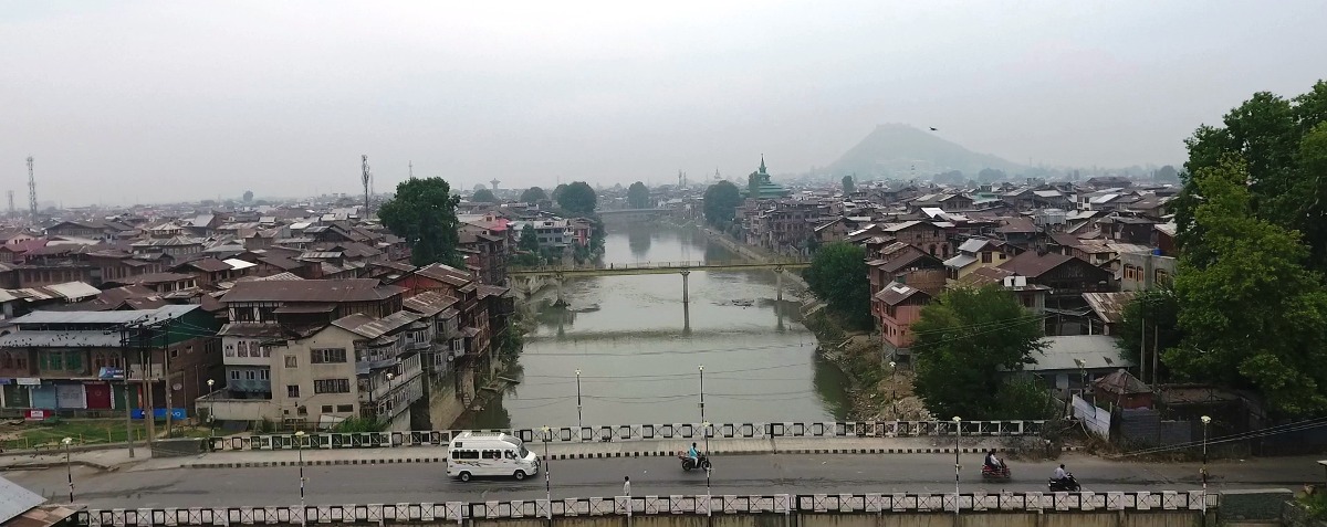
The Jehlum River, one of the five rivers comprising the Indus River basin of the Himalayan Mountains, drains the Kashmir Valley. Kashmir’s unique geography, with land rising in terraces to meet the snow-capped mountain peaks of the Himalayas, provides a perennial water source. Over time, the inhabitants enhanced this natural water flow arrangement.
Death of Nala Mar
As Engineer Hassan Khan noted in his book Kashmiri Musalman, the Kashmiris developed a sophisticated practice of terracing the land and building a network of irrigation canals to bring water to the terraces for paddy cultivation.
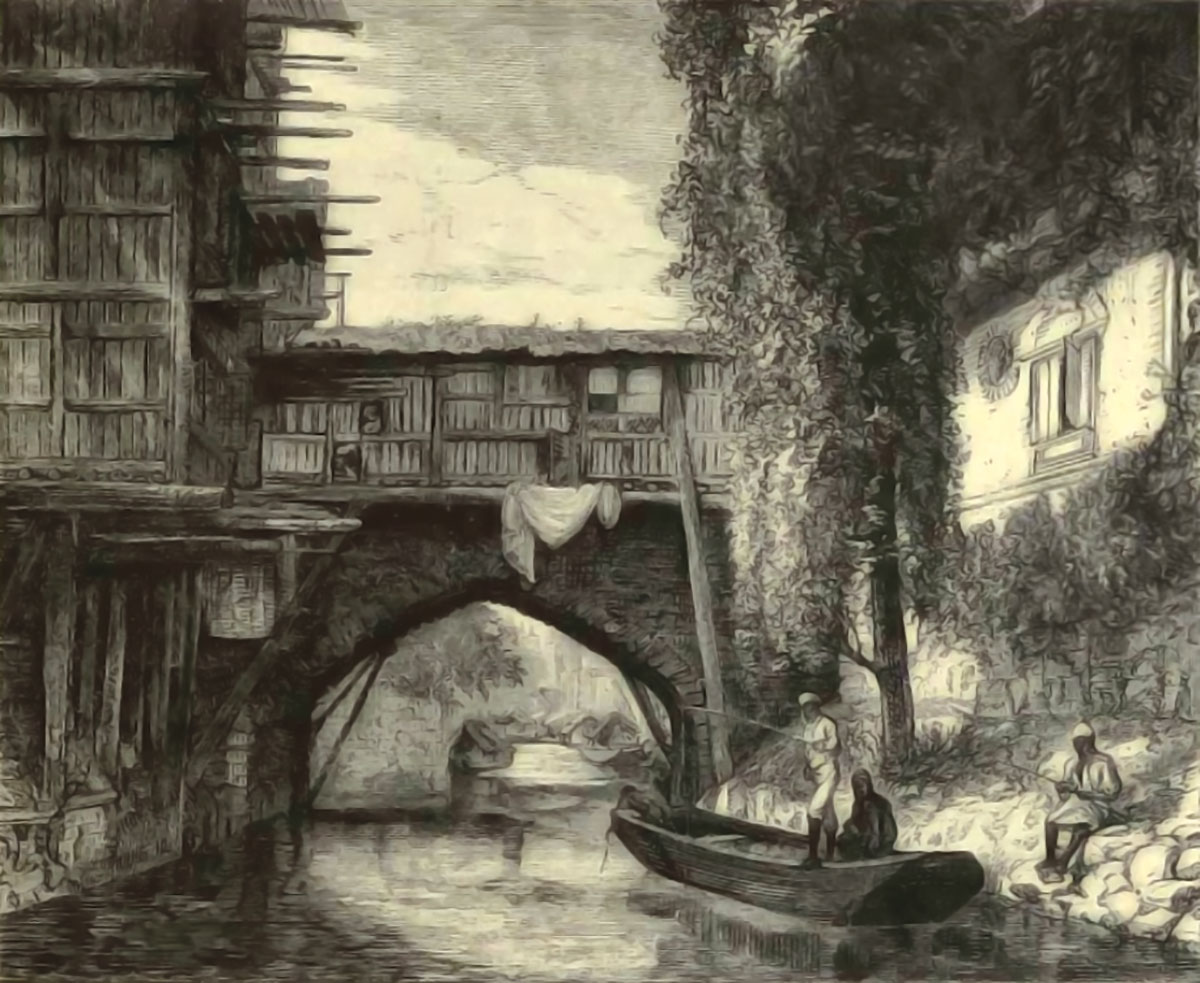
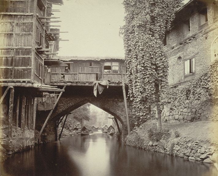
The medieval era saw the construction of numerous navigation and irrigation channels in Kashmir, showcasing the region’s engineering prowess. Srinagar city itself is a testament to this, comprising a series of islands enclosed by water bodies. The Nala Mar canal, built in the fifteenth century by Budshah, was a notable waterway that contributed to Srinagar’s reputation as the Venice of the East.
The River Jehlum, once described by Isabella Bird in 1889 as “a broad rushing river for its high street and the widening canals for its back streets”, was a testament to the natural beauty of the region.
However, the Nalla Mar, a key component of this waterway system, fell victim to short-sighted engineering in the 1960s. To reduce flooding of the Dal Lake, a new canal was constructed to lower the water level. This alteration had a devastating impact on the Nalla Mar, slowing its water flow and disrupting the natural cycle of flooding that once flushed the canal. Over time, the Nalla Mar became stagnant.
A proposed engineering solution to this problem involved converting the Nalla Mar into a trunk drain for Srinagar City, accompanied by the construction of a new motorable road on top. This plan, however, was abandoned midway, and the Nalla Mar was instead filled in as part of an earth-fill project. This decision demonstrated a striking lack of understanding among engineering planers regarding the fundamental difference between a drainage channel and a ditch.
New Drainage Systems
Srinagar is currently undergoing a new drainage construction programme. Celebrated Kashmiri poet Zarif Ahmad Zarief recently offered a scathing critique of this initiative, noting that the engineers are creating huge trenches, only to install pipes that are barely large enough to prevent blockages. “They make a huge trench big enough for a bus to go through and then put a pipe the size of a gooseneck that a corn kernel will choke,” he described. A visit to the construction sites reveals a scene that mirrors Zarif’s description: entire streets dug up, with narrow pipes, often no more than a foot in diameter, laid along the trenches.
The rationale behind the numerous earthwork cut-and-fill projects in Kashmir is a question that has been puzzling many. Given the scale of these projects, it appears that the engineering establishment views Kashmir not as a river valley basin, but rather as a vast ditch in need of excavation.
The Railway Line
A striking example of this approach is the new railway line that cuts across the length of Kashmir, from Khanabal to Baramulla. Visible on Google Maps, this straight line gash through the landscape is a testament to the engineering establishment’s preference for grand, earth-shaping projects.
The rail line runs primarily through low-lying areas, often through paddy fields, and is elevated on an embankment to prevent flooding. However, this embankment, constructed from millions of truckloads of earth mined from hillsides, has disrupted the natural drainage flow, created flood-prone areas, and is, quite simply, unsightly. It has effectively divided Kashmir into Upper Kashmir and Lower Kashmir.
The railway line’s alignment is noteworthy for its lack of consideration for existing habitation areas. The location of stations, often accompanied by adjacent military compounds, suggests that the rail project may be driven more by strategic interests than civilian needs. One cannot help but wonder if alternative alignments were ever considered. A railway line circling the Valley, above flood levels and below forest lands, would have opened up new areas with better drainage, making them more suitable for urban development. Moreover, such an alignment would have become a tourist attraction in its own right.
The choice of the present alignment also raises questions about the practicality of the project. Would it not have been easier and more cost-effective to source earth from the adjoining land along the alignment? Furthermore, the excavated area could have been repurposed as a new navigation channel running alongside the rail line.
Earthworks Everywhere
Earthwork projects have become a defining feature of Kashmir’s engineering landscape. A new bye-pass road, called Srinagar Circular Road, currently under construction around Srinagar, runs parallel to the rail alignment. Notably, this road has been elevated, in some areas surpassing the height of adjacent three-storey structures.
This approach to road construction, whereby roads are built on earth banks, has its roots in the construction of roads connecting towns. The Srinagar Baramulla cart road, built by excavating earth adjacent to the road, is a prime example. This method resulted in the creation of ditches that stored road runoff water and protected the right-of-way road from encroachment.
The Srinagar Circular Road, much like the rail line, is a massive earthwork project. The land between the bye-pass and the rail line, now waterlogged, has become a hotspot for new construction activity. Productive agricultural land is being rapidly transformed into sites for new hotels, automobile showrooms, and housing.
These earthwork projects have a profound impact on the delicate natural drainage balance of the Jehlum Valley. By disrupting this balance, they create swamps and cesspools underground. Besides, the overdesigned and aesthetically unpleasing public works projects are transforming Kashmir into a steel and concrete jungle above ground. Even projects intended to reclaim water bodies, such as the Dal Lake restoration project, incorporate earth filling into their engineering designs.
The Boulevard
A notable example is the extension of the existing road as part of the Dal Lake project. Instead of utilising the silt from the Dal to build a new road or embankment, engineers opted to transport the earth from elsewhere. This decision is all the more perplexing given that the silting of the lake bed is a primary factor contributing to the degradation of the Dal Lake. The removal of silt from the lake is essential to its renewal.
As part of the Dal Lake project, a proposal has been put forth to relocate approximately 5000 families from the area. These families, who are primarily vegetable growers, have ancestral ties to the land. The land within the Dal, often romanticised as floating gardens, is remarkably fertile, boasting a productivity rate roughly ten times that of the surrounding paddy land.
According to Dal authorities, the relocation of these families is intended to eliminate a source of pollution. However, one cannot help but question the wisdom of targeting these 5000 families while ignoring the significantly larger population of approximately 300000 families residing in the surrounding areas.
The relocated families are to be moved to a dried-up marsh bed on the outskirts of Srinagar. In a move that seems to perpetuate the cycle of earthwork projects, the Dal authorities are now seeking funding to earth-fill the marsh.
A more innovative approach might involve creating a new floating garden neighbourhood on the marsh, thereby avoiding the need for extensive earth-filling. However, such an approach would likely be less lucrative for engineering budgets.
Reconsider and Think
To young engineers of Kashmir, I urge please reconsider your approach to engineering projects. The profession’s credibility is at stake, and the long-term consequences of prioritising earthwork projects over sustainable solutions will ultimately shortchange the future of Kashmir and its inhabitants. Engineers are urged to prioritise the restoration of existing waterways and the creation of new ones, rather than dirtying the waterways. The health of the watershed is crucial to the common good, and it is essential that engineers strive to preserve it.
By adopting a more sustainable approach, engineers can help restore Kashmir’s natural beauty. The landscape observed by Isabelle Bird over a century ago, with the Jehlum flowing as a broad, rushing river through Srinagar’s High Street, and widening canals surrounding the city’s many islands, can once again become a reality. Srinagar can reclaim its title as the Venice of the Himalayas.


