SRINAGAR: A new study published in the journal Climate reveals a drastic decline in snow resources across Jammu and Kashmir over the past five decades, warning of serious implications for water security, agriculture, and regional hydrology.
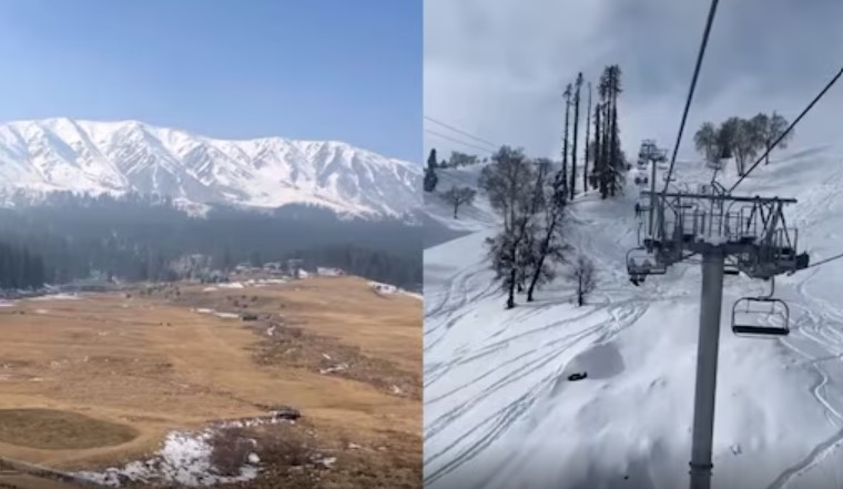
The research paper, authored by Aaqib Ashraf Bhat, Poul Durga Dhondiram, Saurabh Kumar Gupta, Shruti Kanga, Suraj Kumar Singh, Gowhar Meraj, Pankaj Kumar, and Bhartendu Sajan, documents a 31.4 per cent reduction in snow-covered area between 2000 and 2024. Satellite analysis indicates that total snow-covered space shrank from 22,261.21 square kilometres in 2000 to 15,275.75 square kilometres in 2024.
According to the authors, rising temperatures represent the primary driver behind the diminishing snowpack’s. The study, Snow Resources and Climatic Variability in Jammu and Kashmir, India, records a steady warming trend across the region over the last 50 years, with Sen’s slope temperature calculations showing an increase of 0.0016°C per year. High-altitude northern districts such as Bandipora and Ganderbal experienced some of the highest warming rates, recording Sen’s slope values of 0.00031°C per year and 0.00024°C per year respectively. In comparison, Srinagar and Pulwama witnessed more moderate warming rates of 0.00014°C per year and 0.00006°C per year.
Correlation analysis highlights a strong negative relationship between Snow Water Equivalent (SWE), the measure of water contained within snowpacks, and mean temperature, with correlation coefficients ranging from -0.7 to -0.9. “The strong negative correlation between SWE and temperature highlights temperature as the primary driver of snow loss,” the study notes, adding that warmer winters accelerate snowmelt, shorten snow cover duration, and reduce winter precipitation stored as snow.
High-altitude regions have taken the brunt of the decline. District-level evaluation reveals that Kupwara and Bandipora suffered the steepest reductions in SWE, with Sen’s slope estimates of -0.0003 and -0.0001 per year respectively. Other districts showed varying trends; Ganderbal recorded a mean slope of 0.0002, Anantnag 0.0002, Badgam 0.0002, Kulgam 0.0001, Shopian 0.0001, Pulwama 0.0001, Srinagar 0.0001, and Baramulla -0.00001.
The impact of wind speed on snow resources was found to be far less pronounced. Correlation coefficients between wind speed and SWE ranged between -0.2 and -0.4, indicating that wind plays a secondary, localized role mainly limited to snow redistribution and evaporation. Wind speed trend slopes across districts remained low, ranging from a mean of 0.00031 in Bandipora to -0.00001 in Baramulla.
Hydrological modelling conducted in the study shows that annual stream flow volume increased by 38.8% over the last 24 years, rising from 45.68 million cubic metres in 2000 to 63.46 million cubic metres in 2024. The stream flow volume measured 52.35 million cubic metres in 2005, dropped to 47.23 million cubic metres in 2010, and rose to 55.89 million cubic metres in 2015 and 60.12 million cubic metres in 2020. The researchers explain that while snowmelt contributions are shrinking, overall stream flow figures are increasingly inflated by higher rainfall intensity, rapid land-use changes, and expanding urban impervious surfaces.
The authors warn that the combination of rapid early snowmelt and erratic weather poses serious risks to agriculture and smallholder farmers dependent on snow-fed streams. The study also points to potential links between reduced snow cover, altered surface albedo, and an increase in extreme weather events like hailstorms. Districts like Baramulla and Kupwara reported 37 and 29 hailstorm events respectively between 2007 and 2022, compounding crop damage in areas already facing snowpack loss.
To evaluate regional climate data, the researchers validated European Centre for Medium-Range Weather Forecasts (ERA5) reanalysis data against ground observations from Indian Meteorological Department (IMD) stations in Kupwara, Srinagar, and Qazigund. The comparison showed strong statistical alignment, yielding high Pearson correlation coefficients of 0.986 for 1980, 0.965 for 1993, and 0.977 for 2014. Root Mean Square Error (RMSE) values stood at 3.55°C, 3.87°C, and 3.26°C for those respective years.
The study stresses the urgent need for adaptive regional water management strategies, including real-time snowpack monitoring, efficient irrigation systems, and climate-resilient farming practices to counter long-term water scarcity risks across Jammu and Kashmir.