
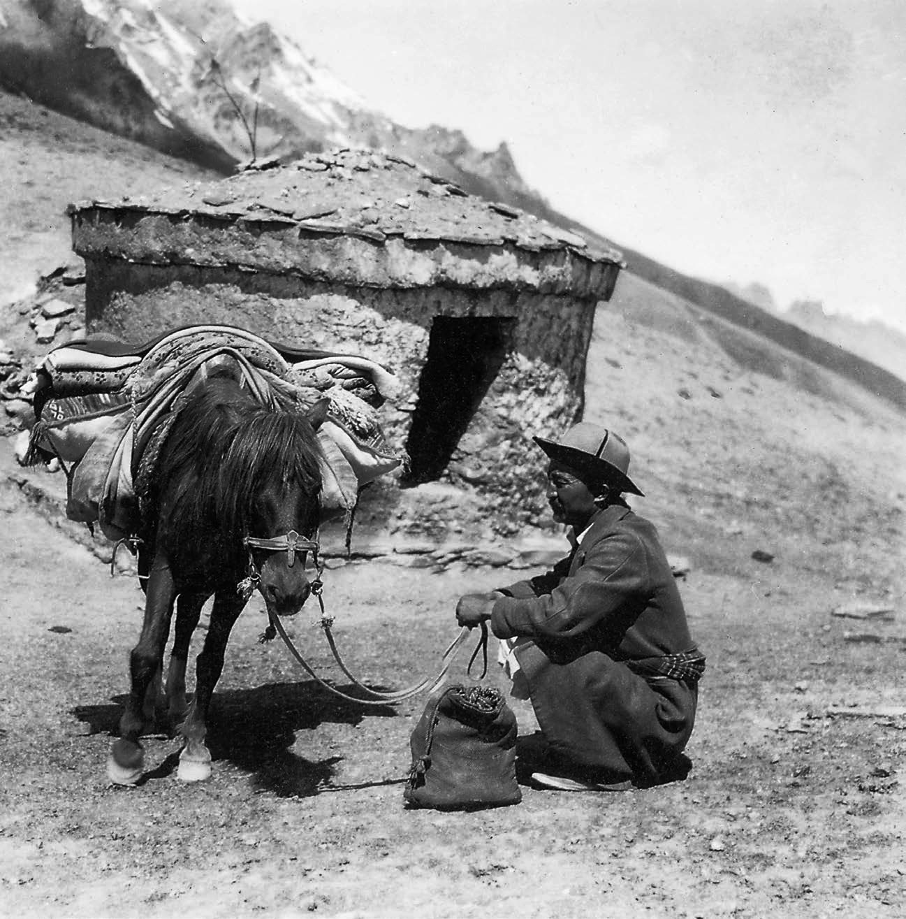
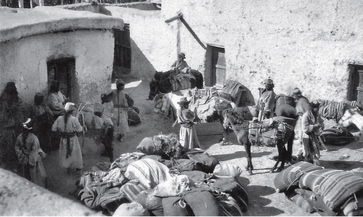
In 1870, when according to a compilation of the East India Company, 15.37 lakh people lived in Jammu and Kashmir and were managed by 26975 soldiers, it was producing revenue of Rs 84.30 lakh to the Maharajas’ coffers. Then, Ladakh was the key dry port and Dr Henry Cayley (1834 – 1904), a physician and the first British resident to Ladakh (1867), submitted a detailed report of the state and status of trade and routes with suggestions about the improvements. Exactly 150 years later, the same routes mentioned in this report are now dotted with artillery guns and tanks as the spots specially mentioned are the points of discord and tension between Delhi and Beijing.

- The object the Joint Commissioners have had in view has been to ascertain and select the route through Ladakh, between the boundaries and in the direction above-mentioned, most suitable for a future commercial highway; and after examining the various lines of road, and taking into consideration the different circumstances affecting the facilities of transport and the development of trade, they have the honour to submit a report on the subject, embracing briefly the following points:
1st – A description of the different routes, and the reasons for selecting a particular one.
2nd– The proposed boundaries of the road.
3rd – The works that have already been carried out and are still required in connection with the new line of road.
- From the Lingti boundary of Lahul to the Rupshu district of Ladakh there are two routes -one, which was previously but little known and often spoken of as likely to prove the easier and more direct of the two, leads from Lingti up the Serab Kiver and then over the Pongpo Pass to the Tsomoriri Lake, and beyond that over another pass to Puga, in Rupshu. On careful examination this road was found to be quite unsuitable for the purpose required, being for a long distance almost impassable for horses. The Pongpo Pass was very difficult and not open for laden horses till the end of July, owing to steep beds of snow and ice, and the distance from Lingti to Puga was 2 stages longer than by the Lachalung Pass.
The other road leads down the Serab River and over the Lachalung Pass to Rukchen, in Rupshu. This pass is an easy one, and opens very early in the season. The road, which is well-known and regularly used, is in good order, and can easily be kept in repair, and is the one now recommended.
- From Rukchen to Lukung at the north-west extremity of the Pangong Lake again there is a choice of two roads. The easterly route takes a direction north-east by the salt lake Tsokar to Puga, and thence to the Indus at Mya, and crossing the river by a ford at Nyama continues over an easy pass to Chushul, and then along the shore of the Pangong Lake to Lukung. There is also another way from the salt lake to the Indus at Kangmar, and thence to Chushul, but through a little shorter, this is more difficult than the Nyama route.
The other way from Rukchen lies along the old-established road over the Taklung Pass through Gya to the Indus at Upshu, and then down the valley to Machalong, which is only 20 miles from Leh. The river is here crossed by a good bridge, and the road then leads up the Chimri valley and over the Chungla Pass to Durgu, and on through Tantse to Lukung.

These two routes are nearly equal in length, and neither of them, present any difficulties that may not easily be overcome. The line by Nyama is the easiest of the two (except for the great difficulty of bridging the Indus at that part of its course), as the Polokouko Pass is lower than the Taklung La. The route by Machalong is, however, considered to be the most suitable for commercial purposes on the following grounds:
First, there is a good bridge at Machalong, whereas there is no bridge over the Indus above that point, and there is no timber in Ladakh of a size sufficient for building such a bridge. Trees of large size would, therefore, have to be brought from Kulu or Kashmir, a distance of from 15 to 20 marches, over a difficult mountain country, and it is very doubtful if this could be done unless at such enormous expense as to render it quite out of the question. The river, it is true, is fordable at several places, but during August, when most of the traders would pass through, the water is often very deep and merchandise would have to be carried over on men’s heads, to the great inconvenience and detriment of the merchants.
Secondly, there is already a good road made the whole way from Rukchen to Lukung, which can, at very little labour and expense, be kept in repair; there are also several serais and rest-houses now ready along the road. Thirdly, the chief advantage the Machalong route possesses over the other is, that from Gya (2 marches distant from Rukchen) to Lukung it passes through inhabited country where cultivation is plentiful; that is to say, there are villages and cultivated lands at intervals of seldom more than eight or-ten miles, so that supplies can be procured in abundance and at cheap rates.
The merchants, after the long and arduous journey from Yarkand or the Punjab to Ladakh, always find it necessary to rest and feed up their horses for two or three weeks before continuing their journey, and this they can easily do in the valley of the Indus, where, from time immemorial, it has been the custom to arrange with the zemindars to graze their animals in the fields of grass or stubble on payment of a certain sum daily or monthly, and the arrangement is a convenience and advantage to both parties. The Chunpo grass lucerne is grown everywhere at and below Machalong, and is the staple food of the Yarkandi horses in Ladakh.

There are villages and cultivated lands at Nyama and Mya, but not nearly sufficient to supply the wants of any considerable number of traders; and although there is a good deal of grassland, it is only the natural grass of the country, and would not be sufficient for feeding up the horses for several weeks. Chunpo is not now cultivated at Nyama, and it is very uncertain if it would grow at that elevation.
Supplies of barley, flour, and similar articles might be readily transported to Nyama, but their price would of course be greatly increased by the carriage; and to carry grass for fodder a distance of six or more stages would be out of the question; so that under present circumstances the merchants would not use the road.
Another advantage possessed by the Machalong road is, that it passes within 20 miles of Leh, so that one road only has to be kept up for traders going to Leh and Kashmir, as well as for those to Yarkand and Hindustan; and it must be taken into account that many if not most of the merchants both from Yarkand and the Punjab will probably never go right through, but will as at present barter their goods in Ladakh and return to their homes; many too will always want to visit Leh and trade with the merchants from Kashmir and other parts.
It is again a matter of important consideration that the Changchenmo route to Shadula in Yarkand is not yet properly open.
The best line of road is not fully laid out, nor are the necessary arrangements for supply depots, serais, &c, completed, and it is impossible that this can be all done in the present season; and it will probably take two or three years before the road can be pronounced ready. In the mean time, the traders generally will prefer to take a road they know, in spite of its difficulties and drawbacks, to one with which they are very imperfectly acquainted, and which has acquired a bad name from the disasters which have occurred this season; and for those coming by the Karakoram, the Machalong road is directly in their way from Ladakh to the Punjab, and will always have to be kept up. To the people of the country it is of the utmost advantage that the trade route should pass through their midst, as they then, without any interference from the authorities, make their own arrangements with the traders in regard to carriage, supplies, &c, to their mutual benefit; but it would be a heavy tax on them to have to carry supplies a distance of six or eight marches; and it would be almost impossible for the merchants ever to procure carriage out at Nyama; and although the authorities might force the people of the country to take their yaks, horses, &c, out there for the season, such an arrangement must give rise to oppression and injury, and could never be permanently maintained.
It is, however, quite possible that in future years arrangements might be made for meeting the requirements of trade, by the establishment of a new town at or near Nyama, as has already been contemplated by His Highness the Maharajah, and by greatly increasing the cultivation there. Under such circumstances the course of the road might easily be changed, if thought advisable at any future time.
- From Lukung the road is now completed and in fairly good order as far as Gogra, in Changchenmo, a distance of three marches; from Gogra there are two routes to Shadula in Yarkand; one of these, which has been frequently followed by traders and others in the last three years, leads over the Lingzithang and Soda Plains to the head of the northern branch of the Karakash River; and down that river to Shadula.
The distance is 12 marches; the road is very easy; and the mountain-passes present no obstacles of any kind; but the distance is long, and there is the drawback of scarcity of grass and water on several of the stages, which is greatly intensified by the traders being imperfectly acquainted with the road, and not knowing where to find the best halting places. The road must, in fact, be regularly laid out before it can come into general use.
There is a second route from Gogra leading to Malaksha, three stages from Shadula on the old Karakoram route. This road is new and has only this year been discovered. It is more direct than the other, and is superior in many respects, as it avoids the barren elevated plains of Chanthang, except for about 15 miles across one corner of Lingzithang, and generally keeps along well sheltered valleys and by the side of plentiful streams of water; grass and wood are abundant at most of the stages.
This line of road, however, must be thoroughly marked out before the merchants are likely to follow it, as they experience the greatest difficulties from being ignorant of the way, and till this is done the Karakoram route will generally be followed.
- With regard to the boundaries of the proposed future trade-route between Lingti and the Changchenmo Valley, as a rule and especially when the road traverses barren mountains and desert plains, or passes along uninhabited valleys, nothing more definite can be laid down than a general limit of akoss(two miles) in breadth. In such regions, which extend the whole way from Lingti to the head of the Gya ravine – five stages, and again the greater part of the way from Tantsi to Changchenmo – five marches, travellers are often necessarily guided in the direction they take by the presence or otherwise of grass, water, &c, which are found in different localities at different seasons. Thus, between the Lachalung and Taklung Passes, a distance of two days’ journey, the traders are often obliged to avoid Rukchen and the Kyangchu Plains altogether, because the water there entirely dries up, and go round by the Zara Valley further to the west.
The Rupshu nomad shepherds, who occupy these regions in summer, in the same way move about from place to place as they find water and pasturage most plentiful. From the foot of the Taklung Pass down the Gya Ravine to Upshi on the Indus, the aides of the valley would be the limits of the road. The valley generally varies in width from a few yards to a quarter of a mile, excepting at the villages of Gya, Meru, and Upshi, where the valley opens out, and contains cultivated lands with houses scattered about.
It is most essential that these villages, as well as all others that lie in the line of route, should be considered as within the limits of the jurisdiction of the Joint-Commissioners, as all transactions with regard to carriage, supplies, grazing, &c, between the traders and the people of the country are carried on in these villages, and it is in such cases that the authority of the Commissioner is most frequently required. This would in no way affect the internal economy of the country, or the authority and administration of the Ladakh officials in matters unconnected with trade.
From Upshi to Machalong the road keeps down the left bank of the Indus, and lies entirely over waste sandy desert. Here the boundary would be one koss from the edge of the river, as the road is sometimes close to the bank and sometimes a mile or more distant. At Machalong the road crosses the Indus by a bridge, and then passes up the Chimri Valley, and over the Chungla Pass to Durgu, and then up the Tantsi Valley, through Muglib to the head of the Pangong Lake. Along this portion the sides of the valleys generally would form the limits of the road, the villages of Chimri, Sakti, Takar, Durgu, Tantsi, Muglib, and Lukung lying in the line of route. It may be observed that these villages, like almost all others in Ladakh, consist of detached houses lying scattered amongst the fields, often long distances apart, and must be considered more as a collection of detached farms than a single village.
From Lukung, a small hamlet of three houses on the Pangong Lake, the road passes up the valley, and over a low spur to Chagra, and thence over the Masimik Pass to the Changchenmo Valley and Gogra. The only village along this portion is the small hamlet of Pobgung, five miles above Lukung; all the rest of the distance the country is uninhabited – the sides of the several valleys along which it passes forming the limits of the road.
- Camping grounds:Along the waste plains of Rupshu and elsewhere, and in the uninhabited valleys, it is quite useless to fix particular sites for camping grounds, as the traders must necessarily halt and encamp just where they find it most convenient; but when the road traverses the inhabited parts of the country, the following sites have been selected :
1st – At Gya. The space of uncultivated ground along the banks of the side stream coming down from the south-west, and just opposite the centre of the village.
2nd – Upshi. The uncultivated land just above the village along the side of the stream.
3rd – Machalong. The open space of waste land on the left bank of the Machalong Ravine, where a serai and depot are to be built.
4th – Chimri. The open space in front of the present serai.
5th – Zingrul. The level space of ground near the lake or pond.
6th – Tsoltak. The open space near the lake.
7th – Durgu. The open ground on the left side of the river just above the village.
8th – Tantsi. The uncultivated space near the rest-house.
9th – Muglib. The meadow land below the village.
10th – Tsoar. The space of ground near the small lakes.
11 th – Zukung. The meadow land above the village.
12th – Chagra. The valley near the rest-house.
Above this all habitation ceases; but serais have been built at Lunkha, Panglung, Pamzal, and Gogra.
- The following works have this year been carried on in connection with the road:
The road from Lingti over the Lachalung Pass has been greatly improved, and the necessary repairs executed. The same has been done over the Taklung Pass and down the Gya Ravine to Upshi.
Again, from Chimri over the Chungla Pass to Durgu, the road has been immensely improved by diminishing the gradients and clearing away large blocks of stone, so that the path is now quite easy for laden horses.
Above Durgu, where there was a very steep and difficult ascent of soft deep sand, the road has been carried round, so as to avoid the bad part.
Over the Masimik Pass to the Changchenmo the road has been greatly improved, and is now very good. In all other places between Lingti and. Changchenmo the road is very easy and in good order.
- Serais for shelter have been built at the following places:
At Gogra in Chanchenmo; At Pamzal, one stage from Gogra;
At Panglung, one short stage from Pamzal; At Lunkha, one stage from Panglung, on the south side of the Masiinik Pass; At Chagra, six miles from Lunkha; At Zingrul, just at the foot of the Chungla Pass, on the south side. At Sumdo, an encamping ground near the top of the Sachalung Pass.
There are also old-established rest-houses and depots for supplies at Tantsi, Sakti, Chimri, and Gya.
It is proposed in future years to build serais for shelter at the following places:
Kiangchu, on the Rupshu Plains, at the spot where water is most plentiful. At Debzing, at the foot of the Taklung Pass, on the south side. At Machalong, where the three routes to Yarkand, Kulu, and Leh meet. This should be on a much larger scale than the others, with abundant storerooms, where merchants might deposit their goods for the season, or longer if necessary.
At Tsoltah, the small lake north of the Chungla.
Beyond Gogra, as soon as the survey of the road has been completed to the head of the Karakash River, it is proposed to erect serais in suitable places for the first four stages. These sites cannot, however, be definitely settled till the line of route is quite determined on and the road marked out.
- The following places have been selected for supply depots, where stones of barley-flour, and other necessaries, are always to be kept up.
Gya, five marches from Lingti, and eight from Darcha in Lahul. This is the furthest village in Ladakh on the road to Lahul.
Machalong, two stages from Gya and one from Leh.
Tantse, three stages from Machalong on the road to Changchenmo.
Chagra, two stages beyond Tantse.
Gogra, in Changchenmo Valley, three stages beyond Chagra. It would also be very advantageous to establish another depot on the Karakash River.
- The Commissioners have not this season been able to carry out their plans of extending and improving the road, building serais, and establishing depots to the extent they had hoped, as, owing to exceptional circumstances, it has been impossible to obtain the requisite labour and materials and assistance from the authorities of Ladakh.
Grain depots have been maintained at Gogra, Tantse, and Gya during the season, and the traders have availed themselves of them, to a great extent; but even in these the arrangements have been deficient.
- Much yet remains to be done before the Changchenmo route to Yarkand can be considered properly open and available for general traffic. The road itself must be made and properly marked out, so that people may be able to find their way if overtaken by bad weather.
The arrangements for supplies at the depots must be permanent, and it is impossible that all this can be done in one season. In the meantime the traders will generally follow the old route by the Karakoram Pass, which they know so well; and it is along the most frequented lines of traffic that the duties entrusted to the Joint Commissioners’ require chiefly to be exercised.
(The report dated October 20, 1870, was excerpted from 1874 publication, Accounts and Papers Vol 15 that was presented to the House of Commons in the session dated March 5 to August 7, 1874)


: The FM Speech")


