SRINAGAR: A recent study has identified a range of geological, geomorphological and culturally significant sites across Kashmir that could be developed as geoheritage and sustainable geotourism destinations, including the Balapur Fault, Chiranbal Meadow, Aharbal and Panzkoot waterfalls, major lakes, glacier landscapes and the globally significant Permian–Triassic boundary at Guryul Ravine.
The study, Exploring the Geoheritage, Cultural Geomorphology, and Geotourism Potential of the Kashmir Region, Northwest Himalaya, India, was published in Geoheritage.
The research was conducted by Mohammad Irfan, Ahsan Afzal, Bikram Singh Bali, Savas Topal, Sambit Naik, Naseer Ahmad and Asif Bashir. Irfan, Afzal, Bali, Ahmad and Bashir are affiliated with the Department of Earth Sciences, University of Kashmir, Srinagar, while Topal is from the Department of Geological Engineering, Pamukkale University, Türkiye, and Naik is affiliated with the Department of Petroleum Engineering and Earth Sciences, University of Petroleum and Energy Studies, Dehradun.
Geological Wealth
The researchers describe Kashmir as a geologically and culturally diverse region situated between the Greater Himalayan and Pir Panjal ranges. The region contains a complex combination of rock formations, tectonic structures, glaciers, lakes, river valleys and Quaternary sediments, alongside historical and cultural landscapes.
According to the study, Kashmir functions as a natural laboratory for understanding Himalayan tectonic activity, landscape evolution, past environments and geological processes. The researchers note that rivers, lakes, glaciers and historical sites are accessible in several parts of the region, creating opportunities for scientific research, education and geotourism.
The study also points out that geoheritage conservation in Kashmir has received relatively limited attention, resulting in deterioration of some sites and inadequate awareness about their scientific, educational and economic significance.
Fault Exposure
One of the key sites identified by the researchers is the Balapur Fault in Shopian district. The study describes the Balapur Fault as a prominent high-angle thrust fault extending for nearly 60 kilometres, although some studies have suggested that its total length could approach 110 kilometres. The fault has produced visible geological and geomorphological features and provides evidence of past seismic activity.
At Balapur village, along the Rambiara River, the researchers say the fault is particularly accessible for field-based study. Geological units across the fault have been vertically displaced by about 13 metres, while paleoseismic investigations indicate an annual shortening rate of approximately 0.3 to 1.5 millimetres.
The researchers describe the site as an outdoor classroom for students, researchers and visitors interested in tectonics, seismicity and landscape evolution.
Alpine Meadow
The study identifies Chiranbal Meadow in Kulgam district as the largest sub-alpine meadow in the southern part of Kashmir.
Located around 75 kilometres from Srinagar through Pulwama, Shopian, Aharbal and Manzgam, Chiranbal can be reached by a short drive followed by an estimated one-hour-and-15-minute trek.
The meadow lies along the Zajinar stream, a tributary of the Veshaw River, and provides views of surrounding mountains including Kachoi, Bardalow, Manzpal and Hapatnad. The researchers also document several geomorphological features, including river terraces, braided deposits, V-shaped valleys, truncated folds, offset streams and evidence of stream capture.
The site also supports pastoral livelihoods through livestock grazing and has potential for activities including fishing, rafting, camping and horse riding.
Waterfall Sites
Panzkoot and Aharbal waterfalls are also highlighted as important geomorphological and geotourism sites.
Panzkoot Waterfall is described as a feature shaped by tectonic and fluvial processes, with multiple cascades and plunge pools carved by flowing water. Its surrounding V-shaped valley reflects the combined influence of tectonic activity and erosion.
The study notes that the waterfall, located in the upper Chiranbal region, is surrounded by valleys, forests, meadows and gorges and has already attracted tourists and earth scientists. The researchers say eco-friendly infrastructure and sustainable tourism could further enhance its geotourism potential.
Aharbal Waterfall, meanwhile, is characterised by a deep, narrow gorge and a large plunge pool. The gorge is primarily composed of jointed basaltic rock, providing a site for studying river incision, erosion, lithology and the effects of tectonic uplift.
Lake Heritage
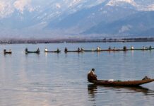
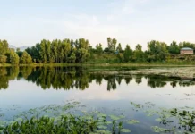
The researchers also identify Dal, Wular, Manasbal and Nigeen lakes as important geoheritage landscapes. The lakes combine geological, ecological and cultural values, while their sediments provide information about past environmental and climatic conditions.
Dal Lake, the study notes, is closely linked with Kashmir’s cultural landscape through houseboats, floating markets and surrounding Mughal gardens. Wular Lake, meanwhile, has geological, ecological and economic importance and is recognised as a wetland of international importance under the Ramsar Convention.
Manasbal Lake provides opportunities for studying limestone folding as well as lake processes, while Nigeen Lake combines its freshwater environment with traditional houseboats and its proximity to Hari Parbat.
Fossil Record
The Permian–Triassic boundary at Guryul Ravine emerges as one of the most scientifically significant sites discussed in the study.
The researchers say the site contains an uninterrupted three-metre stratigraphic record associated with the end-Permian mass extinction, approximately 252 million years ago. The study compares this thickness with the much thinner, globally recognised section at Meishan in China.
The boundary provides an opportunity to investigate mass extinction, environmental change, evolutionary processes and Earth’s palaeoclimate.
The researchers describe Guryul Ravine as having outstanding potential for nomination as an international geopark because of its stratigraphic completeness and relevance to major global biological and climatic transitions.
Protected Zone
The paper notes that the Guryul Ravine fossil zone was officially designated a protected fossil zone by the Jammu and Kashmir Department of Geology and Mining on March 3, 2017.
The Tourism Department acquired approximately 25 kanals of land at the site in 2018 and secured it with fencing for preservation, according to the study. The paper also records an initiative involving the Environment Policy Group, Penn Dixie and a natural history society in New York aimed at supporting development of a major fossil park at Guryul Ravine.
Glacier Potential
Glacial landscapes form another major component of Kashmir’s proposed geoheritage network. The researchers identify glaciers and glacial valleys as important for understanding glacial geomorphology, climate change, hydrology and high-altitude ecosystems. Such landscapes can also support field education and scientific research while attracting visitors because of their distinctive scenery.
The Thajwas glacial valley, in particular, is identified as a potential representative glacial geomorphosite because of its accessibility and existing tourist visitation.
Cultural Link
The study goes beyond geological features by incorporating Kashmir’s cultural landscape into the proposed geoheritage framework.
Sites including Shalimar Bagh, Nishat Bagh, Chashma-i-Shahi, Hari Parbat Fort and Shankaracharya Hill and Temple are identified for their historical, cultural and aesthetic significance.
The researchers argue that geological landscapes and cultural heritage can be presented together, allowing visitors to understand the relationship between Kashmir’s natural environment and the communities that have developed around it.

Sustainable Tourism
The assessment used five broad categories: economic, scientific, educational, conservation and additional values, with the latter covering cultural, ecological and aesthetic considerations.
Field surveys, GPS mapping, satellite imagery, digital elevation models and GIS-based analysis were used to identify and assess potential geotourism sites. The researchers also considered infrastructure, accessibility, accommodation, food facilities, conservation threats and the involvement of local communities and officials.
The study argues that geotourism should be developed alongside conservation rather than through tourism infrastructure alone. It emphasises community engagement, environmental stewardship and economic sustainability as key components of any future initiative.
Geopark Proposal
The researchers conclude that Kashmir’s combination of geological formations, tectonic structures, geomorphological landforms, glaciers, lakes and cultural heritage provides a foundation for a broader geoheritage and geotourism framework.
They specifically propose that the Guryul Ravine Permian–Triassic section be considered for international geopark status and that the region’s geological and cultural attractions be incorporated within a unified framework.
The study states that such an approach could strengthen scientific education, conservation awareness and sustainable tourism while preserving Kashmir’s natural and cultural heritage.