by Er Mohammad Lateef and Er Suhail Khanday

The mountains in Ramban district of Jammu and Kashmir form a vital part of the Pir Panjal Range and the Lesser Indian Himalayas. Their geological history stretches back millions of years, shaped by continental collision, tectonic uplift and sedimentation.
Long before these mountains existed, the region was an ancient seabed. Roughly 1.8 to 1.9 billion years ago, during the Proterozoic and Precambrian eras, layers of sand, mud and organic matter accumulated in submarine environments. Intense pressure and heat compacted these marine sediments over vast stretches of time into the Ramban Formation, comprising slate, phyllites, sandstone and limestone.
The actual mountain-building process, or orogeny, began around 40 to 50 million years ago when the Indian tectonic plate drifted northward and collided with the Eurasian plate. As neither plate could easily sink beneath the other, immense compressive forces buckled, folded and thrust ancient marine rock layers upwards, creating mountain peaks.
As the land was compressed and uplifted, the Earth’s crust fractured along massive regional thrust faults, most notably the Panjal Thrust and Murree Thrust. These acted as enormous ramps, pushing older Precambrian formations over younger Cenozoic sedimentary rocks.
Meanwhile, the Chenab River and its tributaries carved deep, steep, V-shaped valleys through the landscape. The resulting tectonically weakened rock formations remain fragile and susceptible to frequent landslides and slope failures.

Mineral Wealth
The mineral composition of Ramban’s mountains reflects a complex geological history involving metamorphic, sedimentary and volcanic rock formations. The region contains industrial minerals, base metals and silicate minerals.
The foundational geological matrix, primarily comprising the Ramban Formation and parts of the Salkhala Group, contains substantial industrial reserves of high-purity gypsum around Parlanka and Harog.
Quartz and feldspar are major constituents of quartzose sandstones, slates, phyllites and quartzites that form the bedrock structure. Calcite and other carbonates occur extensively in thick, lenticular bands of limestone and dolomitic formations. The terrain also contains substantial bauxite deposits.
Low-to-medium-grade metamorphic rocks, particularly slates and phyllites quarried around Banihal and Ramsu for roofing purposes, contain sheet silicate minerals such as muscovite, chlorite and biotite.
Fragile Slopes
The stratification pattern of Ramban’s mountains is predominantly parallel to potential failure planes and surfaces. Unscientific cutting during road construction exposes the interiors of slopes, allowing water to seep through voids, fault lines, cracks and freshly exposed surfaces.
This infiltration lubricates the underlying geological matrix, causing slopes to move outwards under the combined influence of gravity and water.
Differential thermal expansion of rocks and repeated freeze-thaw cycles generate deep-propagating cracks over time. These progressively weaken the rock formations, causing fragments to break away and fall as characteristic shooting stones.
The steep slope geometry, with angles of repose exceeding 75 degrees and reaching 90 degrees at some locations, further aggravates the vulnerability. Most of the soils are cohesionless, with cohesion (C) approaching zero.
Consequently, the slopes derive almost their entire shear strength and resistance from intergranular friction, with minimal cohesion binding the particles together.
During precipitation, water enters voids, cracks and fractures, increasing pore-water pressure and reducing effective stress. This diminishes the shear strength of the slope and triggers different forms of landslides, including falls, topples, slides, spreads and flows.
Although accumulated slide debris naturally reduces the slope’s angle of repose and allows a degree of natural stabilisation, mechanical interventions such as using JCBs to clear debris can steepen the slope again, increasing its susceptibility to subsequent failures.
Water Pressure
Rainwater plays a critical role in slope failure by reducing effective stress and shear resistance through increased pore-water pressure. This mechanism is informally described as the ball-bearing effect.
The failure sequence generally begins with heavy or prolonged rainfall, followed by water infiltration and soil saturation. This increases pore-water pressure, reduces effective stress and shear strength, and eventually produces slope deformation and landslides.
The region receives an average annual precipitation of approximately 1,330.7 mm, with considerable year-to-year variation. Unlike much of mainland India, Ramban experiences a three-season precipitation system involving winter snowfall, heavy pre-monsoon rainfall associated with Western Disturbances and the southwest monsoon.
Rainfall varies considerably with altitude and local topography. Lower-elevation stations such as Ramban town record around 47 rainy days annually, while higher-altitude mountain observatories such as Batote record as many as 84 rainy days.
Winter, extending from December to February, contributes approximately 33 per cent of total annual precipitation. Nearly 80 per cent of the region’s winter snowfall occurs in higher mountain areas, including the Mahu Valley and the Jawahar Tunnel belt, between November and March.
The pre-monsoon period, from March to May, accounts for approximately 31 per cent of normal annual rainfall. Western Disturbances are a major contributor, with March historically being the wettest month, recording an average of 211.7 mm.
The southwest monsoon, from June to September, contributes around 30 per cent of annual precipitation. Its intermittent showers can sometimes develop into severe, concentrated torrential downpours.
The steep terrain also makes the region vulnerable to extreme localised convective events, including cloudbursts. On April 20, 2025, an event reportedly delivered 60 to 140 mm of rainfall in a single day. Batote’s highest recorded single-day rainfall was 255.4 mm within 24 hours on August 23, 1996.
Highway Impact
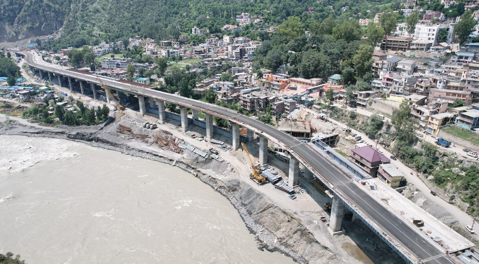
Highway cutting and tunnel excavation inevitably disturb the natural stress equilibrium of mountain slopes. Toe removal, steepened cut slopes, blasting, exposure of fractured rock and altered drainage patterns can reactivate dormant instability.
Tunnelling also disrupts groundwater systems by changing groundwater flow paths and causing fluctuations in the water table. Consequently, streams, springs and channels located considerable distances from tunnel sites may dry up or experience substantially reduced water yields.
Numerical analysis using GEO-5 2026 software on a silty sand slope sample from Kela Morh, comprising 80 per cent sand and 20 per cent silt, produced a critical slip-surface factor of safety of just 0.45.
The assessment considered a traffic surcharge of 1,000 KN/m² and river water levels. The calculated factor of safety was substantially below the generally accepted threshold of 1.5, indicating critical instability under the modelled conditions.
The economic consequences of landslides along the Ramban stretch of National Highway 44 were particularly evident in 2025. Losses were estimated at around Rs 2,000 crore as thousands of fruit-laden trucks remained stranded for weeks, resulting in the rotting of consignments.
The highway’s economic importance makes preventive interventions essential. Controlled road closures allow authorities to assess vulnerable slopes, remove debris, correct drainage and undertake stabilisation work while protecting commuters and workers.
Engineering Solutions
Mitigating landslides across Ramban’s mountainous terrain requires a combination of heavy engineering, targeted drainage management and bio-engineering.
Structural interventions include constructing reinforced concrete retaining walls or wire-mesh rock-filled gabion walls at slope bases. These provide structural retention while allowing efficient drainage.


Soil nails and rock bolts can anchor loose material to stable bedrock. Cutting steep hillsides into benched terraces can reduce overall gradients and provide platforms to catch falling debris.
Anti-slide piles, extending below the critical slip surface, can provide additional resistance against slope movement. At high-risk shooting-stone locations, including Cafeteria and Kela Morh, canopy tunnels with protective slabs can shield road users from falling rocks.
Drainage Control
Drainage management is equally important because uncontrolled water infiltration is a major trigger for slope failure.
Surface water diversion through lined catch drains and chutes can channel rainwater away from vulnerable fracture zones. Subsurface drainage can be improved by installing perforated horizontal pipes deep inside slopes.
Rounded aggregate backfills behind retaining walls can also help relieve internal water pressure and prevent structural overturning.
Green Cover
Bio-engineering and land management offer additional measures to strengthen vulnerable slopes.
Afforestation with deep-rooting native trees and shrubs can bind loose topsoil and improve slope stability. Hydroseeding exposed slopes with a slurry containing mud, fertilisers, seeds and mulch can establish vegetative cover relatively quickly.
Equally important is restricting unscientific toe cutting during road widening and private construction. Preventing further disturbance of naturally fragile slopes is essential to reducing the frequency and severity of landslides.
(Residents of Tral, Mohammad Lateef is geotechnical engineer and Suhail Khanday is structural engineer. Ideas are personal.)