
Pushed into nature by the melancholic hypnosis at Tosamaidan, Mahmood Ahmad spent 15 years trekking and hiking to document Kashmir’s 100 high altitude lakes, rare feat he achieved in 2015.
For me, 2015 was the most gratifying year as I was able to trek to the 100th high altitude lake that summer. For all these years, it has been uninterrupted treks to the Kashmir mountains to seek pleasure and happiness from nature. Unlike people who count years of their lives, I have been counting the lakes I trekked each year. In 2020, five years after my century, my count has gone up to 112 lakes.
I am so used to these treks that Kashmir’s decade’s old turmoil hardly impacted my routine. To many, Kashmir symbolises a place of conflict where venturing out means inviting trouble, going into the mountains is considered scary. To me, however, these mountains are like mother’s lap where I have always found solace. In fact, my photo library has swelled so much that I had to purchase a 4 TB hard-disk.
Emergence From Water
All these mountains surrounding Kashmir have stores to tell about Kashmir’s evolution as the Paradise of the East.
Nilmat Puran, the only text preceding Rajatarangni defines Kashmir as a huge mountain lake where Parvathi used to roam in her boat for pleasure trips till it was drained. Anand’s huge plough divided the mighty chain of the Himalayas flanking towards the west into two parts allowing the vent to the waters of Satisar out, making valley habitable for the Nagas to dwell. That was the beginning of the 5440 sq km valley emerging as the “paradise”. Geologists have their own scientific arguments surrounding around the tectonic theory that drained Kashmir.
The fact remains that Kashmir once was a major lake. While the lake disappeared, small lakes survived the tectonic shifts presumed to be 5 on geotectonic Richter scale. National Wetland Atlas reveals that Jammu and Kashmir has about 2106 high altitude lakes, which aggregates to about 110131 hectares of water surface.
While some of the huge water-bodies like Pangong and Tsomoriri (Ladakh) can be accessed by road, none of Kashmir’s high altitude lakes can be approached by a four-wheel drive. Like rare gemstones, they lie hidden deep in the inhospitable recesses. Unlike the full moon, which appears regularly every fortnight, these lakes remain snowbound for about seven to eight months of the year. For the remaining time, the weather remains hostile and ironically unfriendly for photography.
So every year it requires careful planning to trek to a lake. Things can go off the script anytime – malfunction of GPS, camera, batteries, hostile weather, misleading trails, communication gaps, stubborn guides, lack of terrain knowledge and official exigencies.
But I kept my rendezvous with these elusive creations of nature. By the fall of 2104, I had seen and documented 93. It still required seven to reach a decent century. So my choice of the seven had to be more interesting.
Largest Lake
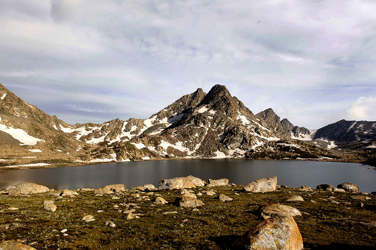
Purani Ganga (4000 meters above sea level) is a lake located east of Gangabal, the largest lake of Kashmir with an area of 167 hectares. It is an important waypoint of the seven-lake-trek, popular as the Great Lake Trek. The trek to Purani Ganga starts 4 km short of Naranag from a village known as Martahoi where from a zigzag trail leads to the lake.
But as always, there was supposed to be a twist in the tale.
The altitude of Martahoi is 2100 metres; therefore, it required a climb of 1900 metres to reach the lake. While we were doing 1300 to 1500 metres of up and down regularly, attempting this one required utmost fitness. Hence, I started to concentrate on my fitness and began to feel confident to do it in one go. But with increasing age lurking in mind, self-doubts creep in.
On September 11, I finally started on the trail with a few of my buddies. As a thumb rule, the trail starts from a village – a base camp, it goes through the forest up to the alpine zone. Invariably most of the trails start in the 2000 metre zone, eventually extending up to 3500 metres, mostly in forests. Thereafter, the alpine zone starts gradually merges into permanent snowline.
As one ascends the heights, nature offers amazing vistas of the lower Sindh valley. Harwar and Harmukh gradually began to unveil themselves as we trudged up through the thick canopy. No sooner did we enter a huge alpine meadow with a gradual incline, the true grandeur of the Kashmir Himalayas was starkly visible. The last stretch to the lake was over a rock, boulders and moraine deposits. While the boulders stand mellowed round by the weather vagaries, these very elements have made moraines deposits razor sharp. Careful manoeuvring is required over these glacial deposits, which litter Kashmir’s alpine zone.
Legend has it that annual yatra used to take place to the Purani Ganga Lake but it was decimated centuries back by a rock slide truncating its area considerably, making yatris to abandon it for its sibling sitting at the foot of the Harmukh mountain, the mighty Gangbal. Hence the lake became known as the Purani Ganga. Kashmir’s legends are as strong as the mountain they are born in.

The trek up to the lake took six hours. Clear weather, a brief breather and a rapid burst of the camera is the most pleasing aspect of the trek, these are the moments that can make or mar your trek. Thank God, I was always fortunate.
Harmukh Bartal
One of the most conspicuous mountain-scape of Kashmir is the Harmukh (5145metres). It is visible from most parts of Kashmir. Harmukh was scaled in 1856 by General Montgomery, the Survey General of British India. He is credited for having discovered K2 from Harmukh while marking the peaks of Karakorum during the survey in the order of K1, K2, K3, and K4. Later, it proved that actually discovered the second highest peak of the world form this mountain.
Various trekkers climbed Harmukh but since 1990, quite a few ventured to scale the cliffs and the crags this mountain offers. Reports have it that para-regiment of the Indian Army made a successful climb in 2010.
However, a purely civilian attempt at the peak was launched by Jammu and Kashmir Mountaineering and Hiking Club in May 2015. As president of the club, I was instrumental in putting a team together, which was able to summit the station peak, 300 metres below the main peak. The Club was able to summit the main or the Eastern peak in the month of September 2015, marking a new beginning for mountaineering in Kashmir.
The skyline of the Purani Ganga trail is dominated by Harmukh, provided sky is cloud-free. Weather in the mountains is the same everywhere. The mornings are usually clear with clouds building up as the day sets in. The forests of Kashmir are evergreen with the lower altitude Kail a predominant species which is interspersed by spruce. As altitude increases, Fir becomes the predominate species. Fir gives way to Rhododendron and Juniper. Finally, the alpine zone covers the mountain faces above 3800 metres. This once abundant natural resource is rapidly depleting; the human race is an un-satiating monster.
Lake Classification
Kashmir’s high altitude lakes stand classified into four categories: Water bodies located above 3000 metres; those which are a perennial source of water; and water body which does not freeze to its bottoms. I could get hold of this classification only when I had visited 68 such lakes. There is subcategorization as well purely on basis of their altitude: Located between 3000 – 4000 metres; found at 4000 – 5000 metres; and those at 5000 – 6000 metres. The last two sub-categories occur in Leh and Kargil, it is the first sub-category that existed in Kashmir.
Gangbal is the largest high altitude lake of Kashmir with an area of 167 hectares. Located at the altitude of 3570 metres and a hike of 5 hours from Naranag, its sibling, Nandkol is located just below it at 3507 metres, barely 60 metres lower than its elder compatriot. Almost all other high altitude lakes in Kashmir are located on higher ground than these twin lakes.
Gangbal is surrounded by a host of high altitude lakes. It falls on the world-renowned Seven Lakes trek. An alternate route to Bandipora goes over the Lalgul Pass, leading into Madhumati river catchment where one can trek to about seven more lakes in close vicinity –a treasure trove of high altitude lakes.
The Gumbergali Pass
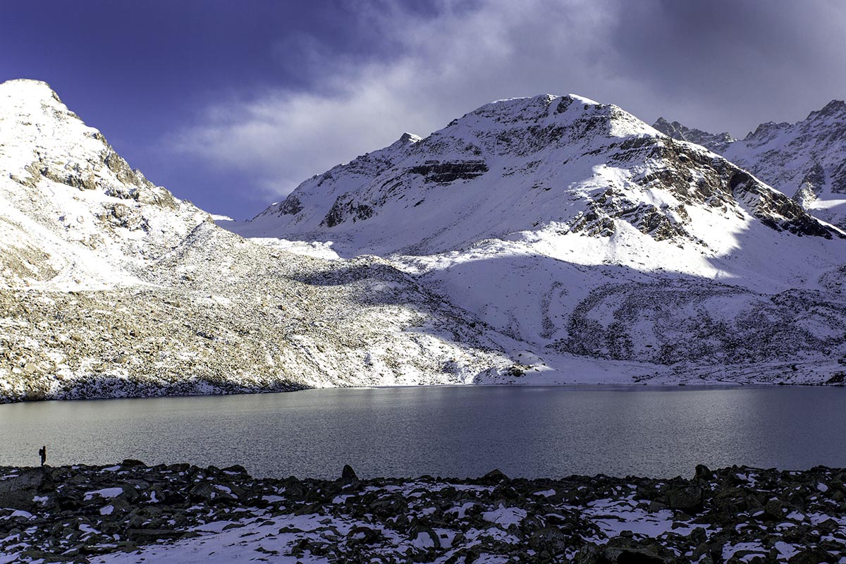
As we sat around Purani Ganga, enjoying lunch, we thought about crossing the nearby Gumbergali pass located at an altitude of 4210 metres. It meant an additional 300 metres of a hike across, then a frustrating descent to find the camping ground. Shorter duration of September daylight was at the back of my mind as I munched the bread. Then, I heard distant thundering sound indicating the weather seemingly was closing in and we were short on time. Hurriedly, we saddled up the horses putting the luggage upon them and starting a tiresome hike up the Gumbergali. One hour later, the Pass is in sight and a distant view of Harmukh shrouded partially in cloud and the blue expanse of Gangbal at its foot looked phenomenal – a rare sight indeed.
The sight for the Pass was panoramic with Sagput making an impressive ridgeline. Sagput separates the Gad Sar valley from Kashmir. These ridges have not been climbed and can prove to be an impressive climbing ground in future.
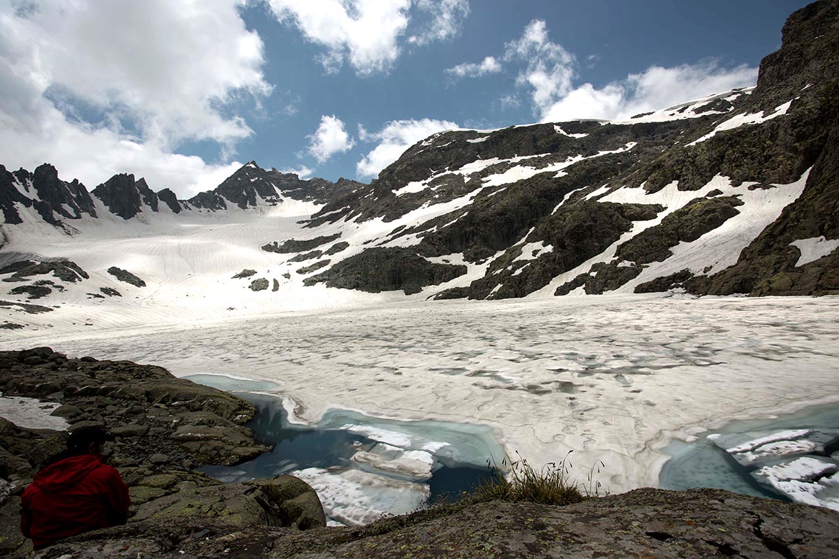
The walk down the Pass provided ample camping ground around Gumbersar, a sizable lake just below the pass. I felt elated on recording my 99th high altitude lake and I eagerly awaited the arrival of the next morning to complete my century, as another lake was located just a ridge across.
A Snowfall
Late night, it began to snow heavily and our tent buckled down under the weight of the snow. We had to leave the warm confines of our tent many times to clear the snow, inadvertently I felt nervous, thinking a heavy snowfall could spoil my dreams. Fortunately, later in the night, it stopped.
Next morning, we were under a foot of snow with a cloudy sky hanging over us. Then there was a twist. We began to hear a whistling sound from the surrounding ridges as we started to scout the slopes. We spotted a dozen snow partridges around the Pass. It was my first encounter with the elusive bird, as the flock flew from one ridge to another. I continued to soak the rare sight wishing them to get near, regretting not carrying along my zoom lens. In mountains weight and pace share an inverse relationship. It is a gamble and you have to take it that way, but this rare sight made my day.
As our guides packed up the horses with the wet baggage for the descent we took a slight detour up the ridge to make the rendezvous with my 100th lake. Salma Sar, an enigmatic name for a small lake that drains into Martchoi Nalla is perhaps the only lake with feminine credentials. It needs a local probe to ascertain legend associated with it. Its outpour meets the Gangbal waters at Dumail, some 10 km upstream of Nara Nag. These lakes and the streams are like neurons interconnected and interdependent.
A Tosmaidan Start
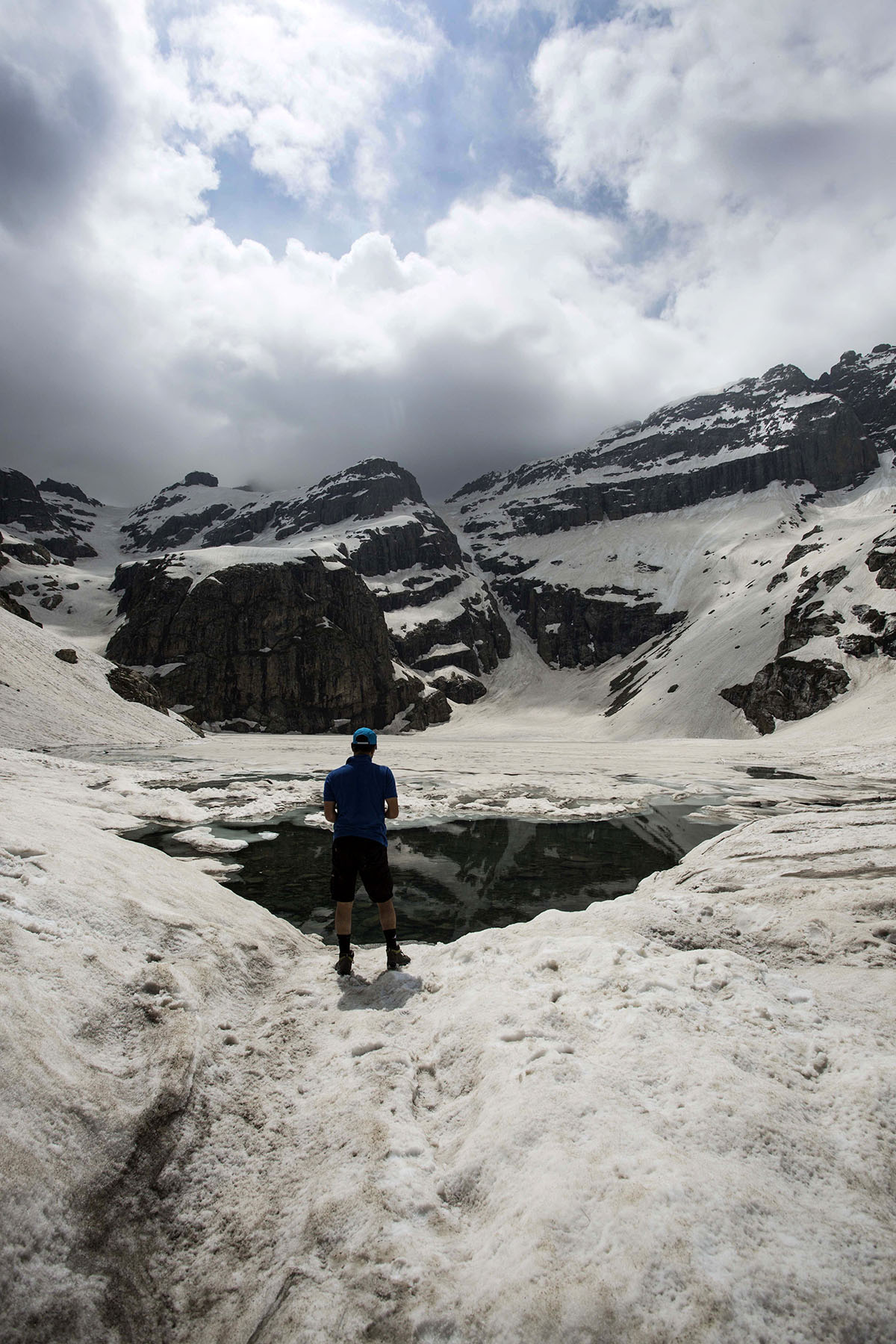
As I settled on the ridge overlooking Salma Sar, I was filled with a sense of accomplishment as it has been a long, long walk in and around the mountains of Kashmir. Almost 15 years back, my first posting in Budgam offered me my first big escapade. The situation in the mountains was tense and hostile but my official connections offered a safe passage up to Tosamaidan, a huge alpine meadow up in the Pir Panchal mountains with an epic status. There, I was destined to do my own soul searching.
As I stood humbled at the edge of the green meadow, its overwhelming effect was hypnotic and indelible. I felt a burning desire to understand this place.
Next few years of turmoil, I took refuge in books, reading travelogues left behind by European travellers with a wealth of information paradoxically demystifying my motherland for me.

Around 2004, I began my serious wanderings into mountains, climbing, trekking and hiking every summer, like a migratory bird. To me, these are my encounters with divinity. I have felt a spirit, an aura lurking around each lake leaving an indelible impression both on the mind and soul. These voyages have been all about sweating in understanding nature. I have lost the count of blisters and damaged toenails. It has been like a cyclic seasonal rhythm that I damage toenails during summer only to re-grow them following winter. I take them as my souvenirs.
(The author is Director Industries Kashmir)


