by Er. Mohammad Lateef and Er. Suhail Khanday
An in-depth analysis of NH-44 examines its geography, landslide susceptibility, economic importance, political significance, disaster impacts, and engineering challenges threatening its long-term stability and reliability.
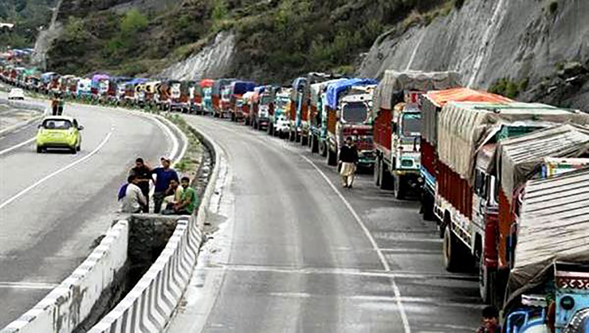
The Jammu–Srinagar National Highway, NH-44, is more than a road. It is the only dependable surface link between the Kashmir Valley and the rest of India, a corridor that sustains daily life, commerce, security movement, and political control. Yet, every year, this same highway repeatedly collapses under landslides, cloudbursts, and geological failures, raising a critical question: Is NH-44 a sustainable lifeline or a permanent vulnerability?
Stretching 247 kilometres from Lal Chowk in Srinagar to the city of Jammu, NH-44, formerly NH-1A, has evolved from a narrow mountain road of the early 20th century into a multi-lane national highway, forming the northernmost segment of India’s longest road corridor. Along with the Mughal Road, it is one of only two surface links connecting the Kashmir Valley with the rest of the country. Traffic along this route is regulated through control rooms stationed in Srinagar and Jammu, underscoring its strategic importance.
From Plains to Foothills: A Geological Transition
NH-44 begins in Jammu at an elevation of about 327 metres above sea level, cutting across the fertile Indo-Gangetic plains before entering the scrub-covered foothills of the Shivalik range. This initial stretch, passing through agricultural landscapes and expanding urban fringes, appears benign. However, geological instability begins as the highway crosses the Tawi River and advances towards Nagrota, Kud, and Udhampur.

Here, the terrain transitions sharply from plains to undulating foothills, marking the outer boundary of the Himalayas. Elevations rise to 700–800 metres, slopes steepen, and the road begins to snake through narrow valleys. The Siwalik formations, composed largely of sandstones and conglomerates, are geologically young and fragile. Combined with monsoon rainfall and seismic fault lines, they render this stretch highly prone to erosion and landslides.
While major widening and alignment improvements on the Jammu-Udhampur section were completed by 2017, engineering challenges persist. Retaining walls, drainage systems, and slope realignments struggle against variable topography, unstable soils, and fault crossings. Udhampur, a key transit hub, marks the last relatively moderate terrain before the highway enters the most treacherous Himalayan zone.
The Pir Panchal Barrier: Engineering Against Nature
The most hazardous segment of NH-44 lies across the Pir Panchal Range, a sub-range of the Lesser Himalayas rising beyond 3,000 metres. This roughly 25-kilometre stretch between Banihal and Qazigund has historically been the highway’s Achilles’ heel, plagued by steep gradients, fractured rock masses, heavy snowfall, and recurrent landslides.

For decades, the Jawahar Tunnel, opened in 1956 at an elevation of 2,194 metres, served as the only year-round passage across the range. Though a landmark achievement in post-Independence engineering, its high altitude left it vulnerable to prolonged snow blockages and frequent closures. Renovations completed by the Border Roads Organisation in November 2024 have improved ventilation, drainage, and structural safety, but limitations remain.
The game-changer has been the Banihal–Qazigund Tunnel, officially known as the Dr Syama Prasad Mookerjee Tunnel. Completed between 2011 and 2021, this 8.45-kilometre twin-tube tunnel runs nearly 400 metres lower than the Jawahar alignment. Built using the New Austrian Tunnelling Method through squeezing ground and water-logged strata, it shortens the route by 16 kilometres and reduces crossing time from over an hour to about 15 minutes. Escape passages, fire galleries, and semi-transverse ventilation systems now allow near all-weather connectivity, though geo-hazards remain a constant threat.
Entering the Valley: Stability Gives Way to Speed
At Qazigund, located at 1,670 metres above sea level, NH-44 descends into the Kashmir Valley. The terrain opens into wide alluvial floodplains shaped by the Jhelum River and its tributaries. Geological conditions change dramatically from fractured Himalayan rock to Karewa deposits and Quaternary alluvium that support intensive agriculture.
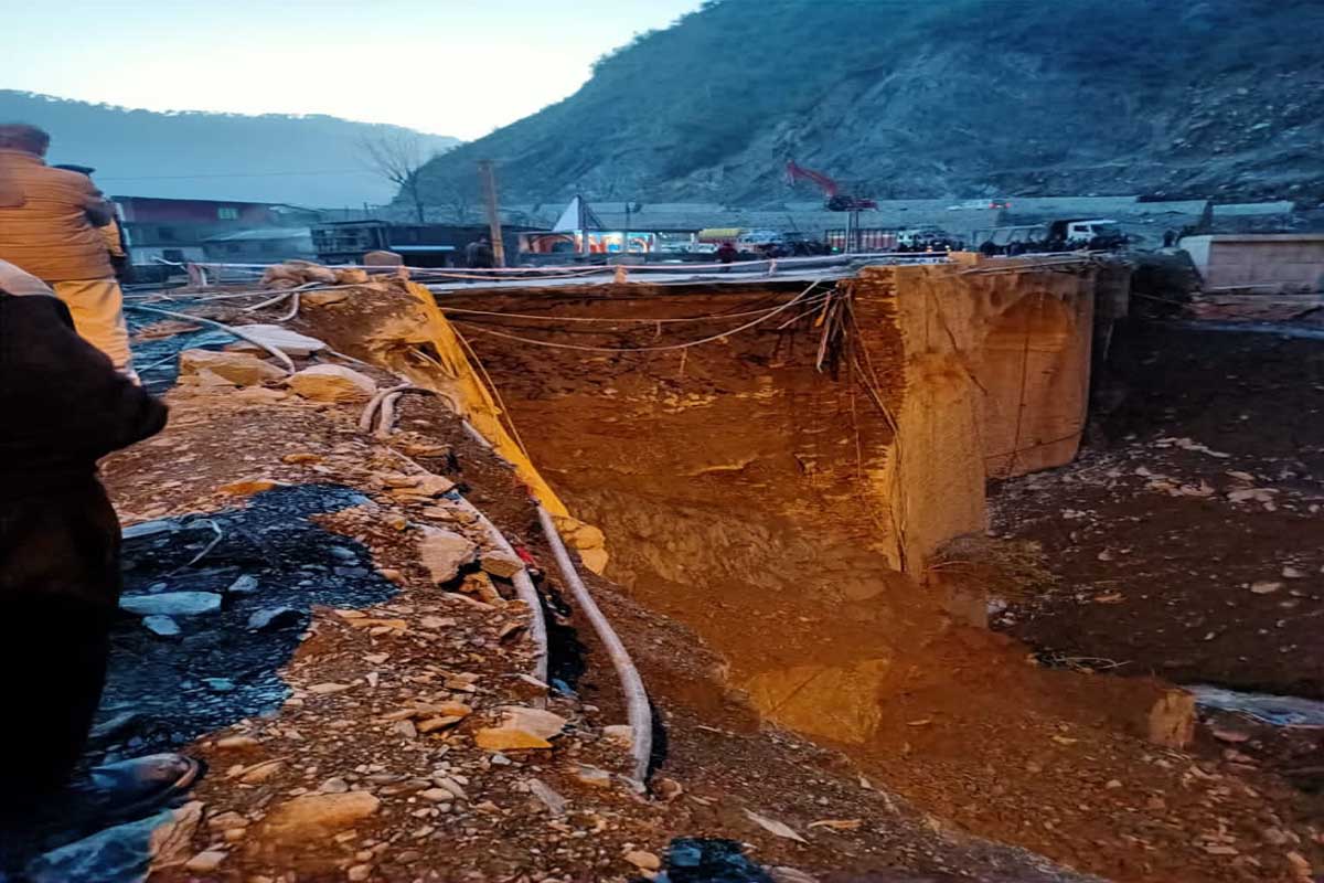
The 68-kilometre stretch from Qazigund to Srinagar passes through Kulgam, Anantnag, and Pulwama districts, with gentler gradients and expanding four-lane sections. Viaducts, realignments, and flood-avoidance measures have improved traffic flow, enabling average daily volumes of 5,000–7,000 vehicles. Under optimal conditions, travel from the tunnel exit to Srinagar now takes around two hours.
Economic Lifeline with Fragile Foundations
Economically, NH-44 is indispensable. It supports the movement of essential goods, fuel, construction material, and agricultural produce into the Valley, and carries horticultural output, especially apples and cherries, out to national markets. Kashmir’s fruit industry alone is valued at nearly Rs 12,000 crore annually, and even short disruptions can result in massive spoilage losses.
The highway has also catalysed tourism, real estate expansion, industrial growth, and employment generation. Tunnel projects and road widening have reduced transportation costs and improved supply chain reliability.
Yet these benefits are persistently undermined by closures. Landslides, traffic mismanagement, delayed maintenance, and weather-induced disruptions repeatedly choke the corridor. When NH-44 shuts down, airfares surge, alternative routes prove inadequate, and both traders and travellers bear heavy financial burdens. Road fatalities remain high due to unstable slopes and dangerous curves.

Disasters of 2025: A Warning Repeated
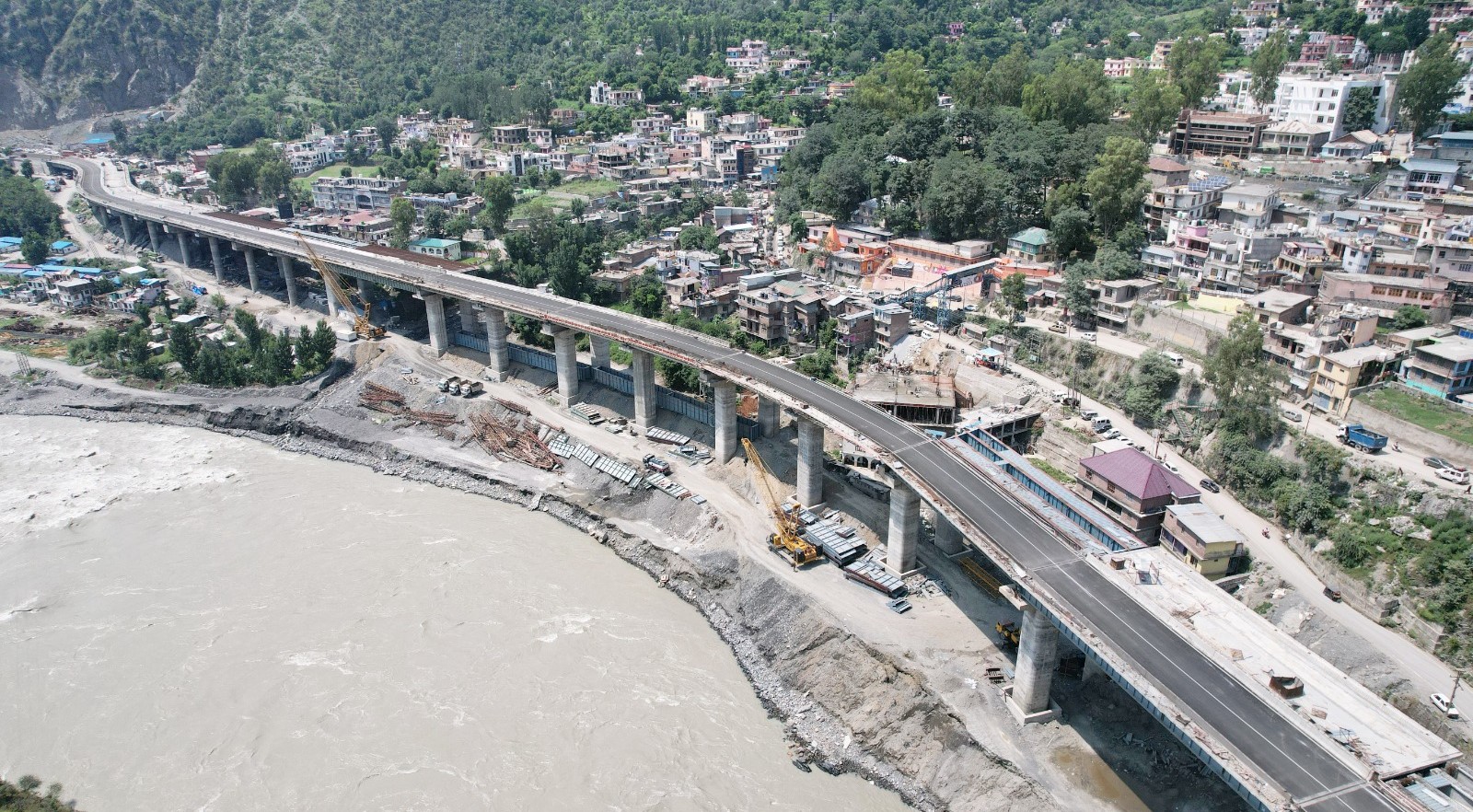
In April 2025, continuous rainfall and cloudbursts triggered massive landslides along the Ramban stretch. Three people were killed, over 200 homes and numerous shops were destroyed, and entire markets were washed away. NH-44 was blocked at Panthal, Seri, Kela Morh, Trishul Morh, Cafeteria Morh, and other locations. Hundreds of vehicles were buried under debris.
Later, in August and September, heavy rainfall damaged a 300-metre stretch between Tharad and Balli Nallah in Udhampur. The prolonged closure caused fruit-laden trucks to remain stranded for days. With apples having a short shelf life, farmers suffered losses estimated at Rs 2,000 crore, losses that could have been avoided with faster debris clearance and better preparedness.
Political and Strategic Dimensions
Beyond economics, NH-44 holds immense political and strategic value. It is often projected as the “lifeline of Kashmir,” symbolising territorial integration and national unity. The highway is crucial for the movement of security forces and military logistics, making its control a priority during crises.
Since the abrogation of Article 370 in 2019, decision-making around NH-44 has become increasingly centralised, further enhancing its political symbolism. At the same time, closures frequently lead to shortages and price hikes, turning the highway into a political flashpoint. Protests, strikes, and environmental concerns linked to highway expansion reflect the broader tension between development, security, and sustainability.
Why Landslides Keep Returning
NH-44 cuts through the Pir Panchal Himalayas, one of the most tectonically active and geologically fragile regions in the world. The slopes consist largely of weak sedimentary and metamorphic rocks, shale, slate, schist, and weathered gneiss, often intersected by faults, joints, and shear zones. Bedding planes frequently dip in the same direction as the slopes, creating natural slip surfaces.


The region lies in Seismic Zones IV and V, where even moderate earthquakes can destabilise slopes already weakened by excavation. Intense weathering forms thick residual soils with reduced cohesion and friction. Freeze–thaw cycles further degrade rock strength at higher altitudes.
Hydrology acts as the primary trigger. Monsoon rains, western disturbances, cloudbursts, snowmelt, groundwater seepage, and river erosion collectively increase pore water pressure and reduce shear strength. Road construction disrupts natural drainage, concentrates runoff, and often traps water behind retaining structures, accelerating failure.
In essence, geology provides the weakness; hydrology pulls the trigger.
Engineering Evidence from Ramban
Numerical analysis using GEO-5 2026 software on a silty sand slope along the Ramban stretch, composed of 80 per cent sand and 20 per cent silt, reveals alarming results. With a traffic surcharge of 1,000 kN/m² and river water levels accounted for, the most critical slip surface yielded a factor of safety of just 0.45, far below the acceptable threshold of 1.5. The slope is categorically unsafe, confirming field observations.
Preventing the Next Collapse
Solutions are known but demand consistent implementation: robust retaining walls, soil nailing, rock bolting, slope flattening, geosynthetics, anti-slide piles, effective surface and subsurface drainage, afforestation, bio-engineering, hydro-seeding, hazard mapping, early warning systems, and strict land-use regulation.
A Road That Mirrors the Region
NH-44 reflects Jammu & Kashmir itself, strategically vital, economically indispensable, politically charged, and environmentally fragile. Without sustained geological understanding, proactive engineering, and responsive governance, the highway will continue to oscillate between lifeline and liability.
The question is no longer whether NH-44 can be built, but whether it can be made truly resilient.
(Er Mohammad Lateef is a Geotechnical Engineer, and Er Suhail Khanday is a Structural Engineer. The ideas are personal.)