Researchers identify soft alluvial soil, shallow groundwater, liquefaction risks and unsafe construction as factors that could intensify earthquake damage in the Valley
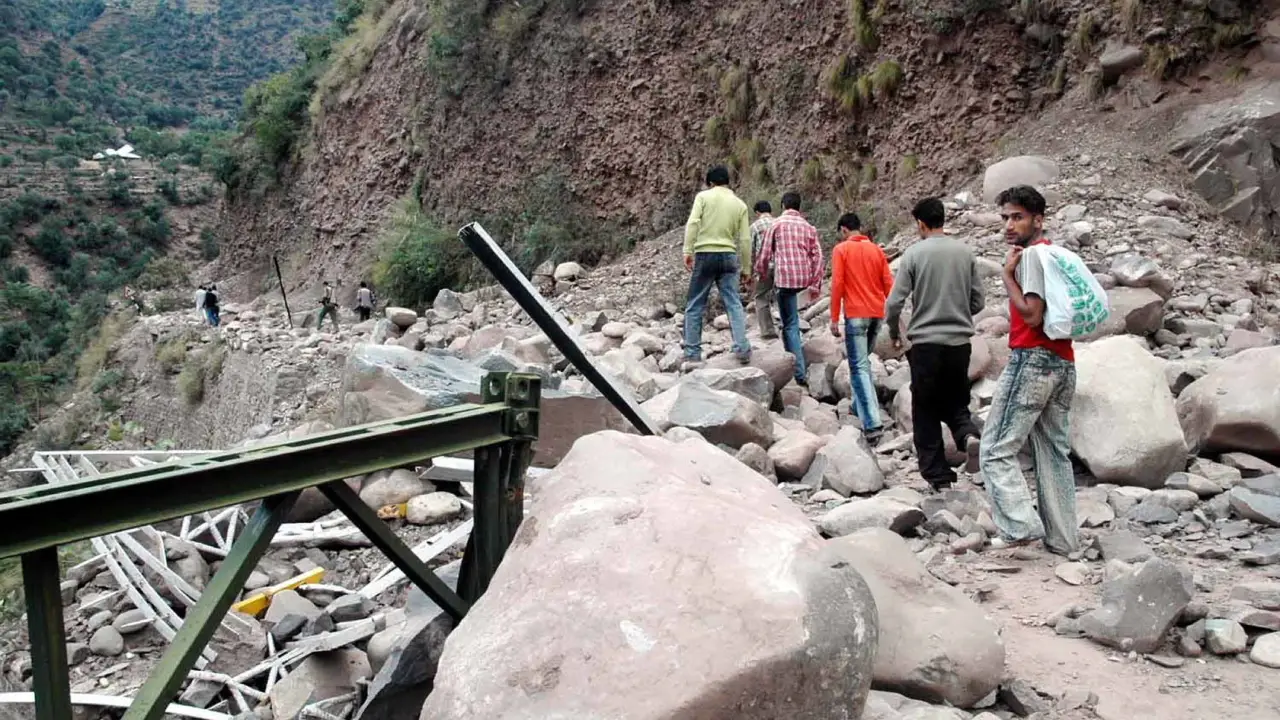
SRINAGAR: Kashmir Valley’s vulnerability to earthquakes is shaped not only by its location in a seismically active Himalayan region but also by the nature of its soil, groundwater conditions, settlement patterns and construction practices, according to a research study published in 2018.
The study, Seismic Hazard and Probability Assessment of Kashmir Valley, Northwest Himalaya, India, examined earthquake records across the northwestern Himalayan belt and assessed the geological, geomorphological, geotechnical, hydrological and socioeconomic conditions that could increase the impact of seismic activity in the Valley.
The research was conducted by Rakesh Chandra, Javid Ahmad Dar, Shakil Ahmad Romshoo, Irfan Rashid, Sareer Ahmad Mir and Midhat Fayaz of the Department of Earth Sciences, University of Kashmir, and Imtiyaz A Parvez of the CSIR Fourth Paradigm Institute, Bengaluru. It was published in the journal Natural Hazards on May 28, 2018.
The researchers analysed 12,125 earthquake events recorded between 1902 and 2017 using the United States Geological Survey (USGS) earthquake catalogue. Their findings highlighted the possibility of significant seismic events in the wider northwestern Himalayan belt and argued that the Valley’s physical and human-made environment could magnify the consequences of ground shaking.
The authors cautioned that even where earthquake activity is comparatively low, local conditions can substantially increase the level of risk. In Kashmir, they identified soft sedimentary deposits, shallow groundwater, the possibility of soil liquefaction, rapid urbanisation and inadequate earthquake-resistant construction as important factors contributing to vulnerability.
Historical Record
The study places Kashmir within the wider tectonic setting of the northwestern Himalayas, where the Indian and Eurasian plates meet. The Valley falls in Zone V of India’s seismic zonation map, the category representing the highest level of seismicity.
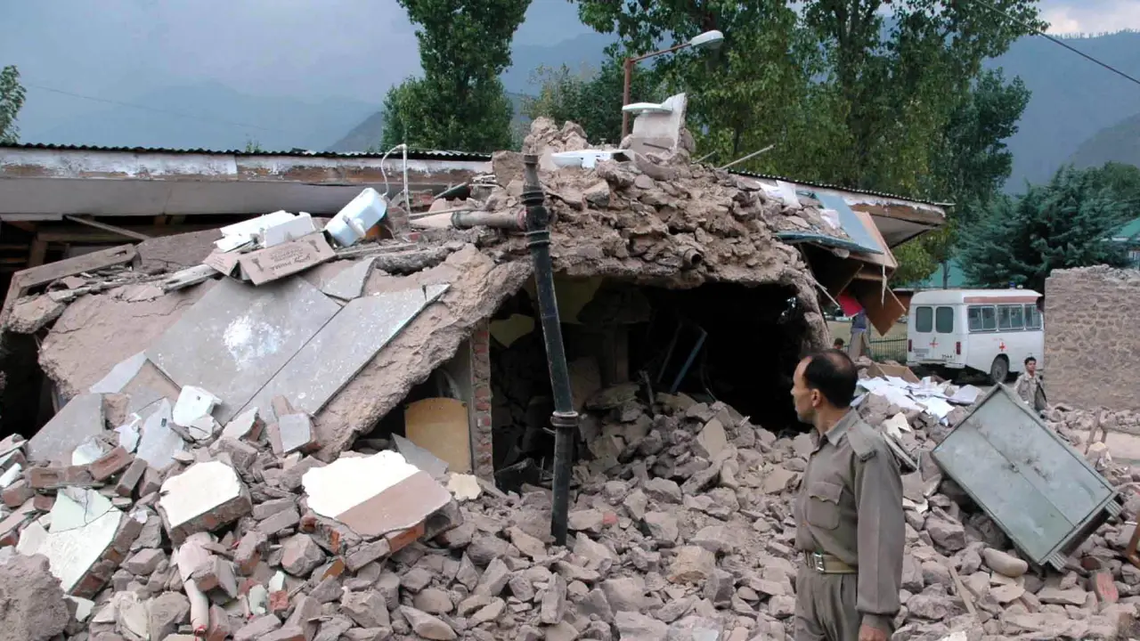
The researchers noted that the region has experienced several significant earthquakes over the centuries. These include the 1555 earthquake, estimated at magnitude 7.6; the 1885 earthquake, which produced reported intensities ranging from VI to X; the 1963 earthquake of magnitude 5.5; and the 2005 Kashmir earthquake, estimated at magnitude 7.6.
The 1905 Kangra earthquake, which affected a wider Himalayan region, was also considered relevant to understanding the seismic exposure of Kashmir. The researchers observed that the intensity patterns associated with the 1905 and 2005 earthquakes indicated that strong shaking could reach the Valley with sufficient force to damage or collapse vulnerable engineering structures.
The paper explains that areas lying between the rupture zones of major earthquakes are often described as seismic gaps. Such areas may accumulate strain over time, potentially contributing to future seismic activity. The researchers examined the relationship between these gaps, regional faults and the distribution of recorded earthquakes.
They identified concentrations of earthquake events along the north-northwestern and south-southeastern extensions of the Kashmir Basin. These patterns corresponded with the presence of thrust faults and, according to the authors, suggested long-term strain accumulation in these areas.
The researchers also pointed to the relationship between the region’s tectonic structure and its earthquake distribution. Their assessment suggested that seismic activity was not evenly spread across the northwestern Himalayan belt, with many recorded events clustered in hinterland areas, including the Hindu Kush-Pamir region and the lateral extensions of the Kashmir Valley.
Statistical Estimates
For the regional assessment, the researchers used extreme value theory and the Gutenberg-Richter frequency-magnitude relationship to estimate earthquake occurrence probabilities and recurrence intervals.
The earthquake catalogue contained 12,125 events recorded between 1902 and 2017. These were classified into five magnitude groups: 5,886 events between magnitude 3 and 3.9; 5,884 between 4 and 4.9; 311 between 5 and 5.9; 38 between 6 and 6.9; and six between 7 and 7.9.
Using the statistical relationship between earthquake magnitude and frequency, the researchers calculated the average rate of seismicity and the recurrence intervals associated with different magnitudes. The paper reported a frequency-magnitude relationship with a negative slope of 0.8277 and a positive intercept of 4.6977.
Its empirical estimates suggested an 88 per cent probability of an earthquake of magnitude 7.7 or greater occurring within 50 years in the northwestern Himalayan belt, with a reported recurrence period of 47 years. For an earthquake of magnitude 7.5 or greater, the estimated probability over 50 years was 97 per cent, with a recurrence period of 27 years. For an earthquake of magnitude 6.5 or greater, the study reported a 100 per cent probability over 50 years and a recurrence period of four years.
These figures require careful interpretation. They are statistical estimates for the wider northwestern Himalayan belt, not predictions that an earthquake of a particular magnitude will strike Kashmir Valley or Srinagar within a specified period. They are also based on an earthquake catalogue ending in 2017 and should not be treated as updated forecasts.
The authors used these estimates alongside an assessment of the Valley’s physical characteristics to explain why its earthquake vulnerability could be greater than seismic activity alone might suggest.
Geological Setting
One of the central concerns identified in the study is the geological structure of the Kashmir Valley. The researchers described a landscape in which the central part of the Valley is largely composed of sedimentary deposits, while harder rock formations occur along its peripheral mountain ranges.
The central sedimentary fill includes deposits associated with the Karewa Group and recent alluvium along the Jhelum River. These deposits contain layers of sand, silt, shale and other unconsolidated materials. The Karewas, according to the paper, are linked to the Valley’s geological history and the accumulation of sediments following the formation and eventual drainage of an ancient lake.
The researchers argued that this geological arrangement has implications for how seismic waves travel through the Valley. Harder rocks around the periphery generally have a damping effect, while softer sedimentary deposits in the central basin can amplify seismic waves.
This means that the intensity of shaking experienced at the surface may be influenced by the material beneath a settlement, not merely by the magnitude or location of an earthquake.
The paper also discusses how the Valley’s sedimentary deposits differ in their physical properties. Lose and unconsolidated materials can respond differently to seismic waves compared with compact and rigid rock formations. The authors therefore considered the geological composition of the Valley an important element in assessing the potential impact of future earthquakes.
Soil Instability
The study identifies the geotechnical properties of the Valley’s sediments as another factor that could increase earthquake-related damage.
Drawing on laboratory observations and earlier research on sediment samples, the authors describe the dominance of sand and silt in parts of the Valley’s central sedimentary deposits. The materials were generally classified as low-to-medium plasticity silts and clays, with relatively low compressibility and quick dilatancy.
The researchers also noted that the sediments exhibited low cohesion and low internal friction. These characteristics can make soil more susceptible to failure when subjected to agitation.
A particular concern is liquefaction, a process in which water-saturated soil loses strength and stiffness during strong ground shaking and begins to behave more like a liquid. This can cause buildings and other structures to settle, tilt or lose support.
The paper explains that the Valley’s fine-grained sediments, particularly those dominated by sand and silt, can become unstable when water content increases. Under earthquake-induced shaking, these conditions may contribute to soil fluidisation and subsequent ground subsidence.
The authors referred to laboratory assessments indicating relatively high liquefaction potential in parts of the Valley’s sedimentary fill. They also discussed evidence of sedimentary deformation structures, which they associated with the interaction of stresses and the physical properties of the sediments.
The implications are particularly important for settlements and infrastructure located on unconsolidated deposits. Even where buildings are designed to withstand a certain level of shaking, unstable ground conditions can increase the forces and movement to which their foundations are exposed.

Groundwater Risks
Shallow groundwater was identified as another factor that could increase the possibility of liquefaction.
According to the study, groundwater levels across the Valley vary depending on rainfall, topography and local hydro-geomorphic conditions. However, the general pattern is one of relatively shallow groundwater, with an average depth of approximately four to six metres below ground level. In some locations, the water table can be as shallow as half a metre.
The researchers noted seasonal fluctuations in groundwater levels. Their cited observations indicated that groundwater depths ranged from approximately 1.5 to four metres below ground level during summer and 1.75 to six metres during winter.
The depth of the water table matters because saturated soil is more susceptible to liquefaction during an earthquake. When soil pores are filled with water, shaking can increase pore-water pressure and reduce the effective stress that holds soil particles together.
The study therefore considered shallower groundwater conditions, particularly during summer, favourable to the development of liquefaction. The authors also pointed to extreme flooding in the Valley as a factor that can create soil and groundwater conditions conducive to liquefaction and the amplification of ground shaking.
This connection between groundwater and soil behaviour adds another dimension to earthquake risk assessment. The vulnerability of a location may depend not only on the type of soil but also on how much water it contains and how groundwater levels change over time.
Urban Expansion
The researchers also highlighted the socioeconomic dimensions of earthquake vulnerability, particularly the rapid and often unplanned expansion of settlements.
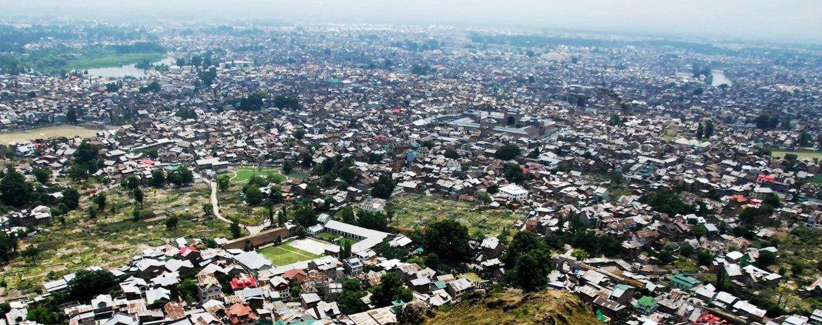
The Valley’s geography, bounded by mountain ranges, has concentrated a large proportion of its population and infrastructure on the valley floor. The paper cited a population of around 70 lakh, based on the 2011 Census, and noted the pressure that population growth and urbanisation had placed on available land.
The expansion of built-up areas, including the growth of high-rise structures and occupation of fragile landscapes, was identified as an additional source of risk.
The authors argued that the concentration of settlements on alluvial plains and wetlands could expose a large number of people and buildings to the combined effects of amplified seismic waves and unstable ground conditions.
They also pointed to the consequences of inadequate site selection. Buildings constructed on unsuitable ground may be exposed to greater resonance during an earthquake, increasing the likelihood of structural damage or collapse.
The study’s assessment suggests that earthquake vulnerability is therefore not determined solely by the natural hazard. The location of buildings, the density of settlements, the condition of infrastructure and the quality of construction all influence the potential consequences of a seismic event.
Construction Concerns
Building practices formed a significant part of the researchers’ assessment. The paper raised concerns about the use of construction methods that do not adequately account for earthquake-resistant design and structural requirements.
It contrasted contemporary construction practices, which it described as frequently lacking appropriate seismic safeguards, with traditional building systems such as Taq and Dhajji Dewari.
Taq construction uses timber elements integrated with masonry walls, while Dhajji Dewari uses a timber-braced framework with infill walls. The researchers described these traditional systems as having features that can help them withstand earthquake shaking.
The paper argued that the loss or neglect of such traditional construction knowledge, alongside the adoption of building practices without adequate structural considerations, could increase the vulnerability of buildings.
It also drew attention to public infrastructure, including schools, hospitals, shopping malls and industrial estates, as areas where earthquake safety requires attention. The authors raised concerns about the lack of adequate safeguards in buildings and the shortage of open spaces and shelters in densely populated residential areas.
The researchers further noted that unsuitable site selection and poor ground conditions can increase the natural period of buildings, influencing how they vibrate during seismic shaking. If the characteristics of a building and the ground beneath it interact unfavourably, the resulting movement can contribute to structural failure.
The paper’s discussion of construction practices does not establish that every traditional building is safe or that every modern structure is unsafe. Rather, it highlights the importance of appropriate design, materials, construction quality and site-specific assessment.
Planning Priorities
In their conclusion, the researchers argued that the earthquake risk facing Kashmir Valley emerges from the combined influence of tectonic, geological, geomorphological, geotechnical, hydrological and socioeconomic factors.
Although the Valley’s recorded seismic activity may be relatively low compared with some surrounding parts of the Himalayan belt, the authors maintained that soft alluvial deposits, populated plains and wetlands, high liquefaction potential and faulty construction practices could considerably intensify the impact of an earthquake.
They called for a more comprehensive approach to earthquake risk assessment, including the consideration of local geological and ground conditions. The study identified seismic micro-zonation as an important step towards understanding variations in earthquake hazard within the Valley.
Seismic micro-zonation involves dividing an area into smaller zones based on differences in local geological, geotechnical and seismic conditions. Such assessments can help identify locations where ground shaking may be amplified or where liquefaction and other forms of ground failure may be more likely.
The researchers argued that a detailed understanding of these factors could support better planning and the development of strategies to reduce earthquake risk.
Published in 2018, the study offers a detailed assessment of the factors that can contribute to Kashmir’s earthquake vulnerability. However, its earthquake catalogue ends in 2017, and its statistical estimates should be understood in the context of the data and methods available to the researchers at the time. Establishing how the Valley’s risk profile and preparedness have changed since then would require updated seismic data, contemporary assessments of buildings and infrastructure, and further research into land use and groundwater conditions.