SRINAGAR: A proglacial lake in the Warwan sub-basin of the Chenab River in Kishtwar has expanded by about 350 per cent between 1993 and 2020, while the glacier feeding it lost 13.16 per cent of its area and retreated 732 metres, raising the prospect of a potentially catastrophic glacial lake outburst flood (GLOF) downstream.
The study estimates that if the lake continues expanding at its recent rate, it could double its present surface area within about 15 years, while the glacier could separate from the lake over the following two to three decades.
The findings come from a study Rapid expansion of proglacial lake and deglaciation of host glacier in Kishtwar Himalaya, Jammu and Kashmir, India, from 1993 to 2020, published in January 2024 in Himalayan Geology (Volume 45, Issue 1). The journal is published by the Wadia Institute of Himalayan Geology, Dehradun.
The paper was authored by Shashi Kant Rai, Rakesh Sahu, Sunil Dhar, Naveen Tripathi and Arun Kumar. Rai and Dhar are affiliated with the Department of Environmental Sciences, Central University of Jammu; Sahu with the Department of Computer Science and Engineering, Chandigarh University, Mohali; Tripathi with the Space Applications Centre, Indian Space Research Organisation (ISRO), Ahmedabad; and Kumar with the Discipline of Geology, School of Sciences, Indira Gandhi National Open University, New Delhi. Sunil Dhar is the corresponding author.
The researchers examined a glacier associated with the proglacial lake in the Warwan sub-basin of Kishtwar, near the Nun Kun peaks. The glacier has a GLIMS identification of G076021E33925N. Meltwater from the glacier forms the Fariabad Nalla, which joins the Warwan River near Yurdu village before the river meets the Chenab near Banderkot.
Using satellite observations covering 27 years, the researchers found that the glacier covered 4.67 square kilometres in 1993, but had shrunk to 4.055 square kilometres by 2020. Its total area loss was calculated at 0.615 ± 0.16 square kilometres, or 13.16 per cent, at an average rate of about 0.487 per cent a year.
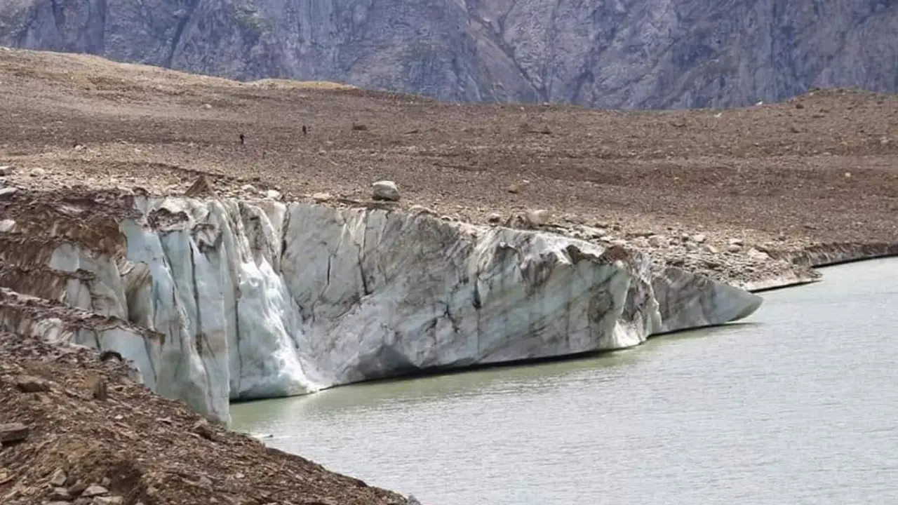
The glacier also became substantially shorter during the period. Its length declined from 3,777 metres in 1993 to 3,045 metres in 2020, representing a retreat of approximately 732 metres, or 19.38 per cent, at an overall rate of 27.11 metres a year.
The retreat was not uniform throughout the period. Between 1993 and 2009, the glacier snout moved back only about 66 metres, at roughly 4.1 metres annually. After 2009, however, the rate accelerated sharply. The glacier retreated 422.93 metres between 2009 and 2016, equivalent to about 60.42 metres a year. It then retreated another 172.33 metres between 2016 and 2018, or about 86.16 metres annually, followed by a further 70.31 metres between 2018 and 2020, equivalent to about 35.15 metres annually.
The most striking change documented by the researchers concerns the lake at the glacier’s terminus.
In 1993, the proglacial lake covered only 0.065 ± 0.0244 square kilometres. By 2020, it had grown to 0.293 ± 0.0056 square kilometres, an increase of 0.228 ± 0.019 square kilometres, or roughly 350 per cent.
The lake’s expansion was relatively modest in its initial years. Its area increased from 0.065 square kilometres in 1993 to 0.076 square kilometres in 1999 and 0.10 square kilometres in 2009. It then expanded dramatically, reaching 0.244 square kilometres in 2016, 0.272 square kilometres in 2018 and 0.293 square kilometres in 2020.
The researchers divide the lake’s development into three distinct phases. From 1993 to 2009, the lake remained comparatively stable, increasing in length by 109.3 metres and area by only 0.035 square kilometres. The situation changed dramatically between 2009 and 2016, when the lake expanded by 0.144 square kilometres and its longitudinal extent increased by 417.5 metres. The researchers attribute this rapid expansion to intense calving and the development of large crevasses near the glacier front.
The lake continued to expand between 2016 and 2020, with its area increasing at an average rate of 0.0123 square kilometres a year and its length by about 61.5 metres a year.
The researchers describe the post-2009 increase as a “significant exponential increase” in proglacial lake area and attribute the particularly rapid growth after 2009 to intense calving activity.
The study suggests that the relationship between the shrinking glacier and expanding lake is not simply one-way. Lake water can enter the glacier’s terminal system, increasing glacier movement near the terminus and exposing more ice to melting and calving. The researchers therefore conclude that the presence of the proglacial lake has enhanced the frontal retreat of the glacier.
Large crevasses close to the snout appear to be particularly important. According to the study, differences between the temperatures of glacier ice and lake water promote crevasse formation and calving, resulting in further loss of the glacier front. Satellite imagery examined by the researchers also showed numerous fragmented chunks of ice floating in the lake, which they associate with intensive calving activity.
The researchers also examined climate data for the area using ERA5 datasets covering 1979-2020. They applied the Mann-Kendall test and Sen’s slope estimator to annual and seasonal temperature and precipitation data.
The analysis found a statistically significant rise in mean annual temperature of 0.028 K per year, with a confidence level of 99.9 per cent. Annual precipitation, meanwhile, showed a declining trend of 3.610 millimetres per year, although the study says this decline was statistically insignificant at the reported confidence level.
Temperature increased in every season examined. The strongest reported seasonal trend was in the post-monsoon period, at 0.058 K per year, with a 99.9 per cent confidence level. Winter temperatures rose at 0.018 K per year, while the monsoon temperature trend was 0.029 K per year; both were statistically significant at the levels reported by the researchers.
The paper links glacier recession to the combination of atmospheric warming and changing precipitation patterns, while cautioning that the precise influence of recent climate variability on glacier-related hazards requires further investigation.
The researchers also estimated the thickness of the glacier using the GlabTop2 model, together with a 12.5-metre-resolution ALOS PALSAR digital elevation model. The resulting estimates ranged from 17.28 metres to 170.68 metres, with an estimated mean thickness of 60 ± 6 metres. The greatest thickness was found in the lower ablation zone, while the upper accumulation zone contained thinner ice.
The researchers stress that these are modelled values and require field validation. The terrain’s inaccessibility prevented ground-based measurements, and they recommend the use of ground-penetrating radar and ice-core drilling to improve the estimates.
Different volume-area scaling methods produced different estimates of ice loss between 1993 and 2020. Depending on the empirical relationship used, estimated ice-volume losses ranged from 0.043 to 0.075 cubic kilometres.
The estimated volume of the proglacial lake also varied considerably according to the empirical method used. For 2020, estimates ranged from 0.1411 million cubic metres to 15.36 million cubic metres, demonstrating the substantial uncertainty involved in applying empirical equations developed for different mountainous environments.
The estimated peak discharge in a hypothetical lake-outburst scenario was similarly variable. Depending on the lake-volume and peak-discharge formula used, the 2020 estimates ranged from 105.125 cubic metres per second to more than 3.06 million cubic metres per second. The authors explicitly caution that some of these approaches substantially overestimate or underestimate discharge.
The study therefore does not present any single discharge figure as a definitive prediction of what a future GLOF would produce. Instead, it calls for a field-based bathymetric survey to establish the lake’s actual volume and provide a more reliable assessment of the outburst-flood hazard.
The study’s forward-looking assessment is particularly significant. The researchers modelled the future evolution of the lake using its 2016-2020 expansion rate of 0.0123 square kilometres per year, while assuming that the lake’s water level remains stable.
Under those assumptions, they estimate that the lake could reach its maximum projected area in approximately 15 years, with its surface area doubling from its present size.
At the same time, the glacier is currently a lake-terminating glacier. Its recent retreat rate of 61.5 metres a year during 2016-2020 would eventually cause the glacier front to separate from the lake. At the current rate, the study estimates that such separation could take another two to three decades.
The authors make clear that these projections are conditional on continuation of the observed rate and the assumption of a stable water level; they are not presented as fixed predictions.
The growing lake is of particular concern because the glacier catchment has a history of avalanche activity. The researchers note that an avalanche occurred in the upper accumulation zone in 2005, when the lake was substantially smaller and no damage resulted.
The researchers warn that the situation is different now. Given the lake’s present size, they say a large ice avalanche entering the lake could cause a sudden rise in water level and disturb its hydraulic balance. Such an event, the paper states, “would lead to a catastrophic event in the downstream area.”
The study identifies downstream settlements including Yurdu, Quadarna and Fariabad as potentially exposed in the event of a failure. The authors compare the lake with the much smaller proglacial lake associated with the Gya Glacier, which experienced a GLOF in 2014, and argue that the Kishtwar lake’s substantially larger size could result in enormous downstream destruction in a similar failure scenario.
The researchers, however, acknowledge that this comparison does not amount to a prediction of a similar flood discharge from the Kishtwar lake because of the uncertainties surrounding lake-volume and peak-discharge calculations.
The hazard also extends beyond settlements. The paper notes that the Chenab basin contains hydropower facilities, communities and important road links that could be vulnerable to risks associated with expanding glacial lakes.
The researchers refer to the 2013 Kedarnath disaster as an indication of the potential consequences of a major glacial-lake failure. They note that the Chorabari Lake outburst generated a peak discharge of 783 cubic metres per second, causing extensive downstream damage and more than 6,000 fatalities according to the studies cited in their paper. The authors say the Kishtwar lake’s estimated water volume is about six times that of the Chorabari Lake used in their comparison.
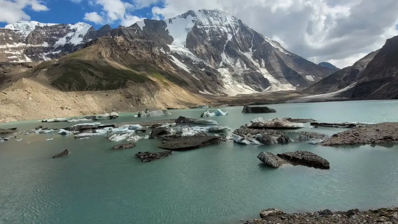
They nevertheless emphasise that this comparison should not be interpreted as a prediction that the Kishtwar lake would generate a flood of comparable magnitude.
The study concludes that the combination of glacier recession, rapid lake expansion, climate warming and the possibility of avalanche-triggered disturbance warrants active monitoring.
The researchers recommend a comprehensive land-use plan for downstream settlements and proposed development projects, including identification of vulnerable areas. They also call for an early-warning system based on geospatial communication technologies to reduce potential impacts on people and infrastructure.
A detailed bathymetric survey of the lake is another key recommendation. Establishing its actual water volume, the authors say, is necessary for a more accurate GLOF assessment because the empirical and model-based estimates used in the study contain inconsistencies and require field-based validation.
The researchers’ central conclusion is that the changes observed between 1993 and 2020 are not simply a case of a shrinking glacier and a growing lake occurring independently. Rather, they identify a reinforcing process in which glacier retreat has enlarged the proglacial lake, the expanding lake has promoted calving and further frontal retreat, and continued lake growth is increasing the potential hazard downstream.
The paper sums up the change by recording “significant deglaciation of the glacier (13.16 %) and rapid expansion (350.7 %) of the associated proglacial lake.”