Analysis of nine sub-watersheds in the north-western Himalaya identifies fault-controlled river networks, ongoing uplift and erosion-prone terrain, offering new evidence to inform geological hazard assessment and water-resource planning.
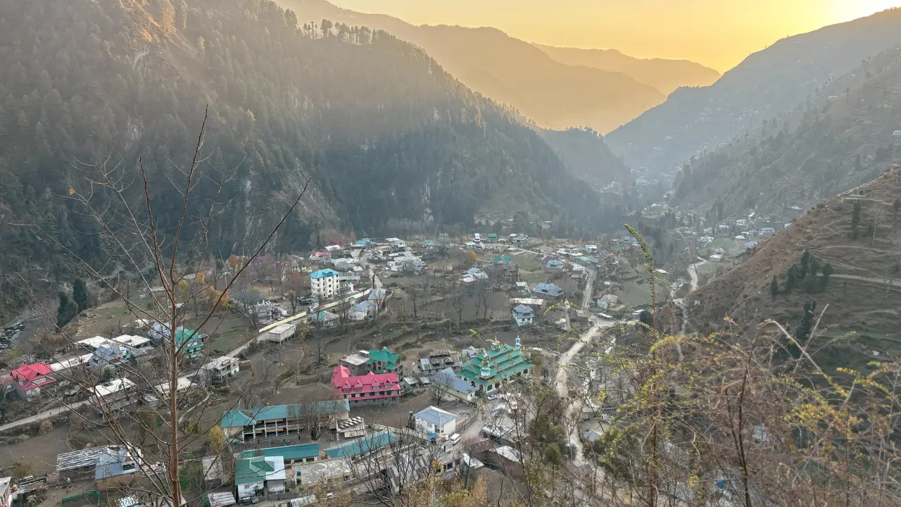
SRINAGAR: A study of the Poonch Basin in Jammu and Kashmir has found that active tectonic processes are significantly shaping its valleys, river networks and landscape. The research identifies evidence of crustal uplift, steep slopes, unusual river-branching patterns, and drainage channels aligned with geological faults. It also points to moderate-to-high erosion potential, particularly in the upper catchments, highlighting the importance of understanding the region’s geological vulnerability for hazard assessment and sustainable land and water management.
The findings are reported in a paper, Geomorphic signatures of active tectonics in the Poonch basin, Northwestern Himalaya, India, published in January 2026 in Results in Earth Sciences, a journal published by Elsevier Inc.
The researchers include Ajay Kumar Taloor, Nuzhat Khurshid, Girish Ch Kothyari, Kanika Sharma, and Rajesh Kumar. Taloor and Khurshid are affiliated with the Department of Remote Sensing and GIS, University of Jammu. Kothyari is affiliated with the Department of Petroleum Engineering and Earth Science, UPES, Dehradun. Sharma is affiliated with the Department of Earth Sciences, Indian Institute of Technology Roorkee. Rajesh Kumar is affiliated with the Department of Geology, Cluster University of Jammu.
The researchers analysed nine sub-watersheds using geological mapping, satellite-based geospatial techniques and measurements of the shape, elevation and drainage patterns of the landscape. Their findings suggest that the interaction of tectonic forces, rock properties and erosion has played a major role in shaping the basin.
Faults Shape River Systems
The Poonch Basin lies in a geologically complex part of the north-western Himalaya, where the Indian and Eurasian tectonic plates continue to converge. This long-running collision has produced major geological faults, including the Panjal and Murree thrust systems, which influence the structure of the mountains and the course of rivers.
The researchers found that the orientations of geological lineaments, linear features associated with faults, fractures and other weaknesses in the Earth’s crust, correspond closely with drainage patterns across the basin.
In sub-watersheds W1 and W2, the dominant structural alignment runs north-east to south-west. In W3, W4, W7 and W9, the prevailing alignment runs north-west to south-east, broadly corresponding with major regional thrust systems.
The study also identifies compressed river meanders, deep incision into bedrock and displaced drainage features between the Main Boundary Thrust and the Kotli Thrust. These features, the researchers argue, provide evidence of tectonic rejuvenation and uplift.
Nine catchments
The study divided the Poonch Basin into nine sub-watersheds, labelled W1 to W9, and examined their drainage networks, elevations, slopes and physical characteristics using digital elevation models and Geographic Information System (GIS) techniques.
The catchments vary considerably in size. W4 is the largest, covering approximately 760 square kilometres, while W6 is the smallest, at about 218 square kilometres.
The elevation analysis revealed marked differences across the basin. W1 reaches a maximum elevation of 4,679 metres, while W9 has a maximum elevation of 1,261 metres. The difference between the highest and lowest points within W1 is 3,598 metres, making it one of the basin’s most rugged and erosion-prone catchments.
The upper sub-watersheds, particularly W1 and W2, have steeper slopes and greater relief, while lower catchments such as W9 generally have gentler terrain. These variations affect how water moves across the landscape, how quickly rivers carry sediment and how the terrain responds to erosion.
Erosion Potential
The researchers assessed erosion and terrain characteristics using several measurements, including drainage density, basin relief and ruggedness indices. These indicators help establish how sharply dissected a landscape is and how susceptible it may be to erosion.
The results point to moderate-to-high erosion potential in parts of the basin, especially in the upper catchments, where steep slopes and substantial elevation differences encourage erosion and sediment transport.
The paper also examines the relationship between catchment shape and the movement of water. Most of the sub-watersheds are elongated rather than circular. The authors suggest that this shape can delay the concentration of runoff and reduce peak flows compared with more compact catchments.
However, the researchers caution through their analysis that hydrological behaviour varies across the basin, depending on terrain, rock type, drainage characteristics and other local conditions. The study’s morphometric indicators therefore provide a basis for identifying differences in runoff and erosion potential, rather than a direct measurement of flood risk during a particular event.

Landscape Evolution
The study uses hypsometric curves, which describe how elevations are distributed within a drainage basin, to assess the stage of landscape development. The findings suggest that most of the sub-watersheds are at youthful to mature stages of geomorphic evolution.
The researchers link these patterns to continuing uplift, rapid river incision and changes in slopes. They also emphasise that tectonic activity is not the only force shaping the basin: differences in rock resistance, erosion and the legacy of glaciation have contributed to its present-day landscape.
The combined evidence indicates that the basin’s rivers and valleys have evolved under the influence of both geological structures and surface processes. This interaction is important for understanding the region’s drainage patterns, sediment movement and long-term landscape development.
Planning Implications
The findings could help guide future research and planning in a geologically sensitive Himalayan region. The authors identify potential applications in geological hazard assessment, groundwater exploration, hydrogeological planning and sustainable land management.
Lineaments can be useful in groundwater studies because fractures in otherwise relatively impermeable rocks may provide pathways for water movement and storage. Mapping these features can help identify areas for further investigation, although the presence of a lineament alone does not establish that a viable groundwater source exists.
The researchers also point to the value of geomorphological indicators in identifying areas requiring closer examination for slope instability and other geological hazards.
The paper does not present a forecast of earthquakes or quantify the probability of a major seismic event. Instead, it establishes a framework for interpreting evidence of active tectonics and identifying areas where further field-based investigation may be needed.
Further Research
The authors recommend combining the study’s findings with field-based structural mapping, higher-resolution remote sensing and additional geological dating techniques.
They also call for the use of geodetic measurements, including Interferometric Synthetic Aperture Radar (InSAR), continuous Global Navigation Satellite System measurements and Persistent Scatterer InSAR, to quantify present-day crustal deformation and uplift more precisely.
Such work, they argue, would help distinguish the effects of tectonic activity from those of climate and erosion, strengthening understanding of how the north-western Himalaya is evolving.
The researchers describe their work as the first quantitative framework of its kind for interpreting tectono-geomorphic evolution in this sector of the Himalaya. They say further investigation is needed to build on the findings and improve their application to hazard assessment and regional planning.