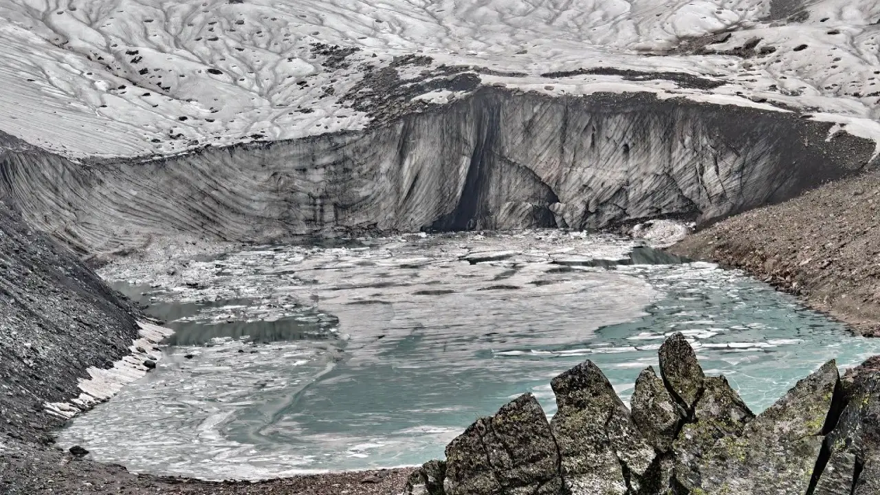
SRINAGAR: A rapidly expanding glacial lake in the Warwan basin of Jammu and Kashmir could pose a substantial future Glacial Lake Outburst Flood (GLOF) threat to downstream settlements, bridges, roads and hydropower infrastructure, with modelling suggesting that a worst-case flood could reach populated areas within about six hours, according to a new study by a team of Indian and international researchers.
The study found that Lake-B in the Warwan sub-basin expanded by about 308 per cent between 1999 and 2024 and could potentially release nearly 98 per cent of its stored water if struck by a large rock-ice avalanche. In the modelled worst-case scenario, nine bridges and 40 buildings, along with multiple road networks, fall within the potential flood-inundation zone. Flow depths at exposed infrastructure could reach 244 metres, with velocities of up to 4-6 metres per second.
The researchers say the danger is not limited to flooding. The large amount of loose sediment already accumulated along the valley means a future GLOF could develop into a debris-flow cascade, potentially magnifying damage downstream and affecting hydropower infrastructure.
The study, Unreported mass movements and future hazard in the Warwan basin, Jammu and Kashmir, Western Himalaya,” was authored by Ashim Sattar (School of Earth, Ocean and Climate Sciences, Indian Institute of Technology Bhubaneswar, Odisha, India) Shashi Kant Rai, Sunil Dhar, (Department of Environmental Sciences, Central University of Jammu, Abhinav Alangadan (Department of Physical Geography and Geoecology, Faculty of Science, Charles University, Prague, Czechia), Adam Emmer (Department of Geography and Regional Science, University of Graz, Graz, Austria), Umesh Haritashya (5Department of Earth and Environmental Geosciences, University of Dayton, Dayton, OH, USA) and Mohammad Farooq Azam (Indian Institute of Technology Indore, Madhya Pradesh). It was posted as a preprint on EGUsphere, the preprint platform published by Copernicus Publications, on January 4, 2026. Sattar and Emmer are the corresponding authors.
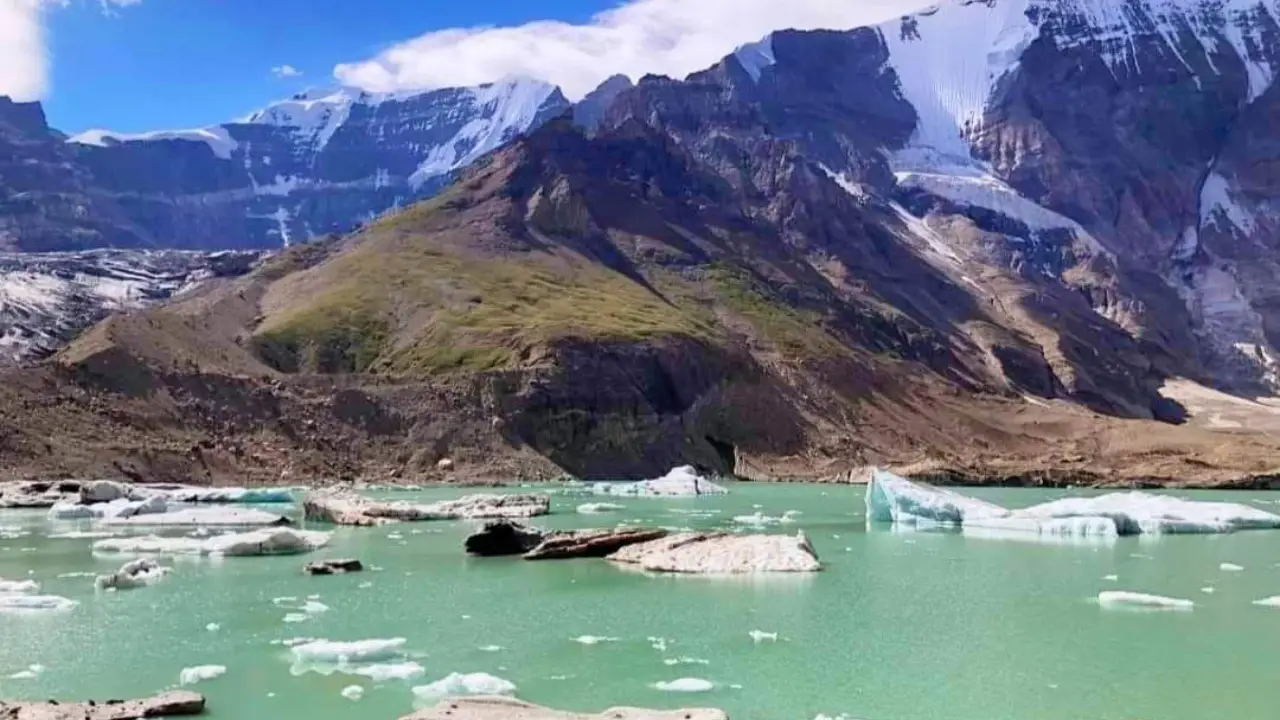
Lake-B
The researchers reconstructed the evolution of glaciers and glacial lakes in the Fariabad watershed of the Warwan sub-basin using satellite imagery spanning 1999 to 2024.
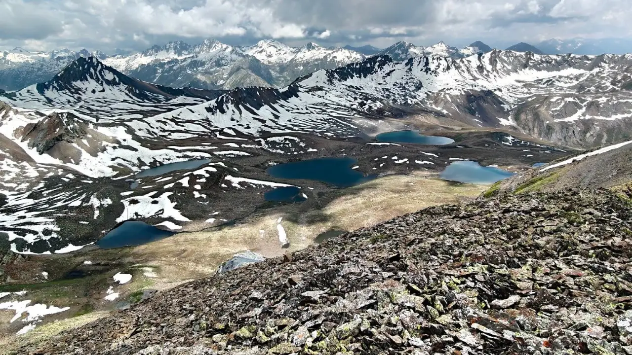
The study area lies in the Kishtwar Himalaya and forms part of the Chenab basin. The Fariabad watershed covers about 1,404 square kilometres, has an average elevation of about 4,308 metres and contains 272 glaciers covering approximately 314.6 square kilometres.
The glacier complex examined by the researchers includes glaciers designated GL-A to GL-E, with another glacier, GL-F, located in an adjacent valley. The meltwater from the complex forms the Fariabad Nalla, which joins the Marusudar River near Yordu before the river eventually meets the Chenab.
The researchers found that the number of glacial lakes in the Fariabad watershed has increased from seven in 1990 to 12, while glaciers in the catchment have also been losing mass.
The lake increased from approximately 0.075 square kilometres in 1999 to 0.306 square kilometres in 2024, an expansion of about 308 per cent. The researchers attribute the expansion primarily to glacier retreat, meltwater inflow and repeated ice-calving events.
The lake’s growth is particularly significant because its glacier, GL-B, has already experienced a major avalanche. In September 2005, an avalanche originating at approximately 5,150 metres travelled around 2.62 kilometres and affected an area of about 0.81 square kilometres. At that time, however, the avalanche stopped before reaching the proglacial lake.
The situation has since changed substantially.
By 2024, Lake-B had expanded to about 3.6 times its 2005 area. The researchers warn that an avalanche of comparable magnitude occurring under present conditions could now directly hit the lake.
Using glacier-bed modelling, the researchers estimated that Lake-B could reach a maximum volume of approximately 7.7 million cubic metres. The lake has a modelled maximum depth of about 60 metres, with a mean depth of approximately 28.5 metres. The frontal section is shallower, at around 13 metres, while the central portion reaches depths of about 60 metres.
The researchers then modelled three possible avalanche-triggered GLOF scenarios.
The largest, or worst-case, scenario assumed a 25-million-cubic-metre rock-ice avalanche entering Lake-B. A moderate scenario used an avalanche volume of 12.5 million cubic metres, while the low-magnitude scenario used 6.25 million cubic metres.
In the worst-case simulation, the avalanche generated a peak liquid-water discharge of about 2,214 cubic metres per second. In comparison, the solid avalanche component peaked at about 1,316 cubic metres per second immediately downstream of the lake.
The model indicated that approximately 97.5 per cent of the lake’s water could be drained in this scenario. Even the moderate scenario could drain about 91 per cent of the lake, while the low-magnitude scenario could drain nearly 86 per cent.
The Resultant Flood
The modelling becomes particularly significant downstream.
Under the worst-case scenario, the flood wave was modelled to reach the researchers’ Section 2 after about five hours and Section 3 after approximately six hours.
Maximum flow depths at the two sections were modelled at about 2.8 metres and 2 metres, respectively.
Although the flood discharge weakened as it travelled downstream, largely because of channel resistance, valley morphology and flow storage, the researchers found that the hazard remained substantial near populated areas.
At Section 3, near downstream settlements, the peak discharge was still modelled at about 535 cubic metres per second, representing a 73 per cent reduction from the initial peak but still a substantial flow.
The researchers overlaid the modelled inundation with high-resolution imagery to identify infrastructure that could be exposed.
They found nine bridges and 40 buildings, as well as multiple sections of road networks, within the modelled flood zone around Youdu and Qaderna. At locations containing infrastructure, modelled flow depths could reach 2-4 metres and velocities 4-6 metres per second.
The foothill Villages
The potential hazard extends well beyond the immediate vicinity of the lake.
The researchers identify Qaderna, Yurod, Anyar, Rinaie and Metwan as settlements located approximately 50-55 km downstream from the glacier complex.
Two major hydropower projects, Bursar, with an installed capacity of 800 MW, and Pakal Dul, 1,000 MW, are located about 90 km downstream.
The study says that although the GLOF flow would be expected to attenuate by the time it reaches the hydropower sites, the large volumes of transported water and debris could still adversely affect them.
The researchers also note that new settlements and agricultural activity have developed along the riverbanks during the past two decades, increasing the number of people and assets potentially exposed to future flooding.
They warn that further hydropower development could lead to additional population growth in the valley and potentially increase exposure.
The 2020 Avalanche
The study’s reconstruction of a September 2020 avalanche-triggered GLOF from Lake-A provides an important indication of how quickly conditions can change.
The avalanche originated from GL-A at an altitude of approximately 4,890 metres and travelled about 2.36 kilometres. It struck the proglacial lake, completely displaced its water and sediment and generated a GLOF.
Satellite imagery showed breaching of the moraine, extensive outwash and deposition of debris downstream. Yet the event remained largely unreported.
According to the researchers, this was partly because Lake-A had already lost much of its storage capacity through sediment accumulation. The resulting outburst therefore released a relatively small volume of water and did not cause major downstream damage.
The authors say the event demonstrates why conventional inventories can miss potentially important GLOFs in remote Himalayan valleys. They write that “small-volume outburst floods are often unreported”, particularly in sparsely populated areas with limited monitoring networks.
Lake-A is Refilling
The danger did not necessarily end with the 2020 outburst.
The study found that a small proglacial lake has re-formed in the Lake-A basin following the event. Sediment continues to enter the basin from neighbouring glacier-fed streams.
The researchers caution that sedimentation can sometimes reduce the hazard by reducing lake storage, but it can also produce what they describe as a “false sense of stability” if the surrounding glacier, slopes and periglacial environment are not continuously monitored.
Lake-A and Lake-B are only a few hundred metres apart, creating another potential problem.
A future slope failure or avalanche could trigger an outburst from Lake-A and generate sufficient momentum to affect Lake-B, potentially producing a sequential or cascading outburst.
The researchers stress that Lake-B is fundamentally different from Lake-A because it has not undergone the same degree of sediment infilling and has retained substantial water storage.
They assess that a similar avalanche to the one that struck GL-B in 2005, if it occurred under present-day conditions, could now directly impact Lake-B because the lake has grown to its full extent.
The Sediment Danger
One of the study’s most important findings concerns what could happen after the water leaves the lake.
The Warwan valley contains large quantities of unconsolidated sediment deposited by previous mass movements, glacier retreat and erosion.
The authors warn that a future GLOF would therefore be unlikely to behave simply as a flood.
Instead, the released water could mobilise loose sediment and generate debris flows, temporary channel blockages and subsequent downstream flooding.
“The possibility of GLOF to debris flow cascades is very high in the valley owing to the available sediment for remobilisation,” the study says, warning that this could increase risks to downstream infrastructure and hydropower.
The researchers emphasise that their hydraulic modelling deliberately focused on water routing downstream and did not attempt to fully model erosion and deposition associated with a future debris flow. They say the complex interaction between sediment erosion, transport and deposition requires further investigation.
The study also links the changing hazard environment to the degradation of permafrost at high elevations.
According to the researchers, warming can progressively thaw ice-rich permafrost along steep headwalls and valley flanks. This can weaken the cohesion of rock-ice mixtures and increase the likelihood of rockfalls and rock-ice avalanches.
The researchers say the 2005 and 2020 avalanche events may be associated with this broader process of slope destabilisation.
Their analysis of permafrost probability and active-layer temperatures indicates increasingly unstable ground conditions in the catchment.
The combination of repeated avalanches, degrading permafrost and expanding glacial lakes, they conclude, represents a serious and evolving GLOF hazard.
Early warning System
The researchers say the modelling should not be interpreted as a prediction that a GLOF will occur, but as an assessment of what could happen under specified avalanche-trigger scenarios.
They also acknowledge uncertainty in the modelled flood hydraulics and arrival times.
Nevertheless, they argue that an early-warning system installed close to the source lake could provide valuable lead time.
Under their worst-case simulation, the modelled arrival time was approximately five hours at Anyar and six hours at Qaderna. But the researchers caution that actual warning times could be shorter depending on the triggering process and the characteristics of a future event.
They recommend integrated monitoring of the glacier-lake complex, improved early-warning systems, community-based preparedness and robust mitigation measures.
They also argue that hazard assessments should be combined with assessments of community vulnerability and social protection, rather than focusing solely on the physical characteristics of the lake.
“All of the downstream infrastructure, including settlements, roads, bridges, and hydropower projects, is located along the potential GLOF path from Lake-B,” the researchers state.
The study concludes that the Warwan basin’s hazard is being shaped by the interaction of glacier retreat, sedimentation, lake expansion, avalanches and permafrost degradation.
Its central warning is that the valley should not be assessed based on individual hazards in isolation.
Instead, the researchers argue, the possibility of compound and cascading events, avalanches, lake outbursts, debris mobilisation and downstream flooding needs to be incorporated into future hazard planning.
They conclude that the findings underscore the need for “integrated monitoring of cryospheric processes, improved early warning systems, community-based preparedness, and robust mitigation strategies” to protect lives, livelihoods and infrastructure in the Warwan region.