A landmark 2026 geological study reveals six massive prehistoric landslides in Batote, Jammu and Kashmir. Triggered by ancient earthquakes, these unstable, encroached slopes are reactivating due to modern development and erosion.

SRINAGAR: A landmark geological study has mapped six massive prehistoric landslides in the Batote area of Jammu and Kashmir, revealing that ancient earthquake events thousands of years ago left behind highly unstable slopes that continue to threaten modern infrastructure. The research establishes that three colossal mud-and-rock slides along the western slope of the Chakwa Nala are between 5,000 and 10,000 years old, dating back to the Early Holocene epoch. Geologists warned that these massive, ancient accumulation zones are progressively waking up due to modern road building, heavy downpours, and river erosion, making the terrain highly precarious for local settlements.
The paper, Landslide morphology of the Batote area, Jammu & Kashmir, NW Himalaya: Implications for the age of prehistoric debris slides, was published in January 2026 in the peer-reviewed journal Results in Earth Sciences by Elsevier Inc. It was co-authored by a collaborative team of experts: Abdul Qayoom Paul (Geological Survey of India, Srinagar), Pankaj Kumar (Geological Survey of India, Jammu), Irfan Maqbool Bhat and Waseem Qader (Centre for Disaster Risk Reduction, Islamic University of Science and Technology, J&K), and Ajay Kumar (Geological Survey of India, Nagpur).
Ancient Slides
The research team combined field mapping with satellite radar data to track down “palaeo-landslides”, ancient slope failures whose distinct shapes have been worn away, smoothed by thousands of years of weather, or covered over by forests and farming. While recent landslides leave sharp, bare scars on the mountainsides, these prehistoric debris slides are hidden beneath a deceptively rolling landscape.

By looking at the way local rivers have been forced to bend and how the hills naturally sag, the team identified six distinct ancient slide zones. The three oldest and largest are concentrated near Faridabad village, Jharag village, and behind the Government Hospital in Batote, making up roughly 94 per cent of the total prehistoric slide area studied. The smooth, heavily vegetated nature of these areas suggests they occurred up to 10,000 years ago, likely triggered by a single cataclysmic earthquake along regional fault lines.
Fragile Terrain
The study highlights that the underlying architecture of the Batote region makes it a textbook environment for slope failures. An overwhelming 81 per cent of the area is draped in a thick layer of loose soil, mud, and fragmented rock pieces known as “unconsolidated overburden material,” which reaches up to 20 metres in depth. This heavy shroud sits loosely over the fragile sandstone and mudstone formations of the local Murree Group rocks.
“The stability of thick unconsolidated colluvium soil in hill slopes cannot be anticipated in such temperate climatic and tectonically active Himalayan terrain,” the authors noted, explaining that the earth acts like a giant, loose sponge waiting for a trigger to slip.
Hidden Risks
A major finding of the paper is that local infrastructure and civilian communities have unconsciously encroached directly onto these ancient, unstable landslide dumping grounds. Entire villages, crop terraces, and crucial highway lifelines, including National Highway 44 and National Highway 244, rely on these fragile slopes.
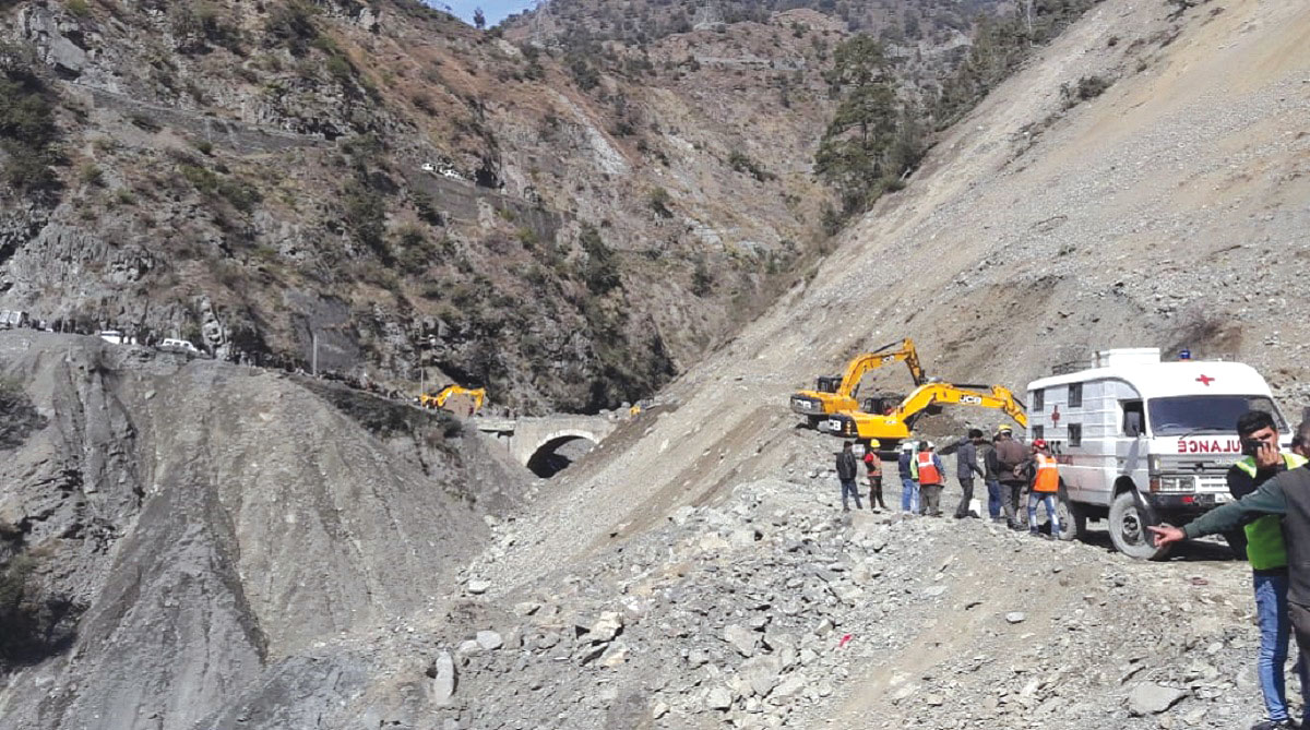
Because these terrains look like regular, gentle slopes, their deep-seated risk was widely overlooked. However, the modern active landslides tearing up the region are not entirely new events; instead, they are the gradual waking up or “reactivation” of these massive ancient slides. The toes of these old slide masses are constantly being eaten away by the rushing waters of the Chakwa Nala stream, causing the land above to buckle and shift.
Modern Threats
The danger is being drastically accelerated by human development and changing climate patterns. Over the last two decades, rapid infrastructural expansion and poorly planned road cuts have destabilised the bases of these slopes. When extreme mountain rainfall hits the area, water gets trapped inside the ancient debris, creating hidden water channels that make the earth fluid and heavy.
The slow-moving reality of this threat is already visible on the ground. The researchers documented several instances where the gradual shifting of the prehistoric slide mass has cracked foundations, warped walls, and rendered numerous local houses completely unsafe and unfit for human habitation.
Future Safeguards
To prevent catastrophic future collapses triggered by a major earthquake or a severe cloudburst, the authors have laid out an extensive civil engineering roadmap. They advise a complete halt to heavy construction in high-risk zones and urge the quick deployment of soil bioengineering. This involves planting deep-rooting native plants, such as willow trees, alongside structural crib walls to stitch the loose topsoil together naturally.
Additionally, the study calls for custom-designed deep drainage networks to safely channel away rainwater before it can saturate the loose earth, alongside high-strength steel catch fences to secure rockfall-prone cliffs alongside the national highways. The team concludes that integrating this ancient landslide inventory into future urban planning is the only way for the Himalayan region to grow sustainably without triggering a disaster.