by Dr Shaikh Ghulam Rasool
The Western Himalaya’s geo-diversity sustains rivers, soils, glaciers, biodiversity and communities, demanding stronger awareness, scientific planning, geo-heritage protection and responsible development across Jammu & Kashmir for future generations to inherit.

There are landscapes that we admire, and there are landscapes that sustain us. In Jammu and Kashmir, the two are inseparable. A mountain is more than a magnificent rise of rock, a river more than flowing water, a valley more than a beautiful view, a glacier more than frozen water, and soil more than the ground beneath our feet. Together, rocks, minerals, fossils, landforms, soils, sediments, groundwater, glaciers, and the geological and geomorphological processes that created them constitute the geo-diversity of the Earth.
Every year on October 6, the world observes International Geo-diversity Day, proclaimed by UNESCO’s General Conference in 2021. UNESCO describes geo-diversity as the non-living component of nature and emphasises its fundamental relationship with biodiversity, food production, water, energy, natural resources, disaster-risk reduction, and sustainable development. The 2026 theme, Geo-diversity on Our Doorstep, asks us to look closely at the geological heritage immediately around us and recognise that geo-diversity does not belong only in geological textbooks or distant museums. It lies beneath our feet, rises before our eyes, and forms the landscapes in which we live.
Nowhere is this message more relevant than in Jammu & Kashmir and the wider Western Himalaya. Here, geology is not an academic subject separated from everyday life. Geological forces create mountains, mountains sustain glaciers, glaciers feed rivers, rivers shape valleys and wetlands, soils support forests and agriculture, and landforms influence settlements, pastoral routes, and livelihoods. Together, these physical foundations create the conditions in which biodiversity and human civilisation flourish. To understand Jammu, Kashmir, and the Western Himalaya, therefore, we must learn to read the Earth beneath the landscape.
Biodiversity is now part of everyday environmental language. We speak readily about forests, wildlife, birds, plants, insects, and ecosystems, yet biodiversity does not exist independently of the physical world. Every ecosystem stands upon a geological foundation. The character of a forest is influenced by rocks and soils. The course of a river responds to geology and landform. Groundwater storage depends partly upon geological formations. Agriculture depends upon soil. Wetlands emerge within particular geomorphological settings, while mountain habitats are shaped by elevation, slope, substrate, climate, and geological history. Geo-diversity has consequently been described as biodiversity’s silent partner. The International Geo-diversity Day initiative emphasises the role of rocks and geological processes in regulating groundwater and river flow, while UNESCO stresses that geo-diversity provides the foundations and habitats upon which living systems depend.
The destruction of a forest is often immediately visible, but damage to a geological system may unfold more slowly while proving equally profound. Excessive cutting of a mountain can destabilise a slope. Soil removal diminishes agricultural productivity. Disturbing sediment movement changes river channels. Paving natural recharge zones reduces groundwater replenishment. Wetland destruction weakens natural water storage, while blasting unstable slopes for poorly planned infrastructure can increase landslide risk. Geo-diversity conservation is therefore not about preserving attractive rocks. It is about maintaining the physical systems that make life possible.
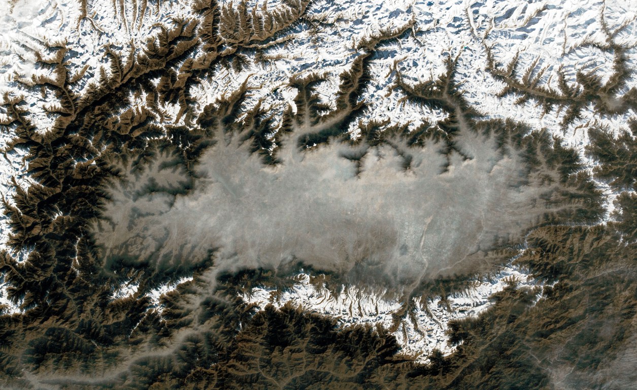
The Himalaya, stretching for roughly 3,000 kilometres across Asia, is among the world’s great mountain systems. The Indian Himalaya contains extraordinary variations in altitude, climate, geology, soils, glaciers, rivers, and ecosystems. ISRO’s GeoHimalaya platform highlights the close relationship among Himalayan geology, climate, soils, hydrology, and ecological diversity. Within this immense system, the Western Himalaya, including Jammu & Kashmir and adjoining mountain regions, possesses exceptional geological complexity. Folded mountains, thrusts and faults, sedimentary formations, metamorphic rocks, igneous complexes, glacial landscapes, river terraces, alluvial plains, Karewa formations, alpine valleys, high-altitude deserts, wetlands, and lake basins together form an extraordinary geological mosaic.
The Geological Survey of India describes the Himalayan belt in this region as a highly complex tectonic system containing rocks ranging from Proterozoic to Quaternary age, with major structural features including the Kashmir Synclinorium, Panjal-related structures, and several tectonic zones. This geological history is not merely ancient. The Himalaya remains a young and tectonically active mountain system. Forces within the Earth continue to shape it, while glaciers, rivers, weathering, erosion, and landslides constantly remodel its surface. The mountain is not a monument frozen in time. It is part of a living geological process.
The geo-diversity of Jammu deserves particular attention because it is sometimes overshadowed by the dramatic landscapes of Kashmir. Jammu presents a remarkable transition from the Himalayan foothills towards the plains. Siwalik formations, younger sediments, sandstone, conglomerates, alluvial deposits, ravines, and river systems create a physical landscape markedly different from Kashmir’s high mountains. Geological Survey and other government sources document the importance of the Himalayan foothill belt, including the Siwalik Group and younger alluvial deposits. Its soils and sediments are intimately connected with erosion and deposition by mountain streams and rivers.
The Tawi, Chenab, Ravi, and their tributaries are consequently far more than waterways. They erode mountains, transport sediment and nutrients, build floodplains, carve channels, and reshape valleys. In this sense, every river is a moving geological archive. Jammu’s ravines and seasonal streams similarly reveal the interaction of geological structure, rainfall, erosion, and land use. When catchments are degraded, vegetation removed, and drainage patterns disturbed, natural erosion can become destructive. Understanding Jammu’s geology is therefore essential for addressing soil loss, landslides, flooding, agriculture, and the vulnerability of settlements.
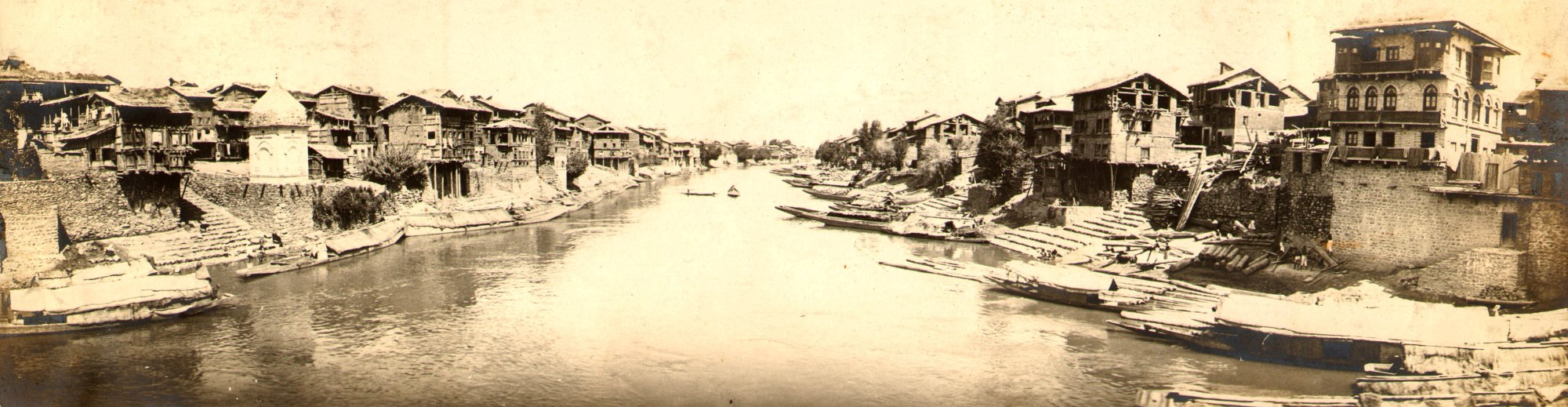
Kashmir Valley presents another remarkable geological story. Celebrated around the world for its mountains, lakes, gardens, and scenic beauty, the valley rests upon an extraordinary geological history involving sedimentary, metamorphic, and igneous rocks. Its central areas contain extensive lacustrine sediments associated with ancient lake environments, while the Karewa formations remain among the most distinctive geological features of Kashmir. The Karewas are much more than agricultural land. They are geological archives preserving evidence of past environmental conditions and landscape evolution. Their soils and sediments have supported agriculture and horticulture for generations, and the saffron landscapes around Pampore are intimately associated with this geological and soil environment. Karewa landscapes occur across parts of Pampore, Pulwama, Budgam, Shopian, Anantnag, Baramulla, and Ganderbal, among other areas. When these formations are levelled, excavated, or permanently altered without understanding their geological and ecological importance, society may lose not simply a piece of land but a chapter of Kashmir’s environmental history.
The Western Himalaya is also inseparable from the Indus River system. The Jhelum, Chenab, and other major rivers and tributaries connect mountains with valleys, wetlands, agricultural landscapes, and downstream communities. The Central Water Commission describes the Indus Basin as incorporating the major western Himalayan rivers and their extensive glacier-fed and snow-fed catchments. This relationship reveals a fundamental principle of river conservation: a river cannot be protected by attending only to the water flowing within its channel. Its mountains, glaciers, snowfields, springs, tributaries, floodplains, wetlands, and groundwater systems form one connected landscape. River health begins far upstream, and catchment geology influences springs, groundwater, sediment, slope stability, and river behaviour. Geo-diversity must therefore become an integral part of river conservation.
High in these mountains lies another critical component of geo-diversity: the cryosphere, including glaciers, snow, ice, and permafrost. Glaciers are not simply reservoirs of frozen water. They are powerful geological sculptors that carve valleys, transport rocks, generate sediments, and influence downstream hydrology. They also preserve evidence of climatic history. Research supported by India’s Department of Science and Technology has documented an overall pattern among glaciers in the Suru sub-basin of the Western Himalaya, with an enhanced rate after 2000, emphasising that cryospheric changes can affect hydrology and the water resources of major Himalayan rivers.
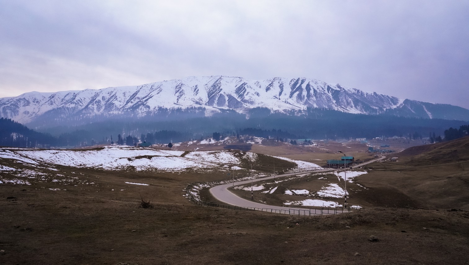
Climate change is now interacting with geological and hydrological processes that evolved over thousands or millions of years. Changes in snow duration, glacier mass, runoff timing, river seasonality, slope stability, glacial-lake hazards, and downstream water availability can alter the behaviour of entire mountain systems. India’s Ministry of Earth Sciences has also supported research on glacial lake outburst flood risks across contrasting Himalayan topographic and climatic zones, including research involving the University of Kashmir and IIT Roorkee. The implication is clear: a changing climate is changing the behaviour of the mountains themselves.
Among the most neglected elements of geodiversity is soil. We walk upon it, build over it, and grow our food in it, yet rarely consider how slowly many soils form. Soil develops through interactions among geological parent material, climate, organisms, topography, and time. It can be severely damaged within a few years, while mature soil may require centuries or considerably longer to form. Jammu & Kashmir’s soil diversity reflects enormous variations in geology, elevation, climate, and geomorphology. From foothills and alluvial valleys to Karewa plateaus, river terraces, high mountains, and alpine landscapes, soils create a mosaic of ecological possibilities upon which agriculture, horticulture, forests, and pastoral livelihoods depend. Conserving soil is therefore simultaneously an act of geodiversity conservation, food security, water conservation, biodiversity protection, livelihood security, and climate resilience.
Rivers, too, must be understood as makers of landscape. The Jhelum has shaped the Kashmir Valley, the Chenab has carved deep mountain valleys, and the Tawi has influenced the landscape around Jammu. Mountain tributaries produce gorges, terraces, alluvial fans, and floodplains that have helped determine where communities settle, agriculture develops, and roads and towns are built. Yet modern development increasingly attempts to control rivers as though they were engineered channels. Rivers require space, floodplains require ecological functions, sediment must be allowed to move, and wetlands require hydrological connectivity. Encroachment, excessive extraction, poorly planned embankments, and inappropriate construction interrupt these processes, with consequences that often become most visible during extreme weather. A healthy river is not necessarily a straightened or confined river. It is a functioning river system.
The same understanding must guide our relationship with mountains. Roads, tunnels, hydropower projects, transmission infrastructure, buildings, and tourism facilities are important components of modern development, but development that disregards geological conditions can create new vulnerabilities. Mountain construction requires knowledge of rock structure, fault systems, slope stability, groundwater, drainage, seismicity, erosion, sediment transport, and landslide susceptibility. The Western Himalayan Regional Centre of India’s National Institute of Hydrology identifies soil erosion, mass movement, sedimentation, landslides, glacial lake outburst floods, flood modelling, springshed management, and cryospheric processes among important fields of Himalayan research. The lesson is fundamental: infrastructure must be designed according to the mountain rather than forcing the mountain to fit infrastructure.
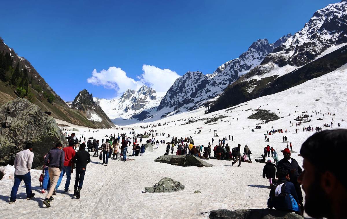
Tourism poses a similar challenge. Jammu & Kashmir’s landscapes attract millions of visitors and generate employment and economic opportunity, but tourism becomes environmentally damaging when natural landscapes are treated as limitless commodities. Unchecked construction, road widening, waste generation, traffic, excessive water extraction, slope cutting, and growing pressure on fragile sites can degrade the very landscapes upon which tourism depends. A mountain destination damaged by poorly planned development ultimately undermines its own tourism economy. The solution is not to reject tourism but to pursue tourism that is geologically informed, ecologically responsible, and beneficial to local communities. Tosamaidan, Gulmarg, Pahalgam, Sonamarg, Doodhpathri, Bangus, Gurez, and other mountain landscapes should be understood not merely as tourist destinations but as interconnected geo-ecological landscapes whose carrying capacities matter.
Geo-diversity is equally inseparable from pastoral life. Pastoral communities do not encounter mountains as abstract geological systems but through generations of movement and observation. Pasture is related to altitude, altitude to temperature, temperature to snow, snow to water, water to grass, grass to livestock, and livestock to household nutrition and livelihood. Traditional seasonal movement therefore reflects an intimate understanding of landscape variation. Gujjar-Bakerwal and other pastoral communities possess valuable observations concerning pasture conditions, springs, snow, weather, erosion, plant distribution, livestock health, and changing seasons. Such knowledge does not replace scientific monitoring but complements it. Modern science has instruments, communities have memory, and the future of Himalayan conservation needs both.
A landscape also carries different meanings for different people. A geologist sees formations, structures, and processes; a hydrologist sees catchments and groundwater; a botanist sees ecological niches; a pastoralist sees grazing routes; a farmer sees soil; a fisher sees water and sediment; and a child may see a landscape filled with wonder. All these perspectives form part of humanity’s relationship with the Earth. UNESCO’s approach to geo-diversity recognises the importance of public awareness, education, research, and community participation, and its 2021 resolution invited governments, universities, civil society, schools, and local actors to participate in International Geo-diversity Day. For Jammu & Kashmir, this provides an opportunity to develop community-based geo-heritage education rooted in local landscapes and experience.
The same principle should guide the use of mineral resources. Jammu & Kashmir possesses valuable minerals, and the government carries a statutory responsibility for managing their exploration and exploitation. The J&K Mining Department states that mineral resources should be explored and exploited scientifically with the objective of establishing mineral wealth for posterity. The words “for posterity” deserve particular attention. Natural resources are not commodities belonging exclusively to the present generation. They form part of an inheritance received from the past and entrusted to us for the future. Mining, quarrying, and construction should therefore proceed through scientific assessment, environmental safeguards, landscape-level planning, restoration obligations, community participation, transparency, and long-term monitoring. Economic development and geoconservation need not be adversaries, but development must remain within the ecological and geological limits of the landscape.

This requires a stronger public policy conversation about geodiversity in Jammu & Kashmir. Geology must no longer be viewed primarily through the narrow lens of mineral extraction. A comprehensive J&K Geo-diversity and Geo-heritage Strategy could identify and protect geological heritage such as significant rock formations, fossils, structures, and exposures; geomorphological heritage including valleys, gorges, terraces, moraines, caves, springs, waterfalls, and distinctive landforms; soil heritage including Karewas, rare soils, and agriculturally important geological landscapes; cryospheric heritage comprising glaciers, glacial valleys, and associated features; river heritage encompassing natural river stretches, floodplains, and important geomorphological formations; cultural geo-heritage where geological landscapes intersect with human history and traditional livelihoods; and community geo-heritage consisting of places identified locally as culturally or ecologically important.
A geopark approach offers another promising pathway. UNESCO’s International Geoscience and Geoparks Programme provides a global framework connecting geoscience, conservation, education, sustainable development, and local communities. Any geopark initiative in Jammu & Kashmir, however, must avoid becoming merely another tourism label. Its purpose should be to bring geology, biodiversity, culture, communities, education, and sustainable livelihoods together within a coherent landscape approach. Potential sites should be assessed scientifically for their geo-heritage significance, beginning with rigorous geological mapping, community consultation, and conservation planning rather than branding.
International Geo-diversity Day itself should become more than a ceremonial occasion. On 6 October, schools could organise “Know Your Rock” activities, universities could undertake “Mapping J&K’s Geo-heritage,” communities could hold “Walk the Landscape” programmes, civil society organisations could lead “Our Rivers, Our Geology” initiatives, researchers could work towards a “Western Himalayan Geo-diversity Atlas,” and government institutions could begin a “J&K Geo-heritage Inventory and Protection Programme.” The 2026 theme is especially meaningful because it asks people to discover the geological diversity of their own surroundings rather than imagining geo-heritage as something remote or inaccessible.
Such an approach also challenges the way conservation is administratively divided. We speak separately of forests, wildlife, rivers, wetlands, soils, and climate, but nature does not recognise these institutional compartments. A mountain does not know where the jurisdiction of one department ends, and another begins. Rivers do not recognise district boundaries, glaciers do not follow departmental files, and wetlands do not separate geology from biodiversity. Nature functions as a system, and governance must learn to do the same. Geo-diversity offers a powerful physical foundation for integrated environmental planning because it reveals how apparently separate environmental concerns are connected through landscape processes.
The central lesson is simple. Before protecting life, we must understand the Earth that supports it. Protecting a forest requires understanding its soil. Protecting a river requires understanding its catchment. Building a road requires understanding the mountain. Developing tourism requires understanding landscape capacity. Extracting minerals requires understanding their ecological and geological setting. Changing a watershed requires knowledge of groundwater. Altering a wetland requires understanding its geological and hydrological history. Even before describing a landscape as wasteland, we should ask what ecological, geological, and cultural functions it performs.
Jammu & Kashmir can translate this understanding into practical action. Geological literacy should become stronger in schools, geo-diversity should form part of environmental impact assessments, and geological and geomorphological information should guide infrastructure planning. Important geo-heritage sites need better protection, communities need a meaningful role in landscape conservation, and scientific monitoring of glaciers, springs, rivers, and unstable slopes should be strengthened. Soils deserve the seriousness traditionally reserved for forests, while floodplains and wetlands must be recognised as functioning components of river systems. Above all, policymakers must acknowledge that economic development pursued without geological wisdom can leave environmental liabilities that future generations will be forced to bear.
The Western Himalaya is not simply a beautiful background to our lives. It is the foundation beneath them. Its rocks carry stories millions of years old. Its mountains record the immense forces that created the Himalaya. Its glaciers hold climate memory and water. Its rivers carve landscapes and sustain civilisations. Its soils feed communities. Its springs connect underground geology with human survival. Its valleys contain forests, farms, wetlands, and settlements, while its landscapes preserve the intertwined memory of Earth and people. Yet much of this extraordinary heritage remains poorly understood by the wider public and insufficiently integrated into environmental decision-making.
International Geo-diversity Day offers an opportunity to change this by teaching us to see what is usually invisible: the rock beneath the forest, the aquifer beneath the field, the geological structure beneath the road, the ancient lake sediments beneath the Karewa, the glacier beneath the snow, the watershed behind the river, the soil beneath the crop, and the geological memory beneath the landscape. Once these connections become visible, conservation acquires a deeper meaning. A mountain becomes more than a mountain. It becomes a water tower, habitat, geological archive, climate regulator, cultural landscape, and home. A river becomes more than flowing water. It becomes a living corridor connecting geology, soil, biodiversity, agriculture, wetlands, and communities. Soil becomes more than land. It becomes the thin interface between geological history and human survival. Geo-diversity, in turn, ceases to be a subject belonging only to geologists and becomes a shared inheritance belonging to everyone.
The Earth beneath our feet is our oldest heritage. We did not create the mountains, rivers, glaciers, or soils. We inherited them. Our responsibility is not merely to use them, but to understand them, respect them, protect them, and pass them forward. For Jammu & Kashmir, for the Western Himalaya, and for generations yet unborn, the task is clear: protect the mountains, rivers, soils, glaciers, and geo-heritage, and protect the communities whose lives and cultures are intertwined with them. Geo-diversity is not simply the diversity of the Earth beneath us. It is the foundation of the biodiversity, livelihoods, cultures, and futures that exist above it.
(The author is a conservationist and climate justice campaigner. He is also Vice President, NFSF-India. Ideas are personal.)