SRINAGAR: Five glacial lakes in the Kashmir Himalaya have been identified as having “very high” susceptibility to glacial lake outburst floods (GLOFs), with a potential outburst threatening 2,704 downstream buildings, 15 major bridges, roads and a hydropower project, according to a new study published in the Journal of Glaciology. The researchers have called for “immediate attention” to the five lakes and urged continuous satellite and field monitoring, hydrodynamic modelling and community-based early warning systems to reduce the risk.
The study, Glacial lake outburst flood susceptibility and potential downstream implications across the Kashmir Himalaya, identifies Bramsar, Nundkol, Bhagsar, Chirsar and Gangabal as the five most susceptible lakes in the region. It warns that the danger is not confined to a single lake or a single flood event: hydrological connections between some of the lakes could produce cascading or “process chain” events in which an outburst upstream triggers a secondary flood downstream.
The research was authored by Syed Danish Rafiq Kashani and Sheikh Aneaus of the Department of Geoinformatics, University of Kashmir; Irfan Rashid of the same department; Argha Banerjee of the Earth and Climate Science department at the Indian Institute of Science Education and Research, Pune; and Ulfat Majeed of the Department of Civil Engineering, National Institute of Technology, Srinagar. The paper was published in the Journal of Glaciology, by Cambridge University Press on behalf of the International Glaciological Society on January 2, 2026.

The study is significant because the Kashmir Himalaya has had no reported GLOF event to date, even as its glaciers have been undergoing rapid recession. The researchers say the absence of a recorded disaster should not be interpreted as an absence of risk. Their assessment instead provides what they describe as a baseline for understanding the region’s glacial lakes and their potential hazard.
The researchers manually mapped 155 glacial lakes located above 2,500 metres, using Landsat satellite imagery and a GIS-based analysis of changes between 1992 and 2024. They divided the lakes into three categories: six ice-contact proglacial lakes, 17 unconnected proglacial lakes and 132 distant glacial-origin lakes.
The overall area of the mapped lakes increased only marginally over the 32-year period, by about 20 hectares or 1.2 per cent. But the change was much more pronounced among the ice-contact proglacial lakes. Their combined area increased by 11 hectares, or 26 per cent, between 1992 and 2024. The researchers say this expansion reflects the sensitivity of such lakes to changing glacier dynamics and climate variability and makes their continued observation particularly important.
The study’s principal finding emerged from an assessment of ten factors associated with GLOF susceptibility. These included lake type, lake area, expansion rate, dam material, length-to-width ratio, dam-front slope, steepest surrounding slope, upstream lake cascades, permafrost occurrence and seismic activity. The researchers used an Analytical Hierarchy Process, or AHP, to assign relative weights to the factors, drawing on historical GLOF events, published research and the judgement of six subject-matter experts in Himalayan glaciology.
The analysis placed five of the 155 lakes, or about three per cent, in the “very high” susceptibility category. Another 35 lakes, or 22 per cent, were classified as having high susceptibility; 77, or half of the inventory, fell into the moderate category; 32 were classified as low and six as very low.
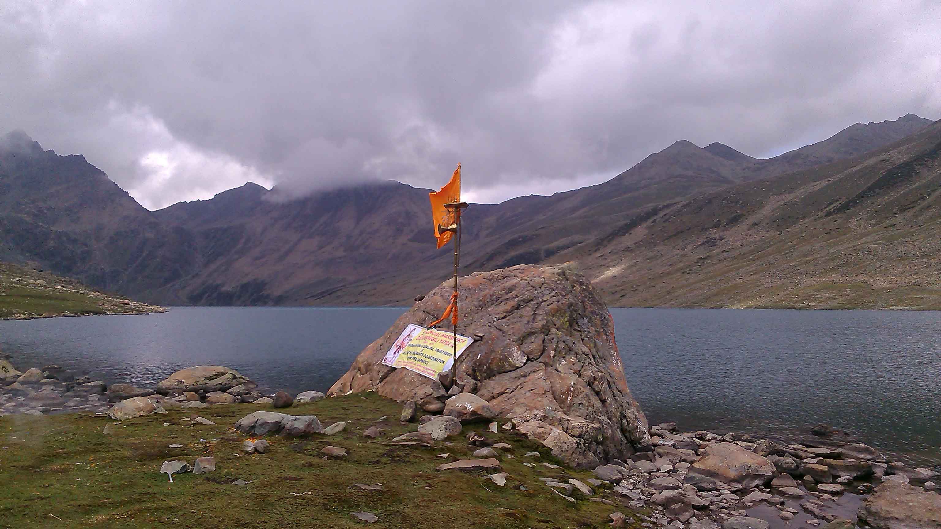
Bramsar emerged as the lake with the highest susceptibility index, followed by Nundkol, Bhagsar, Chirsar and Gangabal. The five have GLOF susceptibility scores ranging from 0.51 to 0.69. Bramsar, at an elevation of 3,746 metres, and Chirsar, at 3,655 metres, are ice-contact proglacial lakes and lie in areas identified as being at risk in Shopian and Kulgam districts. Nundkol and Gangabal are unconnected proglacial lakes associated with Ganderbal, while Bhagsar, a glacial-origin lake at 3,954 metres, is associated with Shopian.
The researchers found particularly important differences in what makes the five lakes dangerous.

Bramsar and Chirsar are in direct contact with their parent glaciers and have expanded by 43 per cent and 65 per cent respectively. Both are debris-dammed, making them more vulnerable to erosion and failure when exposed to triggers such as landslides and rock or ice avalanches. Bramsar is surrounded by particularly steep terrain, with a maximum slope of 62 degrees, which the researchers say increases the likelihood of mass-movement-induced moraine failure.
Nundkol and Gangabal present a different hazard. Although they are not directly connected to their parent glaciers, both are hydrologically connected to multiple upstream lakes. Nundkol covers about 37 hectares and Gangabal about 163 hectares. Their relatively elongated shapes, with length-to-width ratios of 3.85 and 4.37 respectively, may increase pressure on their dams. More importantly, the researchers warn that the presence of two or more upstream cascades raises the possibility of secondary outburst floods through an overtopping mechanism.
That cascading possibility is one of the study’s more important findings. An outburst from an upstream lake could increase the volume and pressure in a downstream lake and potentially trigger another outburst. The researchers describe this as a “hazard cascade” and say it adds another layer of complexity to the risk faced by downstream communities.
Bhagsar has yet another risk profile. Covering about 76 hectares, it is not in direct contact with a glacier, but its dam characteristics, proximity to permafrost and relatively high seismic index increase its susceptibility. The researchers say degradation of permafrost could weaken the moraine, while a strong earthquake could compromise its loosely packed debris dam. At the same time, they caution that earthquakes are relatively uncommon direct triggers of GLOFs and therefore assigned seismicity a comparatively low weight in their model.
The downstream exposure is substantial. Using a 250-metre flood-impact buffer, the researchers found that potential outburst events from Bramsar and Chirsar could affect 406 buildings and five bridges. A GLOF involving Nundkol and Gangabal could threaten 1,184 buildings, four bridges and a hydropower plant. Bhagsar alone could expose 1,114 buildings and six bridges, as well as the Mughal Road, an important alternative road link into the Kashmir Himalaya.
Taken together, the study estimates that the highly susceptible lakes could put 2,704 downstream buildings, 15 major bridges, roads and a hydropower project at risk. The authors stress that these exposure estimates are indicative rather than absolute, because the assessment uses buffer-based modelling rather than a full physically based simulation of an actual flood.
The researchers also tested their susceptibility framework against historical GLOF events elsewhere in the Himalaya. Eight documented glacial lakes that had experienced GLOFs since 2010 were assessed using the same framework, and all eight fell into the “very high” susceptibility category. The authors say this strong correspondence between the model and known historical events increases confidence in the AHP approach as a preliminary screening tool for data-limited mountain regions.
The study nevertheless makes clear that its findings should not be treated as a prediction that any of the five lakes will necessarily burst. The authors acknowledge that their approach relies partly on expert judgement and that complex processes such as mass wasting and lake failure cannot be fully represented through an AHP model. They describe the downstream exposure assessment as a “first-order” assessment and say the values should be interpreted as “indicative and not absolute”.
Satellite resolution also limits the assessment of some characteristics, particularly the precise composition of lake dams and the true nature of glacier contact. The researchers say field investigations are needed to establish these characteristics more accurately. They also note that factors such as extreme climate events, long-term permafrost degradation and hidden subglacial processes are not fully captured by the present model.
Despite these qualifications, the authors argue that the findings warrant immediate action. They specifically recommend prioritised monitoring and targeted mitigation for Bramsar, Chirsar, Gangabal and Nundkol because of their hydrological connections with other lakes and the possibility of cascading floods. Their proposed measures include continuous remote-sensing and field observations, hydrodynamic modelling, stabilisation of dam material, downstream urban-development planning and community-based GLOF early-warning systems.
The study concludes that ice-contact proglacial lakes, although relatively few in number, pose a particularly high hazard because of their direct interaction with retreating glaciers and their comparatively rapid expansion. The researchers say the findings “underscore the influence of glacier dynamics and climate warming on GLOF susceptibility” and that the five lakes with very high susceptibility “require immediate attention”.
Their broader prescription is for a shift from reactive disaster response to proactive GLOF management. They call for continuous monitoring through remote sensing and in-situ observations, hydrodynamic modelling and the incorporation of scientific evidence into decision-making. The objective, they say, should be to protect vulnerable mountain communities and infrastructure before an outburst occurs rather than after it.
The paper was funded under a Ministry of Earth Sciences, Government of India, project titled “Identifying current and future GLOF risk over contrasting topographic and climatic zones of the Indian Himalaya using earth observation data and modelling”. The authors say the work provides a foundation for further research and policy action on GLOF risk in the Kashmir Himalaya.