SRINAGAR: A new study on Kashmir’s flood vulnerability has found that the region’s exposure to devastating floods is not a consequence of extreme rainfall or the geography of the Jhelum basin alone. It is being intensified by urban expansion, encroachment, degradation of wetlands and floodplains, inadequate infrastructure and fragmented flood-management policies.
The study finds that marginalised communities with limited access to services and resources bear a disproportionate share of the consequences, while existing flood-control measures remain heavily dependent on physical structures such as embankments and drainage channels. The authors call for a shift towards early-warning systems, climate-adaptive planning, community-based preparedness, greater equity and transboundary cooperation in managing the Jhelum.
The findings come from the research paper Beyond the banks and deluge: understanding riverscape, flood vulnerability, and responses in Kashmir, authored by Ishfaq Hussain Malik of the School of Geography, University of Leeds; Rayees Ahmed of the Department of Geography and Disaster Management, University of Kashmir; James D Ford of the School of Geography and Priestley Centre for Climate Futures, University of Leeds; Mir Shahid Ahmad Shakoor of the Department of Geography, Aligarh Muslim University; and Shahid Nabi Wani of the Department of History, University of Kashmir. The paper was published in Natural Hazards, a Springer Nature journal, in 2024.
The researchers used a mixed-methods approach combining interviews, focus-group discussions, ethnographic fieldwork, satellite remote sensing, GIS, population data and hydrological records. They conducted 65 semi-structured interviews across 2014, 2017 and 2023, along with nine focus-group discussions. They also examined historical flood-management reports and analysed peak discharge data from three Jhelum monitoring stations for the period 2003–2023.
The 2014 Deluge
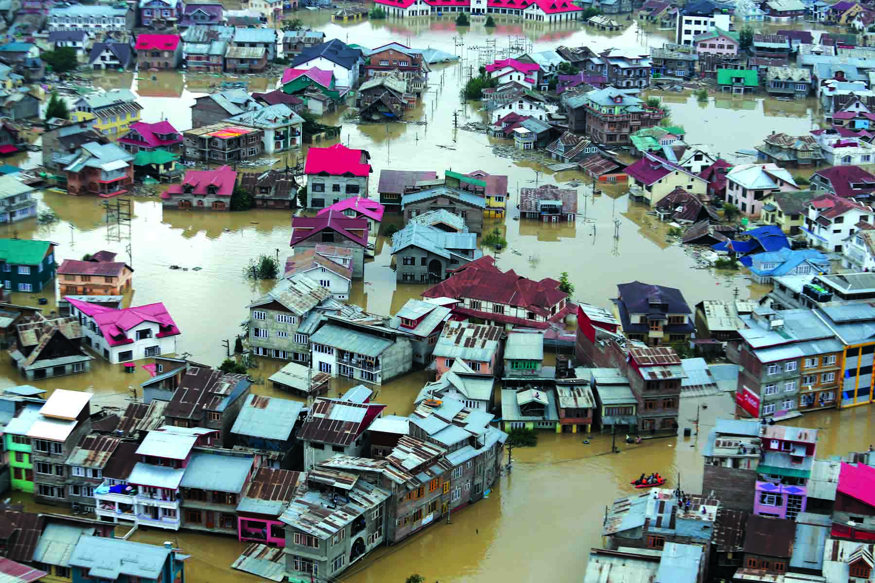
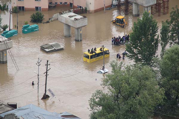
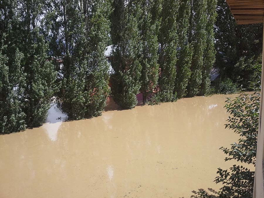
The scale of the 2014 flood emerges as one of the study’s most significant findings. The researchers estimate that 912 square kilometres of the Jhelum basin’s 1,760 square kilometres of floodplains were inundated, affecting nearly two million people. The districts identified as severely affected included Anantnag, Kulgam, Pulwama and Srinagar. Some locations remained submerged for more than a month.
The study places this disaster in the context of a much longer history of flooding. It identifies major flood events in 1893, 1928, 1950, 1959, 1992, 2010, 2014, 2015, 2017, 2019, 2022, 2023 and 2024. The authors note that the 2014 flood has generally been regarded as the worst in a century.
The human accounts collected by the researchers underline how successive floods have affected livelihoods. One resident recalling the 1992 flood said, “All my sheep died, which were my main source of income.” Another participant describing the 2014 disaster said, “The floods of 2014 were unlike anything we had ever seen, overwhelming our capacity to respond.”
The Frightening Levels
The hydrological data shows just how extraordinary the 2014 event was.
Srinagar normally receives an average of 26.6 mm of rainfall during September, but received more than 173 mm in the first week of September 2014. Southern Kashmir received more than 200 mm during the period, producing substantial surface runoff.
At Sangam, the Jhelum’s water level rose from 5.7 metres on September 3 to more than 10 metres the following day. By September 6, the river had breached its banks at several locations.
The study says the flow at Sangam reached about 135,000 cusecs, compared with a stated river capacity of approximately 35,000 cusecs in Srinagar.
The historical comparison is equally striking. At Sangam, the previous highest recorded level before 2014 was 32.60 feet in September 1992, associated with a discharge of 65,305 cusecs. In September 2014, the level reached 34.70 feet, while discharge reached 115,218 cusecs.
At Ram Munshibagh, the previous high was 24.70 feet, recorded in July 1959 with a discharge of 46,000 cusecs. In 2014, the gauge rose to 29.50 feet and discharge reached 72,585 cusecs. At Asham, however, the 2014 discharge of 47,600 cusecs was below the previous record of 52,750 cusecs, recorded in 1996.
The Riverscape
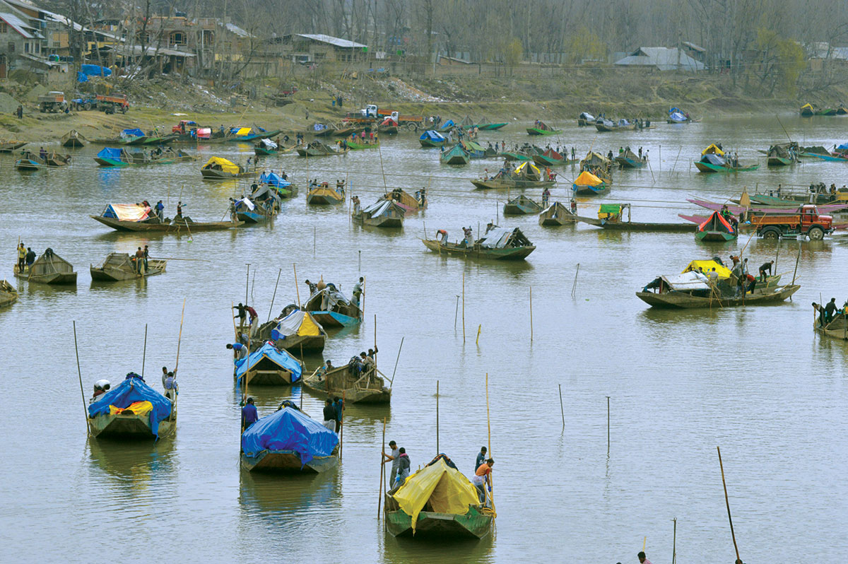
The study’s distinctive contribution is its use of the concept of a “riverscape”, not simply the river channel, but the river, floodplains, wetlands, vegetation, settlements, livelihoods, cultural practices and human interventions surrounding it.
The researchers say the Jhelum is simultaneously a source of irrigation, hydroelectric power, livelihoods, tourism and cultural identity. But it is also under pressure from pollution, encroachment, urban sprawl, land-system changes and changing stream flows.
One community leader interviewed for the study described the transformation bluntly: “Jhelum is not a river now; it is a big drain.” Participants linked the loss of carrying capacity to accumulated waste, silt, encroachment and drainage connections.
The study records complaints about polythene, bottles, drainage waste, tree branches and soil accumulating in the river. It argues that the drainage systems of Srinagar and other settlements along the Jhelum are connected to the river, contributing to pollution and reducing its carrying capacity.
The authors also point to a 75 per cent increase in urban growth over the last two decades, particularly in central and southern Srinagar, as an important factor exacerbating flood vulnerability.
The problem is not simply the number of buildings. The study links unplanned development to the loss of natural space capable of absorbing or storing water.
“Earlier we used to have a very less urbanised area; now it seems like a concrete landscape, making water accumulate within half an hour in our lanes,” one participant told the researchers.
The researchers also highlight the encroachment of floodplains and wetlands, arguing that the loss of these natural buffers has weakened Kashmir’s capacity to absorb floodwaters.
The Satellite Data
The satellite-based land-use and land-cover analysis found that the 2014 flood affected every major land category examined. Cropland constituted 41 per cent of the area and suffered crop damage, erosion and waterlogging. Barren land accounted for 20 per cent and was affected by sediment deposition and changes in soil structure. Built-up areas made up 16 per cent and suffered infrastructure and property damage as well as interruptions to services. Water bodies accounted for 15 per cent and experienced substantial overflow and inundation, while vegetation covered 8 per cent and suffered plant damage and soil erosion. The researchers concluded that agricultural and built-up areas were impacted most severely.
The study links these losses to Kashmir’s dependence on agriculture and horticulture. Floods therefore do not simply destroy houses and roads; they disrupt the economic base of communities and can deepen poverty.
A major conclusion of the research is that flood vulnerability is unequally distributed.
The authors found that low-income households and marginalised communities living along riverbanks frequently have less access to infrastructure, healthcare, clean water, sanitation and other resources needed for recovery.
“We are always the last ones to receive the flood relief, if we receive it at all,” one participant told the researchers. Another participant from an informal settlement said, “Our homes are at the mercy of the waters, and so are we.”
The study therefore treats flood vulnerability as a question of social inequality as well as hydrology. People whose livelihoods depend on agriculture, horticulture, riverbank commerce and other flood-sensitive activities face both physical exposure and economic vulnerability.
History of Floods
The researchers also examine Kashmir’s long history of flood-control planning. The record stretches from Purves’ recommendations of 1915 and Harris’ 1929 recommendations to Uppal’s 1956 proposals, the Master Plan of 1959 and the High-Level Flood Committee of 1975–76. These plans repeatedly proposed stronger embankments, additional channels, dredging, diversion of tributaries, protection against encroachment and better hydraulic information.
The study says flood management gradually moved from purely engineering interventions towards approaches incorporating ecological, social and economic considerations. But implementation repeatedly suffered from lack of data, resources and institutional support.
Its assessment of the present policy structure is particularly critical. Kashmir’s flood-control system remains predominantly dependent on dykes and drainage channels, while early-warning mechanisms, zoning regulations and community-led approaches remain underdeveloped. Multiple departments also operate with separate flood-control agendas, resulting in weak coordination and unclear responsibilities.
The researchers argue that this infrastructure-heavy approach has not been sufficient to reduce vulnerability. The study instead calls for greater emphasis on early-warning systems, climate-change adaptation, community-based disaster preparedness, protection of floodplains and natural buffers, improved drainage and maintenance of embankments, better coordination between government departments, greater use of local and traditional knowledge and stronger transboundary cooperation in managing the Jhelum.
Despite the shortcomings of formal systems, the researchers found substantial social capital in flood-affected communities.
Residents described neighbours rescuing one another and distributing food, clothing and money during the 2014 disaster. One participant said, “It was the community themselves that saved each other.”
The authors argue that these networks of mutual assistance are an important component of resilience and should be incorporated into formal disaster-management planning rather than treated simply as informal responses.
The paper ultimately argues for a change in the way Kashmir understands and manages floods. Rather than treating the Jhelum simply as a channel whose waters have to be contained through embankments, drains and other engineering structures, the authors call for the river to be understood as an interconnected ecological and social system.
They conclude that proactive and flexible management, rather than repeated emergency responses after floods occur, is essential to reducing Kashmir’s vulnerability.