Many historic routes connect Kashmir to the outside world. It has been an important place on the silk route but the political changes in 1947 and the partition of the sub-continent plugged all those routes. Kashmir Life takes a look at some of the most travelled routes in Kashmir’s not so distant history.
Even after the Treaty of Amritsar that created the state of J&K, the state was open and accessible from different sides through diverse tracks and routes. Some of them survived for some time after India’s partition imposed a new political geography on Kashmir besides dividing it in two. But now many of them are literally lost despite half-hearted efforts by the rulers to get those back into the business.
The HAJIPIR ROAD
Laid in the early 1940s, this 46-km road connects Uri with Poonch passing through the highly strategic 9000-ft high Hajipir Pass. During the 1947-48 fighting that eventually sliced the state into J&K and PaK, a huge detachment with MMGs prevented any uphill movement by the Indian army. As the road went into disuse, Silikot village (Uri) became the last forward post from this side and Lone Hut (Bagh) from the other side.

Indian army, however, wrested the pass from Pakistan and raised the tri-colour over the pass on August 28, 1965. All of a sudden the road resumed the routine and after army convoys, civilian traffic was resumed on the road. In fact, Mrs Indira Gandhi, the then Prime Minister landed in the Khawaja Bandi village – the most populous village on the other side – to open a school. Congress leader Ghulam Rasool Kar accompanied her.
The J&K government started functioning in that area after it was seized. Three teachers were posted at Khawaja Bandi school. One of them was Master Hasan Din, an Uri resident who had passed his matriculation recently. He joined his service on September 8, 1965. After the Tashkent Agreement enforced a status quo ante, Din packed his jute mating and blackboard and left the village in February 1966. An abortive attempt was made in 1971 to seize it again.
He retired in May 2005. In wake of the earthquake that flattened areas on either side of the LoC, New Delhi and Islamabad decided to open five crossing points for relief. The last one to open was the Hajipir Pass on November 16, 2005, albeit for symbolic reasons. Lt Col Basit Irfan and Col Gyan Misra representing the rival armies did handshakes for the cameras on the confluence of two small streams that fell in the no-man’s land and exchanged the items their countries had received from third parties – Saudi relief packets and Canadian First Aid Boxes. However, the photo-op fetched the media the first opportunity to reach the spot.
The entire belt suffered immensely after the rise of militancy and most of the population migrated in the scare created by the efforts to plug the infiltrating routes. It was converted into a minefield. The then defence spokesman Lt Col V K Batra told reporters that the army engineers had to work overtime to de-mine the track between Nand Singh Bridge and Silikote besides raising four culverts. “We laid the track on the route that is totally disintegrated with its alignment, almost lost during 58 years of disuse,” he was quoted saying.
Right now, the road that has two ends in J&K (Uri and Poonch) and the main bulge (Hai Pir) in PaK is operational up to Silikote from (Uri) Kashmir side and Khawaja Bandi from the (Bagh) Muzaffarabad side. Pakistan is reported to have widened the 23-kms road between Khawaja Bandi and Haji Pir and laid a track of half a kilometre length from its last village to the LoC as well.
India and Pakistan have agreed in principle to relay the road. In fact Islamabad has requested Indian army to lay a strategic bridge in the outskirts of Silikote because it is difficult for them to construct it from their side. The request was accepted but nobody is aware of the follow up.
The KARGIL-SKARDU ROAD
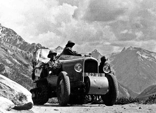
Re-opening of Kargil-Skardu road is the main demand of Kargil. Though the governments in Srinagar and Delhi are supportive of the idea, the initiative seems stuck somewhere in Islamabad. Apart from offering some kind of mechanism for the families divided by 1947, 1965 and 1971 to reconnect and meet, the people want a bit of tourism and trade.
Ladakh has only two roads which are accessible round the year. One is Kargil Skardu and another is Leh-Lhasa. Both are closed and the region is serviced by roads which are fair-weather and operational for only less than half of a year. Prior to the 1948 division, Gilgit/Baltistan and Ladakh (Kargil and Leh districts) was a single region sharing a common geography, language, culture, religion, history and waters.
Hunderman is the place that houses the last forward post from J&K side. It was wrested from Pakistan in 1965 but was returned post-Tashkent. In 1971 it was re-captured and retained.
The entire belt through which the upgraded ceasefire line – the LoC- passes is totally populated from both the sides. Frol – a village that fled to Pakistan after it was taken over in 1971 by India – now houses India’s Bageacha (garden) post. The Balti speaking Brolmo (a village name after an European Mr Brilmin who had his villa there in the pre-partition era) on the other side was vacated in 1999 to house Pakistan army. Almost same is the case with Pakistan’s Shina speaking Shondi hamlet. The residents it seemed were clever. As their masters changed so frequently that the residents fled leaving the rocks for them to battle over.
The post on banks of the Shingo river is called Point 43 by the army. It is barely 17 meters from Olding, Pakistan’s most forward position on the erstwhile road that was connecting Kargil with Skardu, the capital of now Gilgit-Baltistan state.
Skardu, the capital of Gilgit, is only 129 kms from this post that is serviced by a dirt-track taking off from Harka Bahadur Bridge, a strategic culvert that Pakistan was so keen to blast during Kargil war but failed. After crossing this post, the road (now in disuse) reaches Gangani, Belargo up to the junction of Suru and Indus rivers at Marol. It further goes along Indus River crossing Bagicha, Tolti, Parkuta, Mehdi Abad and Gol near the junction of Indus and Shyok rivers. From here it goes straight on to Skardu.
THE JAMMU-SIALKOTE ROAD
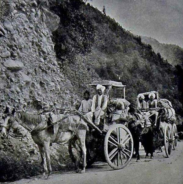
Prior to partition, if there was some kind of rail route connecting Jammu with India it was the Jammu-Sialkote track. The congruity of borders was there but no road passed through post-partition Punjab from Jammu. It was later the controversial Radcliffe award that paved way for the road.
It has been one of the busiest rail tracks. Not many details are available about the track barring that New Delhi is willing to open it. During Mufti’s government, there were efforts to repair the road. In fact some patchwork was done on the 250-meters part connecting the last border outpost – the Octroi Post – to the Zero Line. This was the post where once taxes on goods transported on the track were collected. There were plans of creating a Wagha-type gate besides a guest house and a restaurant.
State’s Planning and Development Ministry had allocated three crore rupees on the widening and upgrade of the 10 kilometres road falling between R S Pora to the last border village of Suchetgargh. People who have visited the area said the alignment of the track is easily detectable though lost at many places.
Unlike all other erstwhile ‘internal’ routes, this track falls on a world recognized border – the International Border. If ever opened, it will become sort of Attari in J&K. Interestingly, for most of the last five decades, it is being exclusively used by the United Nations Military Observers Group for India and Pakistan (UNMOGIP). That is perhaps why it is not in ‘a very bad condition’.
THE LADAKH-TIBET ROAD
Two routes that historians increasingly refer to, the famous silk route, fall in the arid Ladakh desert. One was connecting Ladakh through Karakoram Pass to Kashi (Kashgar), Shache (Yarkhand) and Hotan and another was linking Gilgit through Hunza, the Mintaka Pass and the Khunjerab Pass to Kashi. Post-1947, Pakistan has revived its bit. But nobody is talking about reviving the Leh route.
It is the Tibet route, now know in Ladakh the Damchok road that is part of the discourse. Its re-opening is one of the main demands in the Buddhist region. It was open till 1962 and is still porous for individuals and smuggling.
This track has been the ancient trade route and a literal lifeline for Kashmir that was also used by invaders, fortune seekers and missionaries like Mir Syed Ali Hamadani. This vital route catered to the demands of the wool industry and filled our coffers for centuries. The trade would fetch a good income to durbar by taxes. Every year, Kashmir durbar would sponsor Lapchuk (leader of the trading community) to visit Lhasa to encourage the business with an objective to manage as much of taxes for the kingdom as possible.
This trade trek connects Damchok, the last habitation on this side with Tashigang belt of Tibet. Damchok is accessible by road and is 330 kms from Leh. Beyond Damchok, the next town on that side in Tibet is around 15 km and the area is plain with good roads.
The government is keen to use the same route for taking the pilgrims to Mansarovar yatra, if Beijing permits. Base camp for the yatra, on the other side of border, is hardly 250 kms from Damchok. Central government is keen to use this route as an alternative access to the existing dangerous road especially after over 200 pilgrims were buried under landslides at Malpa (Uttarakhand) in 1998.
Located in one of the most isolated regions of Western Tibet, Mount Kailash (6,675m) is the spiritual centre for four faiths- Tibetan Buddhism, Hinduism, the Jains and Tibetan Bonpos. Also, it is the source of Indus, Brahmaputra, Sutlej and Kamali rivers.
Though since 1981, Kumaon Mandal Vikas Nigam with the help of MEA and Chinese government has been conducting trips to Kailash – Mansarovar through the Lipulekh pass, the pilgrimage remains the most difficult and takes a month.
Basically a defence road, New Delhi has set up a lot of infrastructure on Damchok raod for converting it into a trade route while controlling smuggling. During winters the traders (smugglers) from two sides set up stalls near Dumtsele border point falling in the vast Skakjung pasture where the barter takes place. Its opening figured in many discussions with Beijing but is eluding a breakthrough. Beijing relates it with the “disputed” Pangong lake and claims Damchok belongs to it.
This road was accessible to Kashmir via Gurez. It was Srinagar to Bandipore to Gurez to Drass to Gilgit and finally to Tibet. Off late, the Defence was laying a road on this track for is own requirements between Drass and Tulail. It has been set up and last year two legislators have trekked on it. Dictated by the Kargil war, the road – believed to be 92-Kms – connects Gurez with Drass through Chakwali (Tulail).


