
In news for the cross border shelling, more than seventy thousand people live in Karnah, which has historically remained a gateway to Sharda, Mahmood Ahmad writes
Sandwiched in the rugged Shamshbari peaks of is a pass that connects Karnah with Kupwara. Almost 65000 people live (2011 census) in about 42 villages (2 uninhabited) that make Karnah, a strategically located place that historically was the gateway to Sharda, the ancient Kashmir University.
Technically, Karnah is an amalgamation of three valleys where Pahari speaking people dwell. Given its strategic location, formal permission is required from Deputy Commissioner, Kupwara. The road to Tangdar, the main Karnah town, is a National Highway (NH 701). The 78 km road is well mettled and runs through habitations and rice fields till it reached Chokibal where the army lists all entries.
Once the Transit Point (TP) is crossed, the road bifurcates with one part of it leading towards Bungus. The road leads through the Drangyari valley that is drained by Drangyari nullah. This nullah descends down from the famous Bungus Meadows. The stream acquires the name of Kehmil nullah in the down valley.
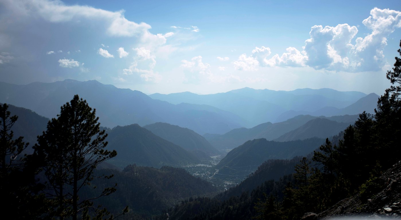
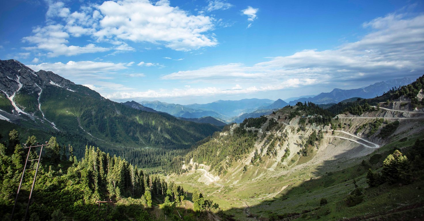
The Darnyari slopes are richly clothed with deodar forests. As the road leaves Chokibal, there are meadows and forests en route, the forested slopes of Shamshbari present a picture-perfect look. The altitude increase as road emerges out of the tree line leading towards the pass, surrounded on the south by rugged mountains.
This 3120 meters pass, between Kashmir and Karnah , is known as Nasta Chhun (a Kashmiri word that means something that lacks a nose). It is popular by Sadhna Pass, however.
It is said Sadhna the famous Bollywood actress of yester-years, at the pinnacle of her career was invited to Kupwara post, India Pakistan war of 1971 to enhance the morale of the army. She visited this pass to change its name forever. Usually, the pass closes with the onset of winter. Off late, however, the army makes every effort to keep the pass open during the winter. The pass is prone to harrowing accidents during winter and every year it kills people. The last major accident was on January 5, 2018, when an avalanche swept away 11 people. This is precisely why the locals are seeking a tunnel to bypass the perilous pass.
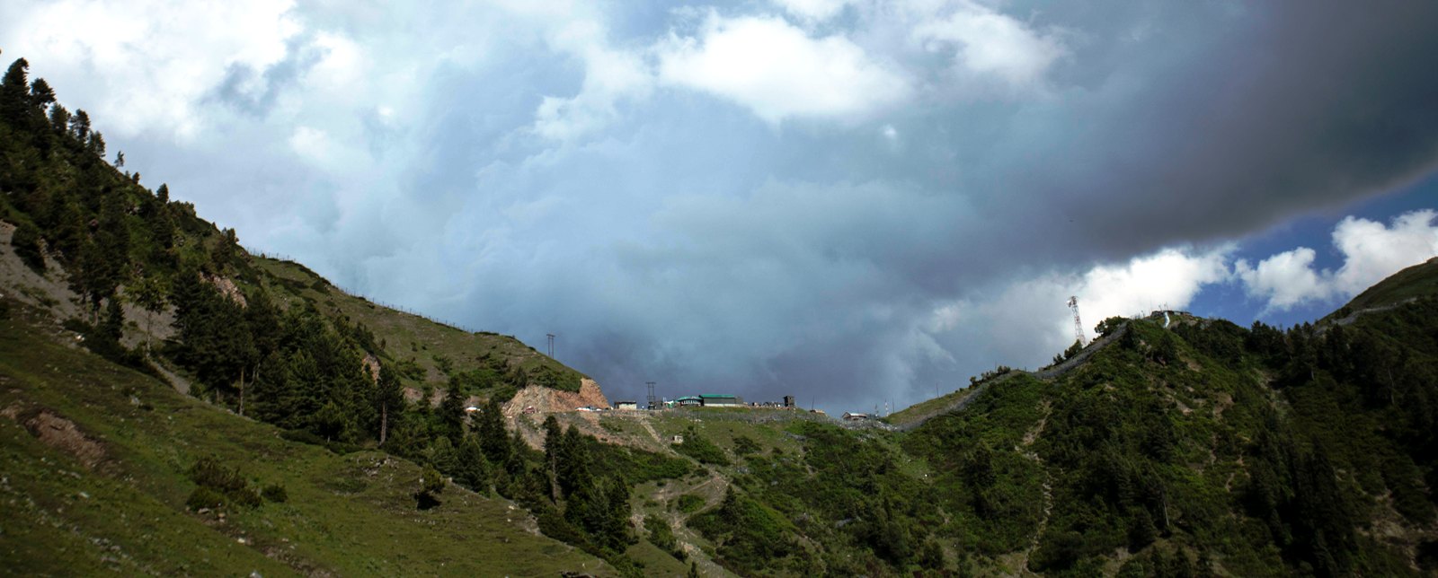
At the peak of the Pass, an army camp maintains a proper record of the travellers and also provides critical help to travellers during winters. This is the most fascinating part of the travel as the scenery from the pass is grand – towards the south with towering Shamshabari ridgeline rising up to an altitude of 4350 mts; towards north lies the Taya ridgeline. The road downhill fallows the Batamaju stream to Tangdar.
During winters, an alternative pass known as Kakua Pass (2987 mts), adjacent to Nasta Chhun pass is used to cross over to Kashmir owing to its lower altitude.
Most of Karnah is located around two principal streams – Batamoji and Kazinag. Batamoji rises from the Sadhna Pass and the Kajinag originates in a mountain range know by the same name and flows through Leepa valley on the other side of the Line to Control and enters Karnah. Both the streams merge into Kishanganga near Teetwal.
Majority of the Karnah population is Pahari speaking and almost 8% are Gujjars. There is only Hajinard village that has Kashmiri speaking people. Surprisingly there are two Sikh villages which speak volumes of the diversity of the place. Karnah is a separate constituency in the Jammu and Kashmir assembly.
Karnah climate is warm compared to Kashmir. The valley produces the best quality walnuts. Batamaji waters irrigate swathes of rice-fields that is why it is called the “Rice mother”. The area grows special red rice, locally known as Zagg. This variety suits high-altitude areas. It is valued for its texture and aroma.
Batamoji is prone to flash floods that usually wreaks havoc. In 2018, Karnah was lucky when the people could escape the wrath of the stream when on August 14; a cloudburst took place around the pass in the afternoon. Frantic phone calls helped Tangdar move to safer ground.
The people are dependent on agriculture and animal husbandry as there is plenty of pasture land available on the mountains. Government and army provide alternative employment opportunities to the locals. Maize, beans, potatoes and rice are the staple crops. The main villages located between Tangdar and Teethwal are Gund Gujran, Amrohi, Tadd and Saidpora. Their etymology can be traced by accessing the revenue records reflecting their historical origin.
Tangdar: At the site of this village old dilapidated structures were found, a narrow passage led to this village, the way to it was difficult due to which the village was known as Tang meaning narrow and Deh meaning village. Later it became Tangdar.
Teethwal: The village was initially called by the name as Teerath Bal. It was because Kazinag stream merges with river Kishanganga hence the spot was venerated, later on, it became Teethwal.
Gundi Gujran: Initially some Gujjar people settled here. Gund means land and Gujran means Gujjars. Later, people from other tribes too settled here.
Amrohi: The place got inhabited by Gujjar people who started cultivating the land. The head of these people at that time was Chando Aamir, the village, later on, became to be known as Amrohi after the headman.
Tadd: A family got settled here and it is narrated that in the ancient times due to devastating floods a large number of huge trees got uprooted and accumulated at this place. In Pahari language a large dump of logs is known as Taal, so Taal was the name given to the village, which later on became Taad.
Saidpora: In past, people of Syed cast came and settled here, as a result, the village was known as Saidpora. A famous Sufi saint named Syed Jasti Sahib lived here and there is a shrine dedicated to this pious soul.
M A Stein in his The Ancient Geography of Kashmir describes Karnah as follows: “This tract which is now known as Karnav or Karnau, bore the old name of Karnaha. It seems to have been held by small chiefs nominally tributary of Kashmir even in later Hindu times. It is but rarely mentioned in chronicles (that) the inhabitants were Khasas who are represented by modern Bomba clan still holding Karnav. Their Rajas were practically independent till the Sikh conquest and often harried the N W parts of Kashmir. The last eruption of the Karnav Bombas and their allies the Khakha chiefs of the Vitasta valley occurred as late as 1846.”
These events stand described by Charles Ellison Bates in A Gazetter of Kashmir as follows: “Raja Shere
Ahmud, who is said to have been the seventh of his family who succeeded to the title of the Raja or Nawab of Karnao was the son of Raja Munsur Khan; he rebelled against the Maharaja in 1867 and collected his retainers on the north side of Kishen Ganga severed communication with the left bank; after a while, his followers mistrusting the temerity of their leader deserted him. In this extremity, the Raja claimed the protection of the Ahkund of Swat, which was refused. He then applied to the British Government with a like result and as a last resource threw to the mercy of the Maharaja who spared his life assigning a small jagir in the Kashmir valley for the maintenance of the Raja and his family.”
K D Maini in his article Historical town of Karnah writes that Maharaja allotted a small village Yaripura in Kashmir valley to Raja Shere Ahmad Khan. He along with his family migrated to Yaripura and passed his last days of life there where he was buried.”
“The misunderstanding and eventual rebellion of Shere Ahmad is stated to have thus arisen. The Maharaja sent to cut timber near the village of Baran on the right bank of the Kishan Ganga and the wood was appropriated by Raja Shere Ahmad for a house he was erecting. The Maharaja servants having expostulated in vain reported the matter to their master who sent certain officers to make an investigation. These were maltreated by Shere Ahmad who especially wreaked his vengeance on the news writer. The Maharaja then moved troops in the direction of Karnao when the Raja raised the standard of revolt,” Bates has recorded.
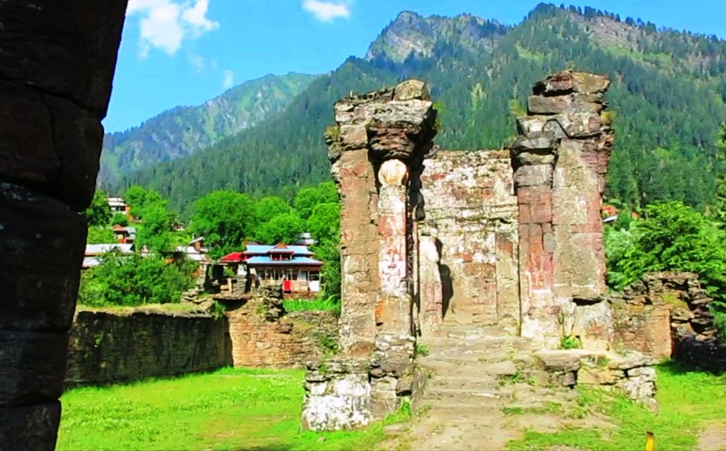
It further adds: “A fort is situated in the middle of the northern portion of Karnao valley, where there something less than a mile in width. It lies on the bare plain just south of the village Tangdar. The walls, which are loopholed are about 30 feet high, built of stone connected with bands of timber, and are double at the west end. At each corner, there is a bastion tower. The garrison is said to number 100 sepoys besides 50 who are accommodated in a line of huts on the north side of the fort. It is said that this fort was built during the Sikh occupancy of Kashmir and Jodh Singh was appointed Killadar. Shere Ahmad Raja of Karnao forged an order directing him to return to Kashmir with his garrison, and the ruse succeeding, the Raja attacked Jodh Singh and his troops as they were leaving the valley; he also burned the fort.” Today no vestiges of the fort are left.
Abdul Rashid Kokhar, Sarpanch Teetwal lives in a double story house. He dreams of the revival of the lost glory of Karnah and Teetwal in particular. He has sent several representations to Ministry of External Affairs imploring upon policymakers to open up the Teetwal crossing to Sharda, the sacred Hindu temple revered by Kashmiri pundit for the annual pilgrimage.
M A Stein in his The Ancient Geography of Kashmir summarizes the importance of Sharda as follows: “The temple of the goddess Sarada is amongst the foremost Tirthas of Kashmir. It is well known ever far beyond the frontiers of Kashmir. Alberuni had heard of it and the story recorded in a Jaina life of the great Grammarian Hemacandra proves that its fame spread even to far off Gujarat. Notwithstanding this former celebrity, the Sharda shrine is now almost forgotten by the pundits of Srinagar and the great mass of the Brahman population of the valley. Fortunately, however, tradition has been more tenacious in the immediately adjoining tract of Kamraz. Guided by it, I was able to ascertain the position of the ancient Tirtha. In Jonarajas time the shrine was still sufficiently popular to attract a visit even from Sultan Zainul Abidin.”
Kokhar has relatives across the LoC and has visited the other side. He has also visited the shrine of Sharda in order to know more about it. He displayed a pamphlet that he and his friends have printed to highlight the potential of the Shrine and the dividends it could bring to this remotest corner of Kashmir if the route is opened for pilgrimage. He remains hopeful that one day he could travel to Sharda with his Kashmiri Hindu friends.
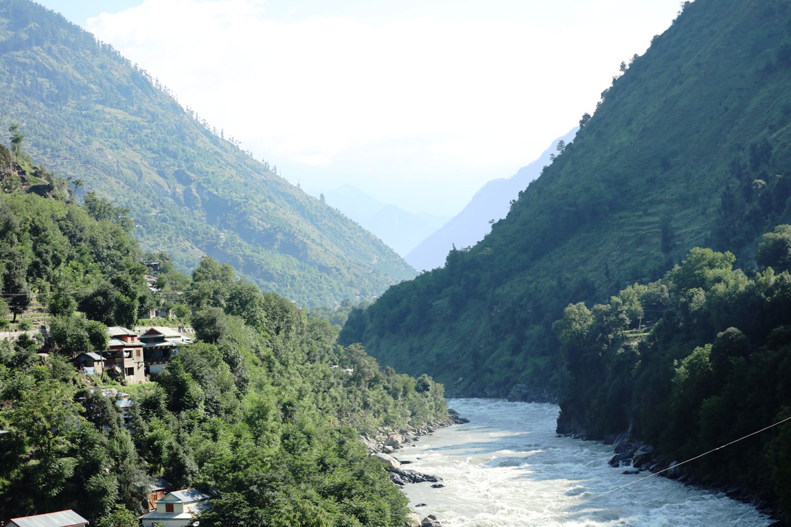
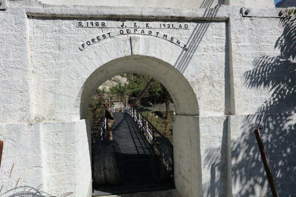
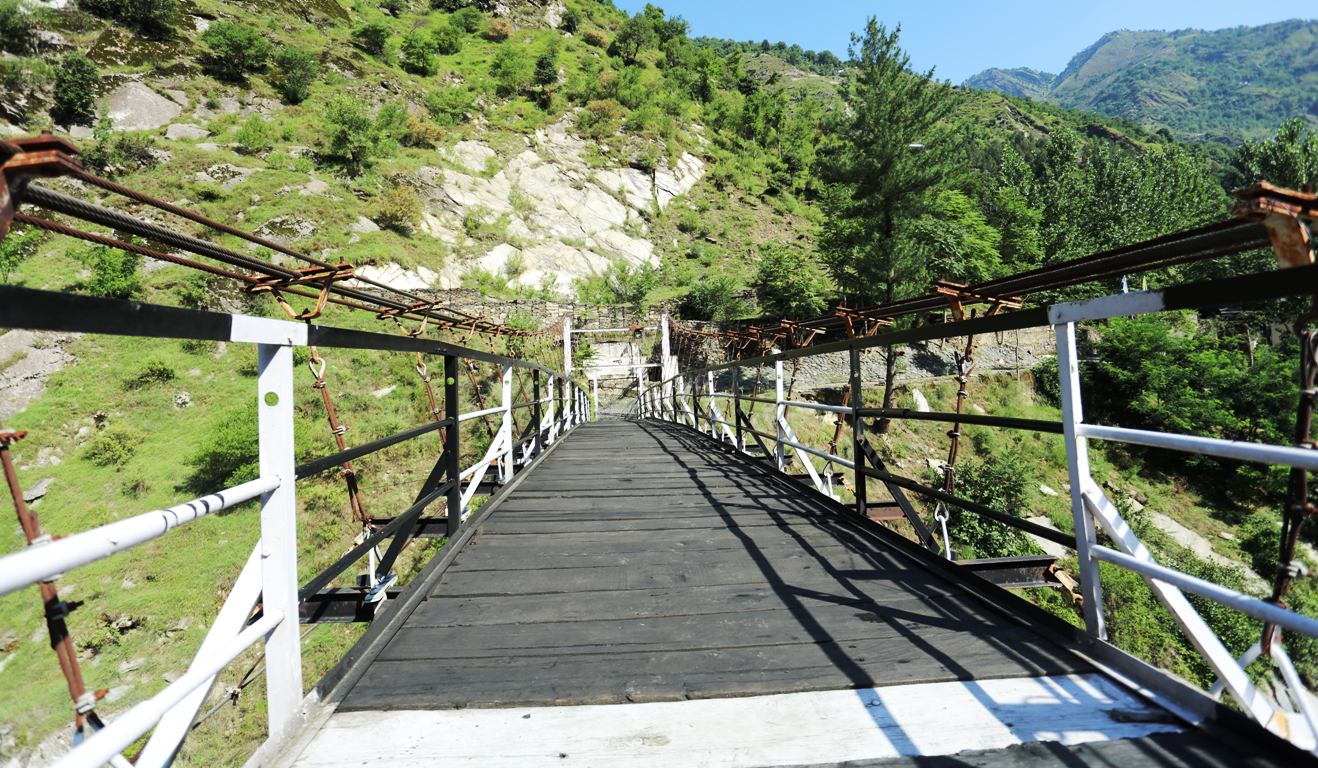
Not far away from Kokars house lies a historical suspension bridge. It was This constructed in 1931 to facilitates passage across Kishan Ganga. What is unique about this is that a white line at the middle of this suspension bridge marks the LoC – half of the bridge belongs to India and the other half belongs to the other side. With the permission of the Indian Army, one can walk the bridge up to the white line. Similarly, people from the other side can also walk up to their side of the bridge.
The villages located on the other side are visible along with the people, the traffic and their daily routine. A rough road leads upriver to the last village know as Simari. Simari is the last village of Teetwal which is perched on a slope on the left bank of Kishan Ganga.
Natural Disasters
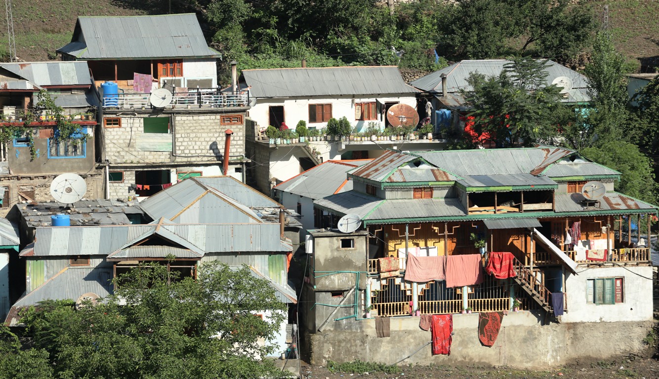
Geographically Karnah is prone to natural disasters as avalanches, landslides and flash floods are of a regular occurrence. Border shelling continues to be the worst nemesis. The place was badly affected by the 2005 earthquake in which about 350 people died and almost all the houses developed cracks, as such most of the houses have been reconstructed. So historical architecture does not exist.
In the aftermath of the earthquake, both sides exchanged relief material, thereafter Teetwal crossing was opened for people to people movement during the summer months. During winter the crossing remained suspended. This crossing was contrary to Salamabad and Chanda Bagh which was open not only for people to people movement but for trade as well. Teetwal crossing like the other two crossings is presently closed.
Karnah is credited for producing some of the most fertile brains – Dr Naseer A Shah, Prof Abdul Wahid Qureshi, Mohammad Yasin Shah and countless others.
A few years back army has constructed an alternative road which connects Nastachunn pass with Farkiyan Pass that leads down to Keran a parallel valley located North of Karnah. Permission from the army is sufficient to travel this stunningly beautiful 60 km road that traverses through a ridgeline of Shamshabari range. The travel over this road provides a bird’s eye-view of Khangan and Shamshabari ranges. In the distant background, stunning views of Kashmir valley can be seen. The road runs around an altitude of 3000 mts where during summer months some rare alpine flora can be seen. This road poses a huge potential for off-roading and border tourism. If the tourism department and the Army jointly work to package this road it can be a new tourism product that can attract huge clientele.
(The author is the Director Industries Kashmir and visited the place during Back to Village.)


