Srinagar’s proposed Dal and Nigeen lakefront roads risk undermining ecological conservation and fragmenting historic landscapes. The Government must prioritise scientific assessment, heritage protection and sustainable, non-motorised alternatives over infrastructure-led development, writes Iftikhar Ahmad Hakim
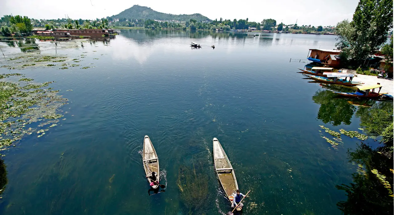
The proposal to construct a Western Foreshore Boulevard along Dal Lake, from Dalgate to Saida Kadal, and another road from Kathi Darwaza along the western side of Nigeen Lake raises fundamental questions about the direction of urban planning and lake conservation in Srinagar. These projects raise fundamental questions about how we understand, regulate and protect our most valuable ecological and cultural landscapes.
The Master Plan
The underlying justification, as articulated in the Srinagar Metropolitan Region Master Plan-2035, is that physical demarcation through road construction would prevent encroachment and pollution while opening up these areas for tourism-related activities. At first glance, this may appear to be a pragmatic intervention. When examined against the ecological diagnosis and conservation principles contained in the same Master Plan, the proposals reveal a serious contradiction. Can road infrastructure that pressures the lake ecosystem also be presented as a tool for its conservation?
The Master Plan, drawing upon the Detailed Project Report prepared by the Alternate Hydro Energy Centre (AHEC), IIT Roorkee, identifies several factors responsible for the degradation of Dal Lake. These include unplanned urbanisation, uncontrolled tourism, changes in land use and land cover across the catchment, siltation, untreated sewage and solid-waste inflows, obstruction of water channels and, significantly, roadway construction disturbing the natural hydraulic movement of water within the lake. It also identifies weak institutional coordination and the absence of integrated planning as contributing factors.
The contradiction is stark and fundamental. The Master Plan acknowledges that road construction is among the factors disturbing the lake’s hydraulic system, yet proceeds to propose two major roads along its fragile foreshore: a 30-metre-wide Western Foreshore Boulevard and a 15-metre-wide Nigeen Foreshore Road, with half its width devoted to vehicular movement. It thus proposes, as a remedy for ecological degradation, an intervention that its own diagnosis identifies as a source of the problem. How can roads that may worsen the lake’s hydraulic disturbances be justified as measures against encroachment and pollution or for tourism, without scientific evidence that they will protect its ecological integrity? The inclusion of the Western Foreshore Road in the Phase-I MRTS corridor (Item iii) further raises questions about its intended function and the Master Plan’s internal consistency.
A Conservation Barrier?
Physical demarcation is not ecological conservation. A road may mark a boundary, but cannot prevent encroachment, pollution or disruption of natural drainage. Improved access may instead attract commercial activity, tourist accommodation, parking and construction. Without strict land-use controls, carrying-capacity limits and enforcement, a road intended to contain development may actually accelerate it.
The concern becomes more pronounced when one examines the dual rationale advanced in the Master Plan: protecting the lake from encroachment while opening its margins for tourism-related activities. These objectives are not necessarily incompatible, but their reconciliation requires a clearly defined conservation framework.
What forms of tourism would be permissible? What would be the limits of development? How would additional traffic, visitor movement, waste generation and commercial activity be managed? Where are the carrying-capacity assessments and the cumulative ecological impact studies? These are not peripheral technical questions; they are fundamental to establishing the legitimacy of the proposals.
There is another important aspect that deserves attention. The Master Plan acknowledges that the Dal Lake Vision Document, assigned to IIT Roorkee, had not been finalised when the Master Plan was prepared. It explicitly recognises that its proposals would need to be readjusted through Zonal Plans in accordance with the Vision Document’s policy framework once finalised. This admission is significant. It suggests that the lake-related proposals were not the outcome of a completed reconciliation between the conservation strategy and proposed infrastructure interventions. The authorities must therefore disclose how the two road proposals were subsequently examined against the finalised scientific vision and what technical considerations informed their retention.
The Missing Buffer-Zone
The issue of buffer zones is equally important. Chapter VIII of the Master Plan-2035 envisages that buffer areas should retain their natural character, with restrictions on construction, development and activities, subject to specified exceptions. It advocates connected green spaces and green reserves along Dal and Nigeen Lakes, including pervious hiking trails, bicycle tracks and bridle paths. Even where roads are permissible, the provisions require them, as far as possible, to avoid natural channels and minimise land disturbance.
The delineation of these buffers came under the scrutiny of the High Court in December 2022. Subsequently, the General Administration Department constituted a scientific committee comprising experts from within and outside the Government, including nationally recognised specialists. The committee submitted its recommendations, which were subsequently reflected in a draft notification SDA/VC/01 dt 02.05.23 issued by the Srinagar Development Authority for incorporation into the Master Plan.
However, the process appears to have remained inconclusive, with the Housing and Urban Development Department yet to take it to its logical conclusion. Why should a scientifically informed exercise, initiated following judicial scrutiny, remain unresolved when decisions with potentially irreversible consequences are being contemplated along these very lake margins?
Nigeen’s Historic Green Core
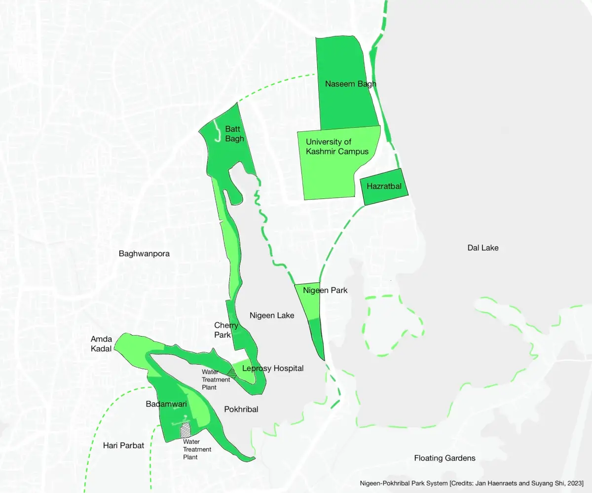
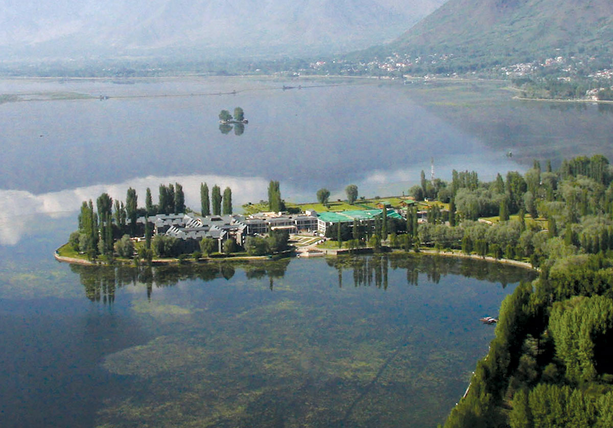
The proposed Nigeen Foreshore Road warrants the strongest possible objection, given the extraordinary ecological, historical and cultural significance of the landscape through which it is proposed to pass. The area encompassing Nigeen, Pokhribal, Badamwari and the historic gardens adjoining Hari Parbat is not vacant land awaiting road connectivity. It is an interconnected green and heritage core of Srinagar, with an exceptional landscape character and surviving archaeological remains including the remains of Mughal Palaces that deserve protection as an integrated cultural and ecological asset.
Dr Jan Haenraets, in his insightful article, Death or Life of Srinagar’s Historic Lakefront Landscapes (My Liveable City in 2023), has drawn attention to the irreversible consequences that the proposed road interventions could have on this historic landscape. His alternative vision of a car-free nature-and-culture corridor connecting Badamwari, Pokhribal, the historic Mughal garden landscape, Cherry Park and the northern end of Nigeen Lake deserves serious consideration. Such a connected eco-heritage park would not only conserve the landscape but also create an extensive public recreational resource for the residents of the Old City, where accessible open spaces are severely limited and Badamwari remains one of the few significant recreational destinations.
In his considered opinion, the proposed Western Foreshore Road would constitute a disastrous intervention in this landscape and should be a matter of grave concern for the entire planning fraternity. He is categorical that motorised vehicular circulation must be completely avoided in this area. Instead, pedestrian and cycling trails should form the basis of an integrated eco-heritage park, allowing people to experience its historical, archaeological and ecological richness without subjecting it to the pressures of vehicular infrastructure. He further emphasises that even the passage through Kathi Darwaza towards Badamwari should be kept to the bare minimum and should not be developed as a major vehicular corridor. In the longer term, Nagar Nagar should be conceived as a protected historic district, ideally free from through-traffic.
This is not merely a design preference but a different urban development philosophy: conserving Srinagar’s historic green core rather than fragmenting it with roads and exposing it to urbanisation. The priority should be to restore landscape continuity, not compromise its integrity through further interventions.
Master Plan-2035 itself recognises the heritage value of Nigeen baghs and the wider Hari Parbat landscape, recommending their designation as Special Areas, Heritage Zones or Eco-Sensitive Areas. How, then, can a vehicular corridor through this landscape be reconciled with its protection? Improved accessibility must not become a pretext for turning a heritage landscape into a development corridor.
Learning from History
There is also a historical planning lesson that should not be ignored. The Western Foreshore Road had figured in an earlier Master Plan but was subsequently discontinued after the initial stretch was followed by urbanisation around Nawpora Canal and the adjoining lakefront. This experience should caution planners against assuming that road construction is an effective means of controlling development along sensitive lake margins. Improved accessibility can alter land values, encourage new uses and generate pressures that enforcement agencies may subsequently find difficult to contain.
The technical issue extends beyond the immediate road footprint. Dal and Nigeen Lakes are part of an interconnected hydrological system involving wetlands, natural channels, drainage networks and catchment processes. The Master Plan emphasises the need to maintain uninterrupted flow towards Nallah Amir Khan and to adopt an integrated approach to the conservation of the lakes and their connecting wetlands and channels.
Any intervention involving earth filling, embankments, culverts or changes in drainage must therefore be evaluated for its implications for water circulation, flood storage, sediment movement and polluted runoff. It would be premature to conclude that either road will necessarily cause such damage without site-specific studies. Equally, it would be irresponsible to proceed without demonstrating that these risks have been adequately addressed.
The Ecological Costs
The transport justification also requires scrutiny. The Master Plan provides for public transport, non-motorised mobility, multimodal integration and traffic management. Additional roads must therefore be justified by demonstrated demand, proven need for capacity and the absence of less damaging alternatives. Better management of existing access, regulated visitor movement, public transport, pedestrian and cycling networks, and stricter enforcement against encroachment deserve equal consideration.
What is required is not another infrastructure-led intervention but a conservation-led landscape strategy. The western margins of Dal and Nigeen should be conceived as connected ecological and recreational greenways, integrating wetlands, natural drainage channels, historic gardens, public open spaces and pedestrian and cycling networks.
The priority should be restoration of degraded landscapes, protection of natural channels, effective pollution control and strict enforcement of development restrictions. Vehicular access, wherever demonstrably necessary, should be limited to carefully assessed sections and designed to minimise ecological disturbance.
The Government should defer both road proposals until their technical and conservation rationale is independently established. Feasibility studies, DPRs, traffic assessments, environmental appraisals and alternatives analysis must be made public. Their consistency with the final Dal Lake Vision Document, buffer-zone framework and applicable Zonal Plans must also be demonstrated. A cumulative impact assessment should examine associated tourism facilities, parking, houseboat relocation and other proposed developments, rather than assess the roads in isolation. Public consultation must precede any irreversible decision.
Ultimately, this is a question of planning philosophy. Lakes cannot be protected by turning their margins into infrastructure and tourism corridors, nor can conservation be reduced to physical demarcation. Srinagar’s lakes are living ecological systems, embedded in a historic landscape and sustained by a delicate hydrological balance. Their protection demands scientific understanding, restraint and institutional consistency.
A road cannot qualify as a conservation measure simply by being described as a boundary. Its necessity, ecological acceptability and long-term public benefit must be established.
Srinagar cannot afford to lose its historic green core in the name of connectivity. What this landscape needs is not more roads, but informed planning, ecological restoration and a firm commitment to conservation.