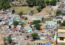
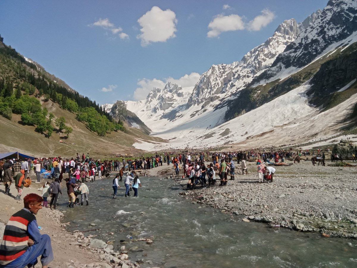
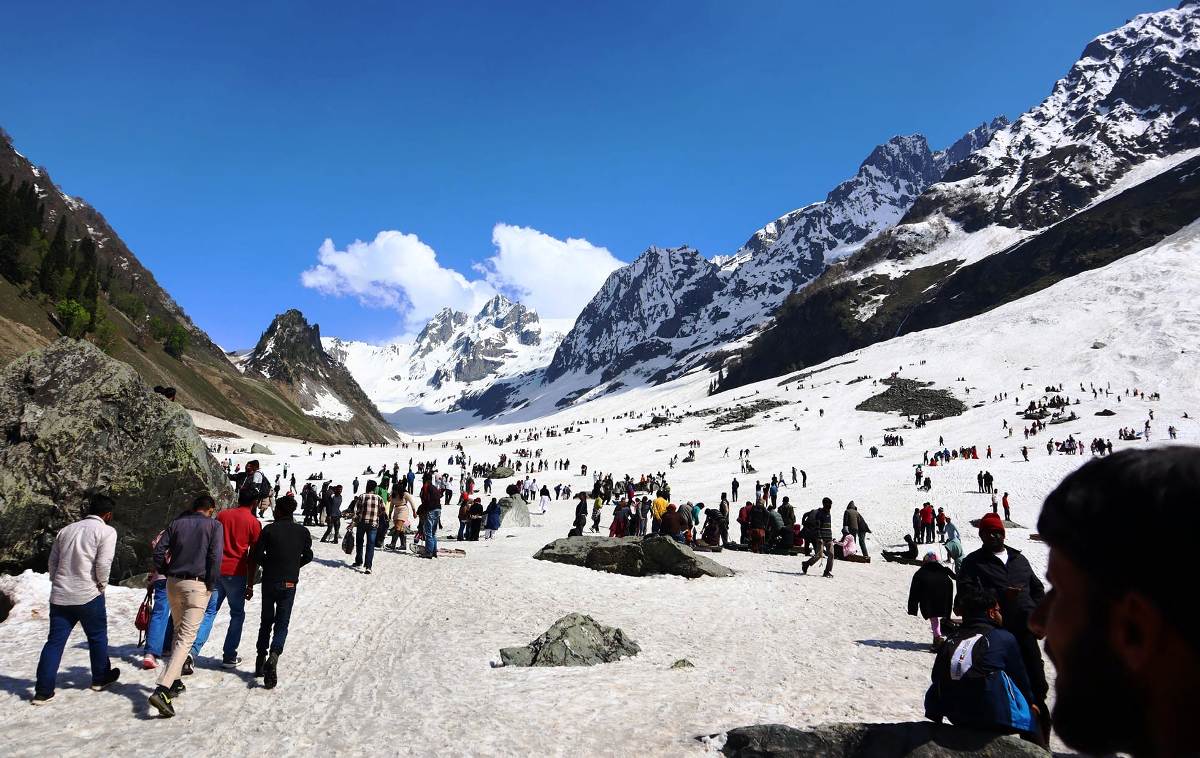
Thajiwas With huge crowds of tourists messing over the foot of the Thajiwas glacier in Sonamarg, it creates tragedies and impacts the eco-fragile area. Read a British mountaineer’s account of the glacier in 1945 and check how phenomenally it has reduced. Cuthbert Wilfrid Francis Noyce (December 31, 1917 –July 24, 1962) was a Shimla-born British mountaineer who made his first ascent to Mount Everest in 1953.
The valley runs Southeast to Northwest to join the Sind River just below Sonamarg. It is characterised by the two very different types of rock of which its bounding hills are composed. On the left, as one climbs up it, is the soft lime and sandstone which at one time may have formed a great dome of the whole. This places outcrops in startling pinnacles and ridges, to slope back at last into the easier grass mouldings of Zabnar, 13334 feet. This peak, a climb of the Cumbrian scale, gives from its position perhaps the best views in the district, and in particular of the steep row of buttresses opposite. Here the lines of tougher, igneous rock jut upward in sharp pinnacle ridges.
Between the ridges, which pile themselves higher and higher to culminate in the peaks bounding the valley on this side, six fairly well-defined glaciers are at present in action. But Nature appears to be stripping and carving the valley so fast that these glaciers, which at one time perhaps joined to flow down it, are retracting their tongues at a speed perceptible in years, to leave smooth ice-worn slabs of an increasing steepness below them.
Only that which we call Number 3 seems to start from an extensive snowfield and to be actively pushing. Yet even as it pushes it is being cut off, threatening in its retreat to leave its hollow by Valehead Peak in the condition of Cwm Llydaw under Snowdon. The glaciers are steep, and harder of ascent than the average Alpine glacier, and the main climbing starts from and between them.
For its purposes, there is a convenient camping ground at some 11,000 feet between Glaciers 3 and 2, directly under Glacier Crag. To start from here saves two hours walk and makes more solid climbing possible in the day. We will take the glaciers as landmarks in their order, beginning with that which overlooks Sonamarg and is the first seen on approaching the valley.
Glacier One
The glacier immediately overlooking Sonamarg and directly under the 15928-foot Thajiwas Peak is, on the pattern of the others, steep of snout with a more level middle portion leading up to the high rock curtain of the watershed.
Thajiwas Peak leans over on this side in a series of fierce cliff faces broken between the two summits by the Great Couloir. The couloir appears the best line of approach on this side. It is perhaps 1000 feet in height, steepening in places to 70° but very much dependent for feasibility on seasonal conditions.
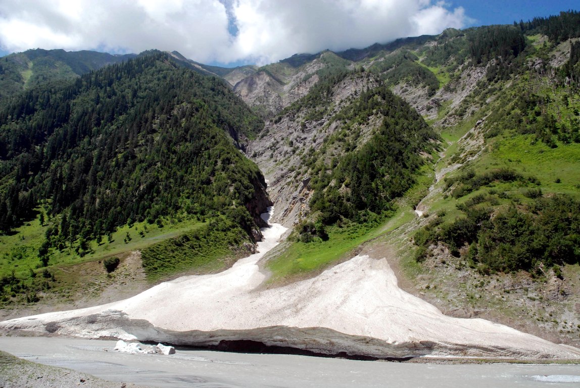
It was first climbed by J Waller in 1937, and the summit of the peak was reached by the final rock pyramid. In October 1944 it was found suitable to crampons, with a hard crust of snow overlaying and ice pitches in some places. But the route remains perhaps the most impressive in the valley; particularly if, as would now seem necessary, (Waller bivouacked at 12000 feet on the glacier and descended by Glacier Two) descent has to be made by the same way.
Another possible route, which was very nearly completed by AJM Smyth and Dr. Graham, would be to ascend to the very head of the glacier, and climb back along the watershed curtain of the Northeast Ridge.
The right (true left) flow of the glacier descends from a peak of lower calibre, Lesser Thajiwas Peak, just 15000 feet in height. This is separated from Thajiwas Peak by the steep rock buttresses, which head the glacier and which are themselves higher than it is. If the glacier is climbed (easily) to the col joining Lesser Thajiwas to the main peaks, a 300-foot rock buttress completes the route with really sound rock climbing. Descent can be made more easily from between the twin summits, down a boulder-filled depression to the lower glacier.
Glacier Two
Glacier Two is divided from one by two parallel rock ridges running up to the higher buttresses of Thajiwas Peak. The main glacier descends from close under the final pyramid, flowing evenly for a while before the jumble of the lower icefall. A broad-level terrace extends the whole way under the watershed rock curtain.
It is impossible to give information about the glacier itself that could be of value. In 1937 Waller descended from Thajiwas Peak “straight down the middle of the icefall”.
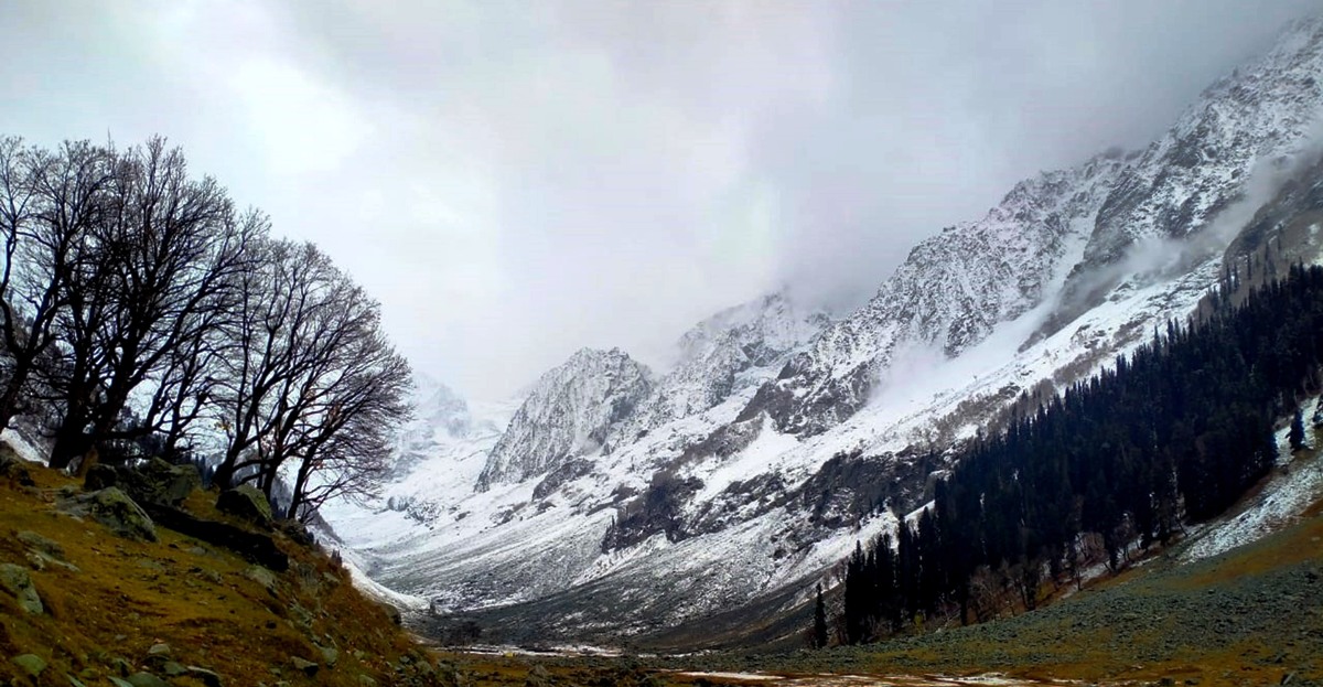
In 1944 the centre appeared hopeless, but an easy line was discovered under the rocks up the left (true right) side until the climbers were stopped by a chasm at a point where the peak itself appeared within easy reach by walking along the snow terrace. Descending disconsolately, they found a traverse into the chasm and ice chimney between the glacier and the rock buttress. This they climbed with some ado, but too late in the day. The line cannot be a certain quantity, while the chasm might under very little different circumstances be bridged and easy. Or a way up the steeper right (true left) flank of the glacier might be possible in crampons and with good conditions.
Some good rock-climbing, of Welsh type, is to be found in the continuation of the Thajiwas Peak ridge bounding the glacier on its North side. The ridge rises in a series of steep pinnacle jerks. At about 11000 feet a colossal slab, very visible from the South, forms the jerk; to its right a yellow Crag about 500 feet in height, and right again a sharp pinnacle with some 400 feet vertical drop-Suicide Rock.
Yellow Crag
Between Great Slab and Suicide Rock; inconspicuous at first in the bulk of the ridge side. The construction is simple; an ill-defined gully running into the cliff, bounded by two main ribs on the left that of Knee Climb, on the right Straight Rib, a sharp and continuous landmark on the cliff.
Knee Climb
460 feet. Starts up the first major rib on the right of the grassy gully dividing from the Great Slab on the left. The rib line is followed as accurately as possible for 200 feet it is customary, when in doubt, to make tactful use of the knee. Passage of a rock window seen on the main rib to the right (that bounding Finishing Gully) lands upon more broken ground, juniper clad, but with good pitches if the line is preserved directly.
Standard: Very Difficult. Rock sound, clean in the first part.
Window Cracks
Finishing Gully, which splits the face, ends in a series of ill-defined caves and overhangs. But for the first 150 feet, it is easy, groove-gully pitch type. Then from the bed, a line of minor gully, in the form of parallel cracks, starts left to end under the window of the Knee Climb ridge. This gives 130 feet of good climbing, in places delicate. Descent can be made from the window by an easily broken gully into Grassy Gully.
Standard: Very Difficult.
Straight Rib Climb
The rib bounding Finishing Gully on the right, the straightest and the cleanest of the cliff, is not climbed through from the base. A chimney immediately right, vertical at the start, leads after 150 feet to a birch tree terrace. Thence the true ridge is reached by traversing left, and the edge is kept directly to the summit. The route is straight and un-artificial. At one point a lasso was needed on the first ascent; the pitch has been climbed without but not led. The line eventually joins the Knee Climb rib very shortly below the summit of the Crag.
Standard: Severe.
Further right the cliff becomes broken and vegetational. To its right again Suicide Rock, which gives a sheer drop of 400 feet, to the South, provides interesting scrambling ways by the back stairs.
Yellow Crag is but one of the cliffs of this bounding ridge of Thajiwas Peak. Higher the same structure continues over many towers and buttresses, with infinite possibilities.
Between Glacier Two and Three
The structure of the rocks between the glaciers is of two prominent low-lying cliffs buttressing two higher peaks. Glacier Two is bounded to the South by a series of very steep tilted cliffs, similar to those of Thajiwas Peak overlooking Glacier One. These culminate in an unnamed Peak of some 16,700 feet in height.
The lower buttressing cliff, Swallow Crag, is broad and split by a deep central gully. Only one climb has been worked out on it: the ridge immediately right of the gully leads, 300 feet up, to a picturesque rock finger, Peggy’s Pinnacle. The climbing is of a difficult standard, reminiscent of Tryfan in North Wales. 200 feet higher another needle, of similar structure but a more impressive scale, gives 150 feet of severe rubber climbing by its direct face: Thajiwas Needle. The ridge continues above. It has not been explored further.
Between Swallow Crag and the next buttressing cliff, Glacier Crag, is a broad rock and snow amphitheatre, providing easy descent. Glacier Crag itself juts boldly into the valley, of which it is the most prominent cliff.
Glacier Crag
The Crag is about 2,500 feet in height. In scale and structure, it resembles some magnified Scottish cliff, and the routes so far worked out on it have the same feel. On the Glacier three side, its wall is vertical and split by ferocious cracks; turning the corner to face across the valley the slab sides are uncovered, steep in the lower part, tending more brokenly as they rise.
At the centre of the cliff, a line of crack splits the face, bounded on the right by a real rock nose, Brother’s Buttress, which is the true dividing line of the structure and continues in a direct line to the summit. To the right again a jumble of arêtes converge at a prominent rock pinnacle, Leaning Pinnacle.
The rock is in the main clean and sound, even when, as on Brother’s Buttress, it is a sequence of sharp spiky steps. Belays are bollardic. It is very often impossible to finish to the summit and walk down the Amphitheatre; Nature has provided in the run of ridges down to the right a series of easier gullies, juniper filled. But it is a cliff upon which one might easily be benighted.
Climbs
Rainy Traverse. The scramble around the base of the cliff towards Glacier Three in search of an opening led to the first baby cleft upon the Southern face, a steep open chimney with good holds. The climb takes, from the top of this, such grass and juniper ledges as will lead most conveniently over the bulge of smooth slab that is the feature of the lower left-hand corner of the cliff (as it faces the valley); and works across to descend a diagonal fault ending near the foot of Central Cracks.
The pitches taken may be varied, but the line is inevitable: Climbing in the first chimney and on one slab pitch of the traverse is standard Very Difficult. Elsewhere, too much vegetation.
One-Way Slab Climb
The lower left-hand section of the crag facing the valley is steep and slabby. The only direct ascent done so far is One Way Slab Climb, which takes the steepness at its shortest and escapes right as soon as possible. A good Lakelalid rubber climb for the sunny weather. Length 250 feet. Stars at the highest part of a broad terrace, Lord’s Rake pattern, crossing under the steep cliff at this point.
A Crack starting left and overhanging slightly leads to a noble belay; 30 feet. To the right, a series of ledges give 80 feet of delicate traverse before a more direct line can be struck up to a high rock pinnacle conspicuously ridging the cliff face. In the latter part, to the pinnacle, there is a variety of choices. After that, Rainy Traverse is joined.
Standard: Just Very Severe, Rubbers.
Bending Gully
The wide open rift starts up left from the foot of Central Cracks. In its lower 200 feet snow worn, delicate slabs. Higher, an excess of juniper. But a small rib to the right, First Day Rib, on a level with the steep section of Brother’s Buttress across Central Cracks, gives 150 feet of sound climbing, a Difficult standard.
Central Cracks and Brotber’r Buttreas
The buttress divides the face, of which it is the most prominent feature, in a series of steps leading directly from the base to the summit of the crag. In height, it is over 2,000 feet. The climbing is everywhere steep, nowhere wanting in just adequate hold. Even the pikes appear to be firm. It is in fact perhaps the best rock climb of the British pattern in the district.
The start is made in Central Cracks to the left. These are forsaken when they become too grassy to be of interest, and the steep section of the buttress, Kestrel Crag, very soon towers above. This can be taken directly over some startling
pinnacles. Above it, the ridge leans beck is a series of 300 feet stretched, upon one of which is the hardest pitch, technically, of the climb. But the line is unmistakable.
Standard: Severe, just in boot.
Leaning Pinnacle Arêtes
On the right of Brother’s Buttress, seen from below, a high pinnacle leans out towards Swallow Crag, at two-thirds height up the cliff. A number of long ridges lead up to it, the most conspicuous rising from the wall of the Amphitheatre.
All give rock climbing a good Difficult standard. They are divided by gullies suitable for descent. Above the pinnacle, which is climbed around its right-hand shoulder, a connection can be made with Brother’s Buttress.
Umbrella Peak (15700 feet, approx)
Glacier Crag is a separate jut of rock. From the col which joins it to the main massif behind, descent can be made quickly by the wide amphitheatre on the right, or to Glacier Three on the left. The peak which it buttresses rises in a series of rock escarpments more broken than is usual in this part, to a summit cone of rock bounded on the right by a sweeping snow ridge. The peak is accessible from Glacier Three.
When it was first climbed in October 1944, very heavy powder allowed an early, laborious ascent of the rocks to the right from the glacier necessary. But under better conditions, it would be easier to ascend the full height of the glacier and traverse back along the summit ridge.
Glacier Three
The largest of the six glaciers is also the most active. In form, it is roughly triangular. One tributary starts under the Umbrella Peak skyline; a broad level terrace stretches South, under the steep cliff of Nesim Pahalin Bal, to meet the main glacier head.
The Twirl ridges of Nasim Pahalin Bal, unclimbed and uncharted, remain a challenge. From the end of the terrace, from the col between Nasim Pahalin Bal and Valehead Peak, the main glacier descends jumbled to break in a confusion of seracs over smooth slabs as its base, into the valley.
A feasible line was found up the centre of the glacier in 1944, but conditions vary greatly. The upper part is level and stable and more closely resembling a Swiss glacier than any other in the valley; the seracs at the bottom are breaking off with e rapidity, which makes the shrinkage almost noticeable during a month’s climbing.
Vaerhead Peak (15,528 feet)
Stands at the head of the valley, buttressing Glacier Three with its right flank; while on the left, as seen from down the valley, it throws an arm, in the form of a miniature Peteret ridge, to connect with its 15100 feet satellite, Mosquito Peak.
Another main ridge extends roughly due North into the valley and divides Glacier Three from the two smaller glaciers that succeed it, Four and Five.
Routes
Four routes have been worked out, so far as we know, up this peak from Thajiwas Valley.
- Glacier Three Route
Takes Glacier Three as directly up its centre as possible, starting under Glacier Crag. From the head, an easy snow couloir leads directly to the summit of the peak, some 600 feet above the glacier. The route depends on conditions on the glacier, but they are never likely to be easy.
- North Face & Ridge Route
The North Ridge of the peak. long and serrated, divides Glaciers Three and Four. Its lowest buttress, Sunday Crag, dominates Glacier Four. The route takes the face directly above the head of Glacier Four, which is reached easily either from Glacier Five or up the rocks of its right (true left) flank.
(a) The Face, An irregular couloir splits this, narrowing later to an ice-bedded rock gully. This steepens uncomfortably until it becomes clearly advisable to traverse right on rocks to the skyline of North Ridge. The exit from the gully’s embrace is awkward; followed by slabs which under new snow conditions may become dangerous. The traverse is some 300 feet and without a really good belay.
(b) The Ridge: Rises in a series of huge monolithic blocks, after the type of glider Fach in North Wales, towards the summit; at first steeply, then after 300 feet as a nearly horizontal, much-battered edge. From the point where the angle eases the summit is seen still some way distant. It is simpler, rather than follow the ups and downs of the crest, to take to a series of block ledges that lead more easily off right, close above Glacier Three, and to join the easy couloirs of the Glacier Three route below the summit.
The expedition involves as much serious mountaineering as any in the valley. Particularly in the couloirs end on the traverse a party of three would be useful. On a summer’s day it should be possible to take the whole ridge, with Sunday Crag.
III Mosquito Peak Route
As seen from lower in the valley, the buttress to the left of Valehead Peak presents somewhat the appearance of the Aiguille Noire de Peteret, joined to the parent mountain by a sharp rock ridge. To the North, the cliffs plunge from this ridge steeply down to Glaciers Four and Five. (Both glaciers are useful practice grounds: from Glacier Four interesting rock routes have been worked out on Sunday Crag to the right).
The skyline, (NE Ridge) of Mosquito Peak (15,150 ft. approx.) descends to the skyline col at the head of the valley, But this col, on arrival, proves to be not yet the true col, 14,200 feet; a quarter of a mile of the easy snow of Glacier Six ‘must first be crossed.
Glacier Six bends down from the very heart of Valehead Peak, beyond Mosquito Peak, in a smooth curve. From their Southern and more broken side Mosquito Peak and ridge are easily accessible.
Thus the traverse of Mosquito Peak and Valethead Pesd is a route with a safe walk-off. From the lower col, the ridge and NE face of Mosquito Peak give 800 feet of rock, difficult if it is plastered in its Northerly frontage with snow.
From the summit, the descent is made to a gap in the ridge (and from here can if necessary be continued easily to Glacier Six). Continuing the climber follows up the obvious block structure of the ridge, with sharp views down the precipices to the right, until the line steepens to the final section of Valehead Peak.
The ridge ends in m series of sharp pinnacles, cut off from the peak itself by a narrow col. From this, a broad easy gully descends to the head of Glacier Six. The simplest line circumvents two pinnacles to reach the col. The wall of the main peak remains.
A line of traverse to the left, on vary steep rock reminiscent of the Devil’s Kitchen traverse, lands after 200 feet on easier ground and a scramble to the summit. The route is therefore safe and easy to retreat. The rock is in the main sound. The time taken by a single climber from the summit of Mosquito Peak to the summit of Valehead Peak was one and a half hours. A good continuation returns by Pinnacle Ridge to the 14,200 ft col, and along the whole remaining crest to Zabnar.
- Glacier Six and Pinnacle Ridge Route.
By crossing Glacier Six to the 14,200 ft. col overlooking Durin Nar, the further arm of Valehead Peak is reached. It sweeps around with and on the Southern side of the glacier, to give the easiest line of approach to the peak. Glacier Six, which is practically uncrevassed, is crossed easily; from the col the ridge is unmistakable.
After a rock scramble for some distance, a pinnacle buttress must be traversed over its left shoulder the one tricky patch of the climb. Some of the rocks are unstable. Above this, the ridge continues round to the right, almost level in its upper portion, to the summit cairn.
For the descent, a couloir dropping to the glacier just short of the pinnacle buttress seems more suitable. But it is a tempting glissade line and maybe iced near the bottom. It can also be used for ascent. The ridge is the usual and quick way down from the other routes on the peak.
The East Side
The change from igneous to lime and sandstone is abrupt. At the 14,200 ft. col at the head of the valley, it is possible to stand with one foot on the firm, the other on the fragile. For the Valehead Peak ridge continues in shaly form over a line of pinnacle peaks gradually descending as it curves round North with the curve of the Durin Nar, towards the easy grass ridge of Zabnar. The pinnacles are not too difficult for their instability to matter. From the col to Zabnar summit takes about two hours, and the scramble gives among the best views around Sonamarg, including Nanga Parbat, Nun Kun and the Ladakh peaks.
Zabnar can also be ascended from Sonamarg. The most usual path leaves the Thajiwas track about a mile and a half from Sonamarg, among the woods. It rises in zig-zag through the forest, striking finally high grass slopes reminiscent of the Lakeland fells.
(Excerpted from A Climber’s Guide to Sonamarg Kashmir, a guide by CWF Noyce. It was published by the Himalayan Club in 1945)