SRINAGAR: A Buddhist archaeological site on the Jhelum in Baramulla faces a high risk of structural collapse within the next three decades, with a new study projecting that another 10,122 square metres of land could be lost by 2050 if protective measures are not undertaken.
The study identifies the 1989-2000 period as the most damaging phase, when riverbank erosion at the site accelerated to 3,616 square metres a year, with evidence pointing to intensive unregulated instream mining, removal of riparian vegetation and consequent changes in the river channel as major drivers.
The findings are contained in a study Assessing the Impact of Soil Erosion on the Zehanpore Buddhist Archaeological Site in Baramulla (Kashmir, India): A Remote Sensing and GIS Analysis, authored by Bilal Hassan, Mohammad Ajmal Shah, and Mumtaz A Yatoo. All three authors are associated with the Centre of Central Asian Studies, University of Kashmir. While Bilal is a research scholar, the two other authors are Assistant Professors. The paper was published in Ancient Asia (Volume 17) in July 2026.
The researchers used a 46-year sequence of satellite and geospatial data, including Landsat imagery from 1976, 1989, 2000 and 2022, together with high-resolution Google Earth imagery, to measure changes in the Jhelum’s riverbank around the archaeological site. Their analysis found that the reach experienced 32.5 per cent lateral land erosion and 71.6 per cent fluvial deposition, resulting in a 39.1 per cent net expansion of the river channel driven by aggressive meander migration.
Critical Decade
The most dramatic change occurred between 1989 and 2000. The average annual erosion rate rose from 818.15 square metres during 1976-1989 to 3,616.09 square metres during 1989-2000, before falling sharply to 361.50 square metres a year during 2000-2022. The study describes the 1989-2000 erosion surge as nearly 4.5 times the preceding period and about 10 times the subsequent period.
The researchers say the pattern cannot simply be attributed to natural river dynamics. Field evidence and satellite overlays indicate that the archaeological complex was affected by intensive illegal instream mining during the critical period.
The extraction of material from the riverbed undercut the bank, leaving the upper archaeological layers without structural support and triggering gravity-induced collapse. At the same time, migration of the Jhelum’s meander brought high-velocity erosive currents directly towards the archaeological stratigraphy. Removal of riparian vegetation and creation of mining pits further reduced the bank’s resistance to erosion.
The authors conclude that the evidence “strongly indicates” that intensive mining and deforestation at Zehanpore were the primary drivers of the 1989–2000 erosion surge. They note that the decline in erosion after 2000 coincided with reduced mining and localised replanting efforts.
Ancient Landscape
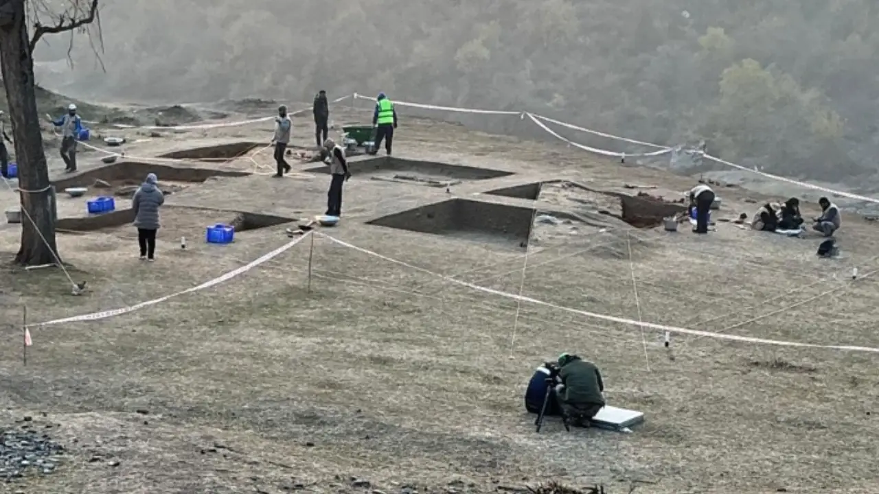
The Zehanpore site is located in the village of the same name, about 10 km from Baramulla town on the right bank of the Jhelum. The researchers place it within an ancient route that linked Kashmir with Gandhara and Central Asia.
The landscape around the site underwent major changes in the 1970s when canal and road construction divided the earlier landscape. The paper notes that severe erosion has occurred around the Buddhist stupa, which is now at risk of collapse.
The study also places the site within the wider historical landscape of Baramulla, identifying the area as an important corridor in the history of Kashmir. It notes references to the route in accounts associated with Hiuen Tsang, who arrived in Kashmir in AD 631, and later references to the Buddhist centres of Baramulla. The researchers link the Zehanpore stupa to the historical Jayendra Vihara mentioned in these traditions.
River Shifts
The researchers found that the Jhelum’s changing course has progressively altered the archaeological landscape. Their analysis shows that the river’s expansion is not simply a matter of gradual bank retreat but involves a combination of erosion, deposition, meander migration and channel movement.
Between 1976 and 1989, the measured eroded area was 10,636 square metres, while deposition accounted for 31,891 square metres. Between 1989 and 2000, erosion increased dramatically to 39,777 square metres, with 33,904 square metres recorded as deposition. From 2000 to 2022, erosion fell to 7,953 square metres, while deposition rose to 62,787 square metres.
The researchers say this combination of natural river processes and human interference has resulted in what they describe as “stratigraphic collapse” at the site.
Future Loss
Using the 2000-2022 erosion rate as the basis for a linear extrapolation, the researchers estimate that 10,122 square metres of additional land could be lost between 2022 and 2050.
They caution, however, that this is not a deterministic hydrological prediction. The projection does not incorporate potentially extreme events such as mega-floods or nonlinear effects arising from future climate changes in the Jhelum basin. The authors therefore describe the figure as a “minimum risk threshold.”
The warning is nevertheless stark: without geotechnical intervention such as retaining walls or bio-engineering, the primary monument faces what the study calls an “acute risk of structural failure within the next three decades.”
Urgent Action
The study argues that the threat to Zehanpore has now moved beyond a general conservation concern to a quantified and time-bound risk.
It recommends urgent stabilisation measures, including retaining walls, gabions and nature-based bio-engineering, particularly strategic planting of deep-rooted vegetation such as vetiver. The authors argue that the evidence provides a basis for moving from passive monitoring to active conservation.
The researchers also stress the usefulness of freely available satellite data for heritage protection. Because the analysis relies substantially on open Landsat archives rather than expensive commercial imagery or LiDAR, they say the methodology could be replicated at other vulnerable archaeological sites, particularly where access to costly high-resolution datasets is limited.
The paper concludes that the 46-year remote-sensing analysis has established the Zehanpore site as being under severe riverine erosion pressure, with the 1989-2000 period emerging as the critical decade of accelerated destruction. Its forecast, the authors say, provides a data-driven basis for policymakers and conservation agencies to intervene before the remaining archaeological monument is lost.